Finding the right hunting app for private land maps can make or break your next hunting trip. Modern hunters face a complex landscape of property boundaries, changing regulations, and access restrictions that can turn a promising hunt into a legal nightmare. The days of relying on paper maps and guesswork are over.
This guide will walk you through everything you need to know about choosing the best hunting app for private land maps. You'll learn which features matter most, how to compare the top apps, and what to look for in pricing models. We'll also cover setup tips and boundary navigation to keep you hunting legally and successfully.
Whether you're tracking whitetail through mixed ownership terrain or planning an elk hunt across vast private ranches, the right digital mapping tool is your key to confident, legal hunting.
Why Private Land Mapping Apps Are Essential for Modern Hunters
The hunting landscape has changed dramatically over the past decade. What used to be straightforward public land access has become a complex web of private ownership, lease agreements, and restricted areas. Today's hunters need more than basic navigation skills.
Private land makes up a significant portion of prime hunting habitat across North America. In many states, over 70% of the land is privately owned. This means the best hunting opportunities often require permission, leases, or guided access. Without proper mapping tools, hunters risk trespassing violations that can result in hefty fines and lost hunting privileges.
Modern hunting apps solve this problem by providing real-time property boundary data. According to North American Whitetail, top-tier digital mapping apps have evolved far beyond simple aerial imagery. They now include advanced features like weather forecasts, wind direction graphics, and even predictive models for deer activity.
The technology has reached a point where hunters can access up-to-the-minute satellite imagery updated monthly. This allows you to see current agricultural practices, identify clear cuts, and spot habitat changes that affect game movement. When combined with accurate property boundaries, this information becomes a powerful scouting tool.
Safety is another critical factor. Getting lost on unfamiliar private property isn't just inconvenient - it can be dangerous. Modern hunting apps provide offline GPS tracking that works even without cell service. You can mark your entry point, track your path, and navigate back to safety with confidence.
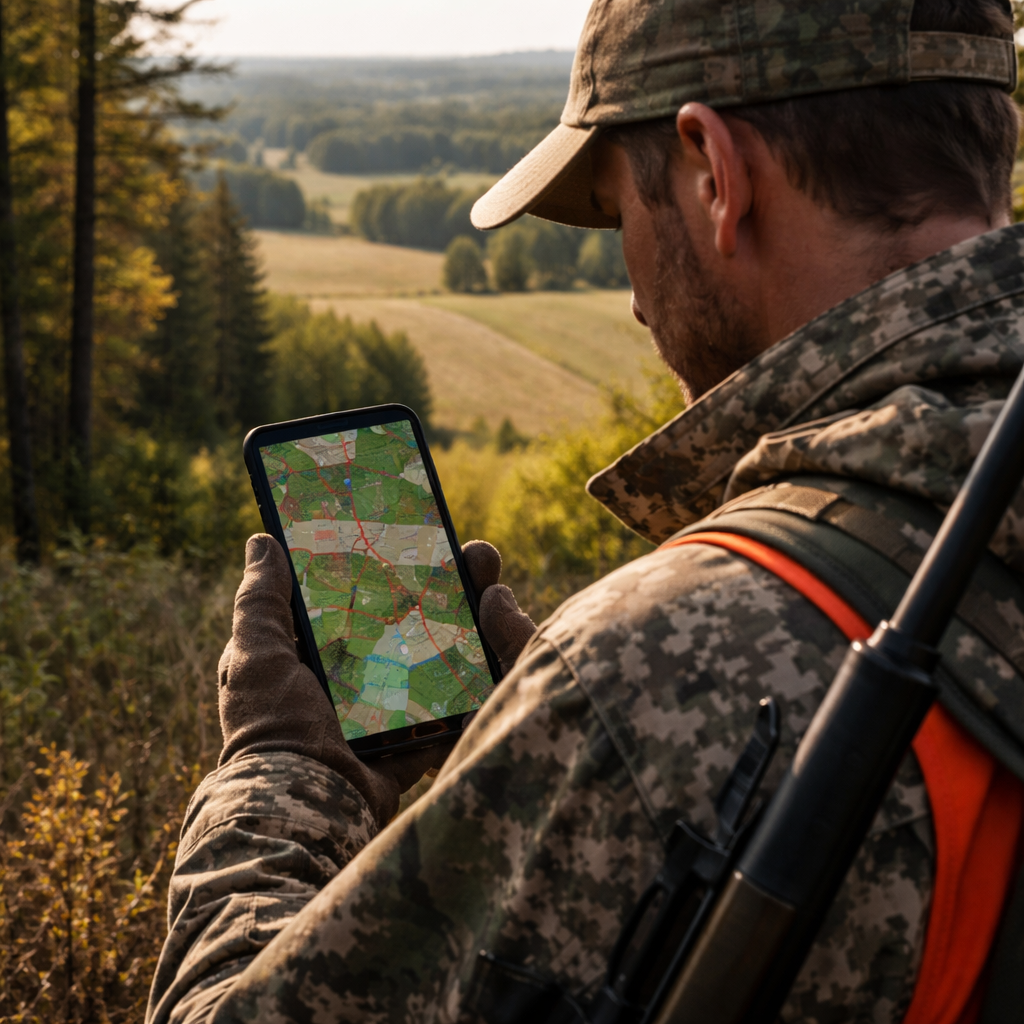
The data accuracy of these apps has improved significantly. They pull information directly from county assessor databases and government land records. This means you're getting the same boundary information that surveyors and real estate professionals use. The margin of error is typically less than a few feet, which is more than adequate for hunting purposes.
Trail camera management has become another essential feature. Many hunters deploy multiple cameras across their hunting areas. A good hunting app for private land maps lets you mark each camera location, import photos, and track game movement patterns over time. This creates a comprehensive picture of animal behavior on the properties you hunt.
Weather integration takes the guesswork out of hunt timing. Apps now provide hyperlocal forecasts that account for terrain features like elevation and water bodies. Combined with barometric pressure data and moon phases, this information helps you pick the optimal days and times to be in the field.
The economic impact is substantial too. Trespassing fines can range from hundreds to thousands of dollars, depending on the state and circumstances. A single violation can cost more than several years of app subscriptions. The peace of mind and legal protection these tools provide make them an essential investment for any serious hunter.
Top Hunting Apps for Private Land Mapping
The market for hunting apps has exploded in recent years, but not all apps are created equal when it comes to private land mapping. Some excel at public land navigation while others focus specifically on property boundaries and landowner information. Here are the standout performers for private land hunting.
onX Hunt remains the gold standard for land ownership data. The app provides detailed property boundaries with landowner names and contact information. According to onX Maps, their platform covers all 50 states plus Canada with highly accurate boundary data sourced directly from county records. The app receives over 239,000 user ratings with an average of 4.9 out of 5 stars, indicating exceptional user satisfaction.
The strength of onX Hunt lies in its comprehensive data layers. Beyond basic property lines, it includes hunting unit boundaries, topographic maps, and high-resolution satellite imagery. The offline capability is robust, allowing you to download entire regions for use without cell service. This makes it ideal for remote private land hunting where connectivity is limited.
HuntStand has carved out a niche with its whitetail-specific features. The Pro Whitetail subscription includes a proprietary activity forecast that analyzes over a dozen variables to predict deer movement by the hour. This feature proved valuable for hunters who rely on timing their hunts around peak activity periods.
The monthly satellite imagery updates in HuntStand are particularly useful for private land hunters. You can monitor crop rotations, identify new clear cuts, and track habitat changes throughout the season. The trail camera management system allows you to organize photos by location and automatically tags them with weather and lunar data.
BaseMap focuses on 3D visualization and detailed terrain analysis. While it has fewer whitetail-specific features than HuntStand, its mapping accuracy and terrain representation are exceptional. The HuntWind feature uses realistic wind stream graphics to show current and predicted wind patterns, which is crucial for scent management on private properties.
| App | Best Feature | Private Land Focus | Offline Maps | Price Range |
|---|---|---|---|---|
| onX Hunt | Landowner Information | Excellent | Yes | $35-$100/year |
| HuntStand | Whitetail Forecasting | Very Good | Yes | $70-$100/year |
| BaseMap | 3D Terrain | Good | Yes | $50-$80/year |
| HuntWise | Wind Prediction | Good | Yes | $30-$60/year |
HuntWise brings artificial intelligence to hunt planning with its WindCast feature. You input all your stand and blind locations along with optimal wind directions for each. The app then ranks your locations based on current conditions, taking the guesswork out of stand selection. This is particularly valuable on large private properties with multiple hunting locations.
The RutCast feature in HuntWise tracks rut phases across different regions. For hunters who travel to hunt private land in multiple states, this provides valuable timing information that can make the difference between success and disappointment.
Each app has developed unique strengths, but they all share core capabilities essential for private land hunting. Property boundary accuracy, offline functionality, and landowner information are the foundation features. The advanced capabilities like weather integration, activity forecasting, and terrain analysis are what separate the premium options from basic mapping tools.
When evaluating these apps, consider your hunting style and target species. Whitetail hunters benefit most from apps with detailed activity predictions and trail camera integration. Western hunters pursuing elk or mule deer need robust terrain analysis and wind prediction tools. Waterfowl hunters require apps that excel at showing water access and property boundaries near wetlands.
The user interface matters more than you might think. When you're in the field with cold fingers and limited time, you need an app that responds quickly and presents information clearly. All the top apps have invested heavily in mobile optimization, but some are more intuitive than others under field conditions.
Key Features to Look for in a Hunting Map App
Not all hunting apps are built the same way, and the difference becomes critical when you're dealing with private land access. According to Infinite Outdoors, private land hunting apps generally fall into two categories: mapping and contact tools versus direct booking platforms. Understanding these distinctions helps you choose the right tool for your hunting style.
The most fundamental feature is accurate property boundary data. Your hunting app for private land maps must source its information from authoritative databases like county assessor records and government land registries. The data should be updated regularly, ideally monthly or quarterly, to reflect recent sales and boundary changes.
Look for apps that display boundary accuracy ratings. The best apps indicate their confidence level in each property line, typically measured in feet or meters. This transparency helps you make informed decisions about where to hunt and where to exercise extra caution.
Offline functionality is non-negotiable for serious hunters. Cell service is spotty or nonexistent in many prime hunting areas. Your app must allow you to download detailed maps including satellite imagery, property boundaries, and topographic data for use without internet connectivity. The download size and storage requirements vary significantly between apps, so consider your device's capacity.
The offline maps should retain full functionality, not just basic viewing. You need to be able to drop waypoints, measure distances, and track your movement even when disconnected. Some apps limit offline features to premium subscribers, so verify what's included in your subscription level.
Landowner information separates hunting-specific apps from general mapping tools. The best apps provide property owner names and contact information, making it easier to request permission for access. Some apps go further by including property tax addresses, which can help you locate owners who don't live on the land.
This information comes with privacy considerations. Reputable apps source their data from public records and present it responsibly. They don't provide personal phone numbers or private addresses that aren't already part of public property records.
Integration with hunting regulations saves time and reduces confusion. Top apps overlay hunting unit boundaries and link to current regulations for each area. This is particularly valuable when hunting near unit boundaries where rules can change dramatically within a few hundred yards.
Some apps take this further by providing season dates, bag limits, and weapon restrictions specific to your location. This real-time regulatory information helps ensure compliance and can prevent costly violations.
Weather and environmental data has become a standard feature in premium hunting apps. Look for hyperlocal forecasts that account for terrain features like elevation and water bodies. Wind direction and speed are particularly important for scent management on private property where you can't easily relocate if conditions change.
Barometric pressure trends help predict animal movement patterns. Many experienced hunters swear by pressure changes as indicators of increased deer activity. Having this data integrated into your mapping app eliminates the need for separate weather apps.
Trail camera integration addresses a common challenge for private land hunters who deploy multiple cameras. The best apps let you mark camera locations on your map and organize photos by location and date. Some apps automatically tag photos with weather conditions and lunar data captured at the time each photo was taken.
This feature becomes particularly valuable when managing cameras across multiple properties. You can track which locations produce the most activity and adjust your camera placement strategy accordingly.
Sharing and collaboration tools are essential if you hunt with partners or on family properties. Look for apps that allow secure sharing of waypoints, tracks, and property information. Some apps create private groups where hunting party members can share real-time locations and communicate without revealing information to other users.
The sharing features should include privacy controls. You don't want your carefully scouted locations visible to other hunters, but you do want to share information with your hunting partners.
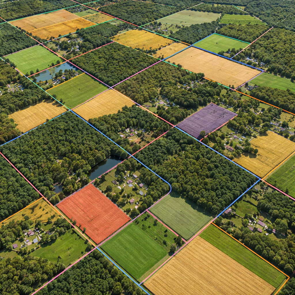
Understanding Property Boundaries and Land Ownership Data
Property boundaries are the foundation of legal hunting, but understanding how this data is collected and presented in hunting apps requires some background knowledge. The accuracy and reliability of boundary information can vary significantly depending on the source and age of the data.
Most hunting apps source their property data from county assessor databases and parcel mapping systems. These databases are maintained by local governments for tax assessment purposes and are generally considered authoritative. However, the update frequency varies by county, with some updating quarterly and others annually.
Survey accuracy is another important consideration. Property boundaries shown in apps are based on legal descriptions and survey data, but they may not reflect physical markers on the ground. Fences, for example, don't always align perfectly with legal boundaries. This is why hunting apps typically include disclaimers about boundary accuracy and recommend treating them as guides rather than definitive markers.
The Regrid Property App demonstrates how property data is compiled and verified. Their platform aggregates information from multiple sources including parcel records, zoning data, and ownership histories. This multi-source approach improves accuracy but also highlights the complexity of modern property ownership.
Understanding different types of land ownership helps hunters navigate access issues more effectively. Fee simple ownership gives the landowner complete control over access decisions. Leased properties may have different access rules depending on the lease terms and the relationship between the landowner and lessee.
Easements and right-of-way designations can affect hunting access even on private property. Some properties have utility easements or access easements that may restrict hunting activities in specific areas. Advanced hunting apps display these designations when available in the source data.
Property size and configuration impact hunting strategies significantly. Small, fragmented parcels require different approaches than large contiguous holdings. Apps that display acreage information help hunters assess whether a property is large enough to support their hunting style and target species.
Neighboring property information becomes crucial when planning entry and exit routes. You need to know not just where you can hunt, but how to access those areas legally. Some properties are landlocked, accessible only through other private lands, making permission from multiple owners necessary.
Recent sales and ownership changes can affect hunting access. Properties that have been in the same family for generations may have established hunting traditions, while recently sold properties may have new owners with different policies. Apps that track ownership history help hunters understand the access landscape.
Zoning designations provide additional context for property use and potential hunting opportunities. Agricultural zoning often indicates active farming operations that may affect hunting timing and access. Residential zoning typically means restricted or prohibited hunting due to safety concerns and local ordinances.
Tax assessment data included in some apps reveals property values and use classifications. This information can indicate the primary use of the land and suggest appropriate approaches for requesting access. High-value recreational properties may have different access policies than working agricultural land.
The integration of this ownership data with mapping tools creates powerful planning capabilities. You can identify potential hunting properties, research ownership information, and plan approach strategies all within a single app. This streamlines the often time-consuming process of identifying and contacting landowners.
Understanding the limitations of property data is equally important. Boundary disputes, survey errors, and outdated information can all affect accuracy. Responsible hunters verify critical boundaries through multiple sources and maintain respectful relationships with landowners regardless of what their apps display.
Setting Up Your Hunting App for Maximum Effectiveness
Proper setup transforms a hunting app for private land maps from a basic tool into a comprehensive hunting management system. The initial configuration process determines how effectively you'll be able to use the app throughout the hunting season.
Start by creating a systematic waypoint organization system before you begin dropping pins randomly. According to GoHunt's waypoint organization guide, experienced hunters use consistent color coding and naming conventions to keep their data organized and accessible.
Establish a color coding system that makes sense for your hunting style. Yellow waypoints might represent glassing locations during e-scouting, changing to blue once you've confirmed them through ground truthing. Black waypoints could mark successful harvest locations, while light blue indicates animal sightings. White waypoints might represent navigation aids like trail junctions or parking areas.
The key is consistency. Once you establish your system, stick with it across all hunting seasons and properties. This creates a personal database of hunting intelligence that becomes more valuable over time.
Waypoint naming requires a balance between descriptive information and brevity. Include key details like the date, activity type, and relevant conditions. For example, "Oak Stand Nov 15 AM" tells you more than just "Stand 1." Many apps automatically append timestamps, so focus your custom names on location-specific details.
Download offline maps for your entire hunting region before the season starts. Don't wait until you're in the field to discover that your target area isn't cached on your device. Download maps at the highest resolution your storage space allows, and include all relevant layers: satellite imagery, topographic lines, property boundaries, and hunting unit designations.
Test your offline functionality at home before heading to the field. Verify that you can drop waypoints, measure distances, and track your movement without an internet connection. Some apps limit offline features for free users, so confirm that your subscription level includes the functionality you need.
Configure your GPS settings for optimal battery life and accuracy. Most hunting apps allow you to adjust tracking frequency and accuracy settings. Higher accuracy settings drain battery faster but provide more precise location data. Find the balance that works for your hunting style and device capabilities.
Set up sharing preferences if you hunt with partners or family members. Create private groups for sharing waypoints and real-time locations, but be selective about what information you share. Your carefully scouted stand locations might be sensitive information that shouldn't be widely distributed.
Import existing data from other apps or GPS devices if you're switching platforms. Most apps support standard formats like GPX or KML files. This preserves years of accumulated waypoints and tracks when transitioning to a new system.
Customize your map display preferences for field use. Adjust contrast and brightness settings for outdoor visibility. Choose basemap styles that work well in your typical hunting conditions. Satellite imagery might be perfect for open country, while topographic maps could be better for dense forest navigation.
Enable relevant notifications and alerts. Some apps can notify you about weather changes, season dates, or when you're approaching property boundaries. Configure these alerts to be helpful without being distracting during critical hunting moments.
Practice using the app's measurement tools for distance and area calculations. Understanding how far you are from property boundaries or how much ground you can cover in a given time helps with hunt planning and safety.
Set up hunt folders to organize information by property, season, or hunting partners. This organizational structure makes it easier to find relevant information quickly when you're planning hunts or reviewing past seasons.
Create backup systems for your important data. Export waypoints and tracks regularly to prevent data loss if your device fails or the app crashes. Cloud synchronization features in premium apps provide automatic backup, but manual exports create additional security.
Familiarize yourself with the app's customer support resources. Know how to contact support if you encounter issues in the field, and understand what help is available for technical problems or data questions.
Pricing and Subscription Models Compared
Understanding the pricing structure of hunting apps helps you choose the right balance of features and cost for your hunting needs. The subscription models vary significantly between apps, with some offering basic features for free and others requiring premium subscriptions for essential functionality.
According to onX Hunt pricing, their subscription tiers range from $34.99 per year for single-state Premium access to $99.99 annually for Elite nationwide coverage. The Elite subscription includes advanced features like landowner contact information and exclusive map layers that aren't available in lower tiers.
The Premium subscription at $34.99 covers one state and includes property boundaries, offline maps, GPS tools, and basic weather information. The Premium Two-State option at $49.99 adds a second state for hunters who cross state lines regularly. The Elite subscription provides nationwide coverage plus pro deals, expert resources, and application research tools.
HuntStand's pricing model focuses on whitetail-specific features. Their Pro Whitetail subscription costs $69.99 annually and includes the 7-day activity forecast, rut mapping, and advanced trail camera management. This represents good value for dedicated whitetail hunters who can use the predictive features effectively.
Free versions of hunting apps typically include basic mapping functionality but limit advanced features like offline downloads, property owner information, and detailed boundary data. These limitations can be significant for private land hunting where property boundaries and owner contact information are essential.
Consider the geographic scope of your hunting activities when evaluating subscription costs. Single-state subscriptions work well for local hunters, but multi-state or nationwide coverage becomes cost-effective for hunters who travel frequently or hunt in multiple states each season.
The value proposition extends beyond just the app features. Compare subscription costs to alternative methods of obtaining the same information. Professional surveying services, detailed property research, and premium weather data would cost significantly more if purchased separately.
Family and group sharing options can reduce per-person costs for hunting parties. Some apps allow multiple users on a single subscription, while others offer discounted group rates. This can be particularly valuable for hunting clubs or families who hunt together regularly.
Annual versus monthly payment options affect the total cost. Most apps offer significant discounts for annual subscriptions compared to month-to-month payments. The onX Elite subscription, for example, costs $14.99 monthly but only $99.99 annually, representing a $80 annual savings.
Trial periods let you test functionality before committing to a full subscription. Most premium hunting apps offer 7-day free trials that include access to all features. Use this trial period to verify that the app meets your specific needs and works well in your typical hunting areas.
Frequently Asked Questions
What makes a hunting app specifically good for private land mapping?
The best hunting app for private land maps must provide accurate property boundary data sourced from county assessor records, landowner contact information, and the ability to function offline in remote areas. Key features include real-time GPS tracking with property line overlays, detailed satellite imagery for terrain analysis, and integration with hunting regulations specific to each property location. Apps designed for private land also need robust waypoint management systems for marking stand locations, trail cameras, and access routes across multiple properties.
How accurate are property boundaries shown in hunting apps?
Property boundaries in quality hunting apps are typically accurate within 3-10 feet when sourced from official county records and survey data. However, accuracy varies by location and the age of the underlying survey information. Most apps include disclaimers noting that boundaries are for reference only and shouldn't replace professional surveys. Physical markers like fences may not align perfectly with legal boundaries, so hunters should use app data as a guide while remaining respectful of posted signs and obvious property markers in the field.
Can I use hunting apps without cell phone service?
Yes, most premium hunting apps for private land maps offer robust offline functionality. You must download maps and data layers before losing cell service, but once cached, the apps provide full GPS tracking, waypoint marking, and boundary display capabilities. Your phone's GPS receiver works independently of cellular service, so you can see your exact location on downloaded maps even in remote areas. The key is planning ahead and downloading sufficient map coverage for your entire hunting area before heading into the field.
Do hunting apps show who owns private land?
Premium hunting apps typically include landowner information sourced from public property records, showing property owner names and sometimes contact addresses. This information comes from county assessor databases and tax records, which are public information. However, apps don't provide private phone numbers or personal contact details beyond what's available in official records. This feature helps hunters identify property owners for permission requests but requires respectful outreach through appropriate channels like certified mail or in-person visits.
What's the difference between free and paid hunting app features?
Free versions of hunting apps usually provide basic mapping and limited property boundary information, but restrict advanced features essential for private land hunting. Paid subscriptions typically unlock offline map downloads, detailed landowner information, high-resolution satellite imagery, and advanced GPS tools. Premium features often include weather integration, hunting regulation updates, trail camera management, and customer support. For serious private land hunting, paid subscriptions are generally necessary to access the property data and offline functionality required for safe, legal hunting.
How often is property ownership data updated in hunting apps?
Property ownership data in hunting apps is typically updated quarterly or annually, depending on how frequently the source county databases are refreshed. Some counties update their assessor records monthly, while others may lag by six months or more. Premium apps usually refresh their databases more frequently than free versions. Recent property sales, boundary changes, or ownership transfers may not appear immediately in hunting apps, so hunters should verify current ownership through multiple sources when planning access to newly purchased or recently sold properties.
Which hunting app works best for large private ranch hunting?
For large private ranch hunting, the best hunting app for private land maps should offer detailed terrain analysis, robust waypoint management, and excellent offline capabilities. onX Hunt excels with comprehensive landowner data and reliable offline functionality across large areas. HuntStand provides superior trail camera integration and habitat mapping tools valuable on extensive properties. BaseMap offers exceptional 3D terrain visualization helpful for understanding large ranch topography. The choice depends on whether you prioritize property data, wildlife management features, or terrain analysis for your specific ranch hunting needs.
Can hunting apps help me find landowners to request hunting permission?
Quality hunting apps provide landowner names and property addresses from public records, giving you the information needed to contact property owners professionally. However, the apps don't facilitate direct contact or provide private phone numbers. You'll need to research contact methods through phone directories, social media, or in-person visits. The most effective approach involves respectful written communication followed by face-to-face meetings when possible. Many successful hunters build long-term relationships by offering to help with property maintenance, providing game processing services, or sharing harvest reports with landowners who grant access.
Conclusion
Choosing the right hunting app for private land maps can transform your hunting success and keep you on the legal side of property boundaries. The technology has evolved far beyond basic GPS navigation to provide comprehensive hunting management systems that integrate property data, weather forecasting, and wildlife activity predictions.
The standout apps each offer unique strengths. onX Hunt provides the most comprehensive landowner information and reliable offline functionality. HuntStand excels with whitetail-specific features and predictive activity models. BaseMap offers superior 3D terrain visualization for understanding complex topography. The choice depends on your hunting style, target species, and geographic scope.
Key features that separate premium apps from basic mapping tools include accurate property boundaries sourced from official records, robust offline functionality for remote areas, landowner contact information, and integration with hunting regulations. These features justify the subscription costs by preventing trespassing violations and improving hunting success rates.
Proper setup and organization multiply the effectiveness of any hunting app. Consistent waypoint color coding, systematic naming conventions, and comprehensive offline map downloads create a personalized hunting intelligence system that improves over time. The investment in learning these tools pays dividends throughout your hunting career.
The pricing models reflect the value these apps provide. Annual subscriptions typically offer better value than monthly payments, and the costs compare favorably to alternative methods of obtaining property data and detailed mapping information. Free versions provide basic functionality but lack the advanced features essential for serious private land hunting.
As hunting pressure increases and land access becomes more challenging, digital mapping tools become essential equipment rather than optional accessories. The best hunting app for private land maps gives you the confidence to explore new areas, maintain legal compliance, and focus on what matters most - successful, ethical hunting experiences.

