Ontario's vast wilderness, stretching from the rugged Canadian Shield to the fertile southern lowlands, offers some of Canada's most diverse and rewarding hunting opportunities. With millions of hectares of Crown land, countless Wildlife Management Units (WMUs), and complex, shifting regulations, the greatest hurdle is often knowing exactly where to start. Finding reliable hunting spots ontario can feel overwhelming, turning potential adventures into frustrating planning sessions.
This guide eliminates that guesswork. It's not just a list; it's a strategic blueprint designed for your next successful hunt. We have meticulously curated 12 of the province's top public-land hunting destinations, breaking them down region by region and by target species.
For each location, you will find actionable intelligence:
- Specific WMUs to focus your efforts.
- Crown land access notes and parking/approach tips.
- Primary game species and optimal seasons.
- Key waypoints to get you started.
More importantly, we demonstrate how to use modern mapping tools like HuntScout to translate this information into a concrete field plan. You will learn to navigate property boundaries with confidence, identify access points efficiently, and execute your hunt with ethical precision. This resource is built to help you move beyond searching for a spot and get you into the field, fully prepared to explore Ontario's premier public lands like never before.
1. Northern Ontario Crown Land - Boreal Forest Moose
For the quintessential Canadian big-game experience, the vast expanses of Crown land in Northern Ontario's boreal forest are unparalleled. This region, stretching north of the French River to the Hudson Bay lowlands, offers some of the best moose hunting spots in Ontario, characterized by minimal pressure and a truly wild environment. The sheer scale of this area means opportunities are abundant, but success requires meticulous planning and a deep understanding of the terrain.
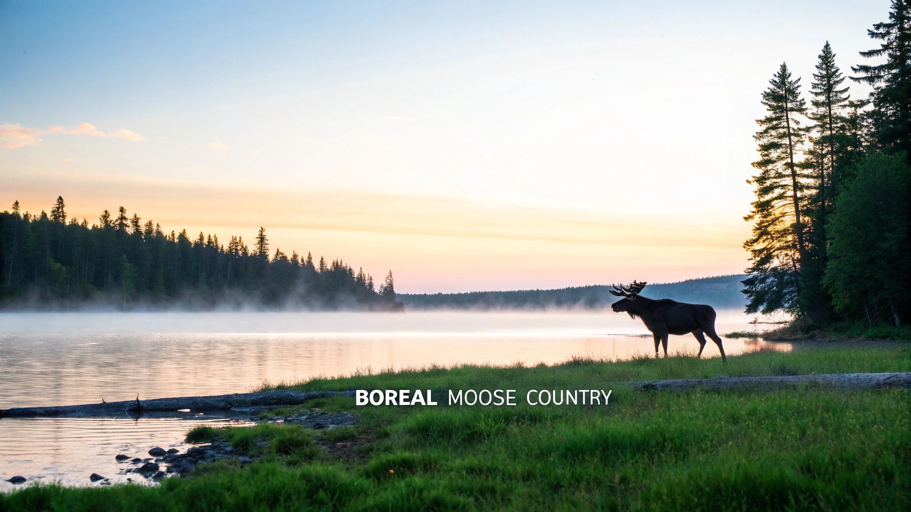
This area is less a single "spot" and more a massive ecosystem of prime habitat. The key is to leverage modern tools to narrow down productive zones. Using an app like HuntScout is critical for identifying specific Crown land parcels within promising Wildlife Management Units (WMUs), such as the corridor along WMUs 3A-3B near the Nipissing District or accessible lands in the Abitibi region.
Strategic Planning & Execution
- Timing is Everything: Plan your hunt around the peak moose rut, typically from mid-September to early October. This is when bulls are most responsive to calls, significantly increasing your chances of an encounter.
- Access & Navigation: Cell service is non-existent in most of this region. Before you leave, use HuntScout to download detailed offline maps of your entire planned route, including logging roads and water access points. Save crucial waypoints for your camp, potential glassing spots, and your vehicle's location.
- Know Your WMU: Tag allocation and seasons vary significantly between WMUs. Use HuntScout's WMU lookup feature to verify regulations, check tag draw results, and monitor any in-season updates or closures.
- Safety First: Black bears share this habitat. Be bear-aware, store food securely, and carry appropriate deterrents. For a deeper dive into locating these vast hunting grounds, you can learn more about how to find Crown land in Ontario.
2. Muskoka and Haliburton Highlands - Whitetail Deer & Black Bear
For hunters seeking premier whitetail deer and black bear opportunities closer to Southern Ontario, the Muskoka and Haliburton Highlands are an exceptional choice. This region offers a diverse mix of accessible Crown land, managed forests, and private lands, creating a rich mosaic of habitat. The rolling Canadian Shield terrain, characterized by hardwood ridges, coniferous swamps, and countless lakes, provides ideal cover and forage for both species, making it one of the most productive hunting spots in Ontario.
This area blends public access with private holdings, demanding careful navigation. Key areas include the Crown land parcels surrounding Bracebridge and the Dorset area within WMU 52, known for consistent deer harvests. The HuntScout app is indispensable here for its property boundary layers, helping you distinguish Crown land from private property and avoid accidental trespassing while identifying promising funnels and bedding areas.
Strategic Planning & Execution
- Timing is Everything: Target the early archery season in September for black bear when they are actively feeding on mast crops. For whitetails, plan your firearms hunt around major weather fronts in early November, as these pressure changes often trigger significant deer movement during the rut.
- Access & Navigation: Cell service can be unreliable in the highlands. Before heading out, use HuntScout to download offline satellite and topo maps of your chosen area. Mark key waypoints like parking spots, travel corridors identified during scouting, and potential stand locations.
- Know Your WMU: Regulations for deer and bear can differ between adjacent WMUs like 52, 54, and 55A. Use HuntScout to verify season dates, tag requirements, and any specific baiting regulations for your target unit.
- Safety First: This is a multi-use area popular with hikers and cottagers, especially in the early fall. Always be 100% sure of your target and what lies beyond it. Meticulous preparation is key, and you can get started with these expert hunting season planning tips for Canadian hunters.
3. James Bay Lowlands - Waterfowl and Shorebird Hunting
For waterfowl enthusiasts seeking a world-class hunt, Ontario's James Bay Lowlands represent a legendary destination. This remote coastal region is a critical migration corridor for millions of birds, offering unparalleled duck, goose, and shorebird opportunities. The expansive tidal flats and immense marshes, particularly around the Moose River estuary and Attawapiskat River, create a truly unique and challenging hunting environment that rewards the well-prepared.
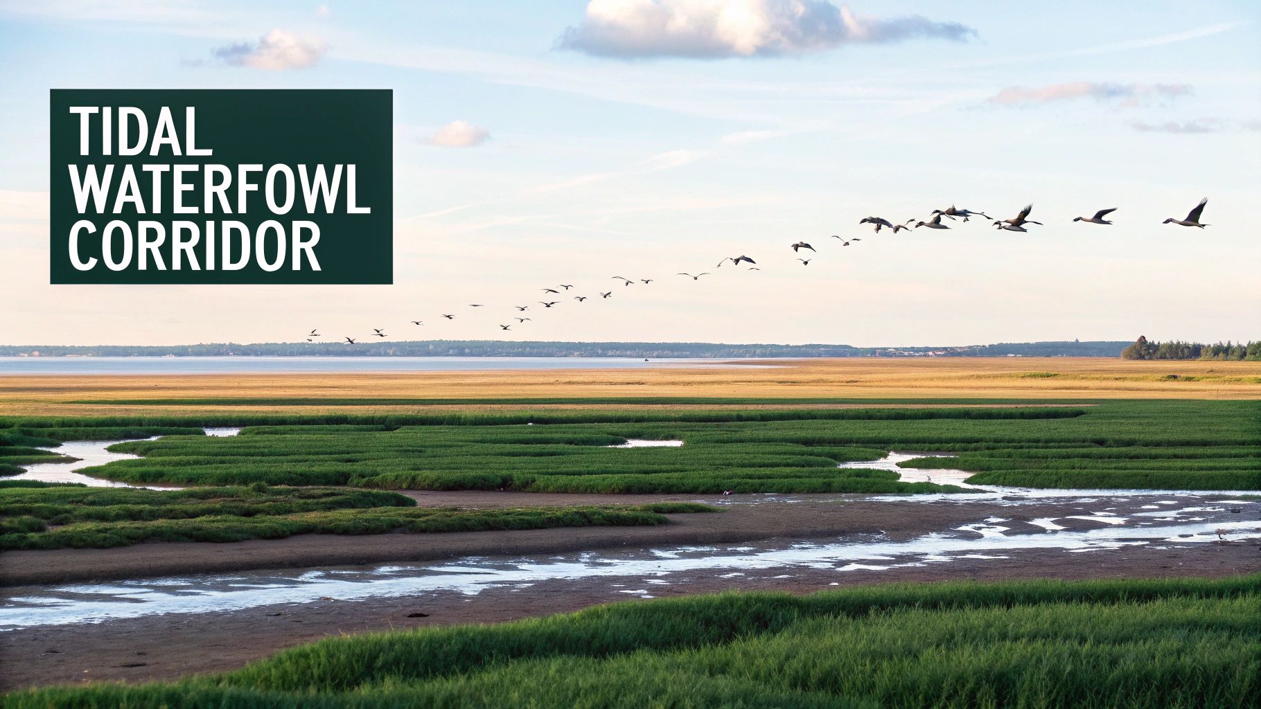
This hunt is less about finding a spot and more about surviving and thriving in a demanding landscape. Success hinges on precise timing, local knowledge, and logistical excellence. Using a tool like HuntScout is indispensable for studying satellite imagery of the tidal flats and downloading detailed topographic maps showing marsh features and water depths long before you arrive, as connectivity is non-existent.
Strategic Planning & Execution
- Timing is Everything: Your trip must align with peak migration windows in spring or fall. Research historical migration data and connect with local outfitters or Indigenous guides to pinpoint the optimal weeks for species like snow geese.
- Access & Navigation: Most areas are accessible only by boat or charter flight. Before your trip, use HuntScout to download offline maps of the entire coastal area you plan to hunt. Save crucial waypoints for your camp, potential blind locations, and boat launch or pickup points.
- Know Your Regulations: This region covers multiple WMUs (e.g., 1C, 1D), and federal migratory bird regulations are paramount. Use HuntScout's WMU lookup feature to confirm provincial seasons and check federal guidelines for bag limits and species identification.
- Safety First: The coastal weather is unpredictable and harsh. Prepare for extreme conditions with appropriate gear, redundant communication devices, and extensive backup plans for weather delays. Understanding tidal patterns is a matter of safety, not just hunting success.
4. Algonquin Park Periphery - Moose and Black Bear
The vast, protected wilderness of Algonquin Park creates a sanctuary effect, nurturing robust wildlife populations that spill into the surrounding huntable areas. These peripheral Crown lands and private leases offer some of the most overlooked and productive hunting spots in Ontario for both moose and black bear. Hunting is strictly prohibited within the park, but the adjacent Wildlife Management Units (WMUs) benefit directly from this core habitat, providing excellent opportunities for hunters who know where to look.
The key is to target the transition zones where park boundaries meet public-access lands. For example, WMU 51, located south of the park and accessible via Highway 60, holds a consistent moose population. Similarly, the East Side Road corridor and the Barron Canyon area are known for concentrations of black bears and prime moose habitat, with access via a network of park and logging roads. Using HuntScout is essential to clearly define these WMU boundaries and identify legal access points.
Strategic Planning & Execution
- Plan Ahead for Tags: Success here begins long before the hunt. Both moose and bear tags in these high-demand WMUs are allocated through a lottery system, so be sure to submit your application well in advance of the deadlines.
- Leverage Off-Season Scouting: Use summer hikes or camping trips to scout the terrain. Identify game trails, feeding areas, and potential glassing spots. Before heading out, download offline maps on HuntScout, as cell service is unreliable, and save waypoints for any promising locations you find.
- Master Your WMU: Regulations can vary significantly even between adjacent units. It's crucial to understand the specific rules for your chosen WMU. To ensure full compliance, you can review the essentials of Ontario's hunting regulations and use the HuntScout app to confirm season dates and boundaries.
- Effective Calling: During the September moose rut, the bulls in this region are highly active. Position yourself near park boundaries or along travel corridors and use a combination of cow and bull calls to draw them out of the sanctuary and into your hunting area.
5. Georgian Bay Islands and Mainland - Waterfowl and Upland Game
For hunters seeking variety, the Georgian Bay region offers a dynamic mix of waterfowl and upland game opportunities across its iconic islands and mainland forests. This area, particularly the Thirty Thousand Islands archipelago, provides incredible habitat for migratory ducks, while the transitional forests near Parry Sound and other mainland access points hold healthy populations of grouse and woodcock, making it a premier destination for mixed-bag hunts.
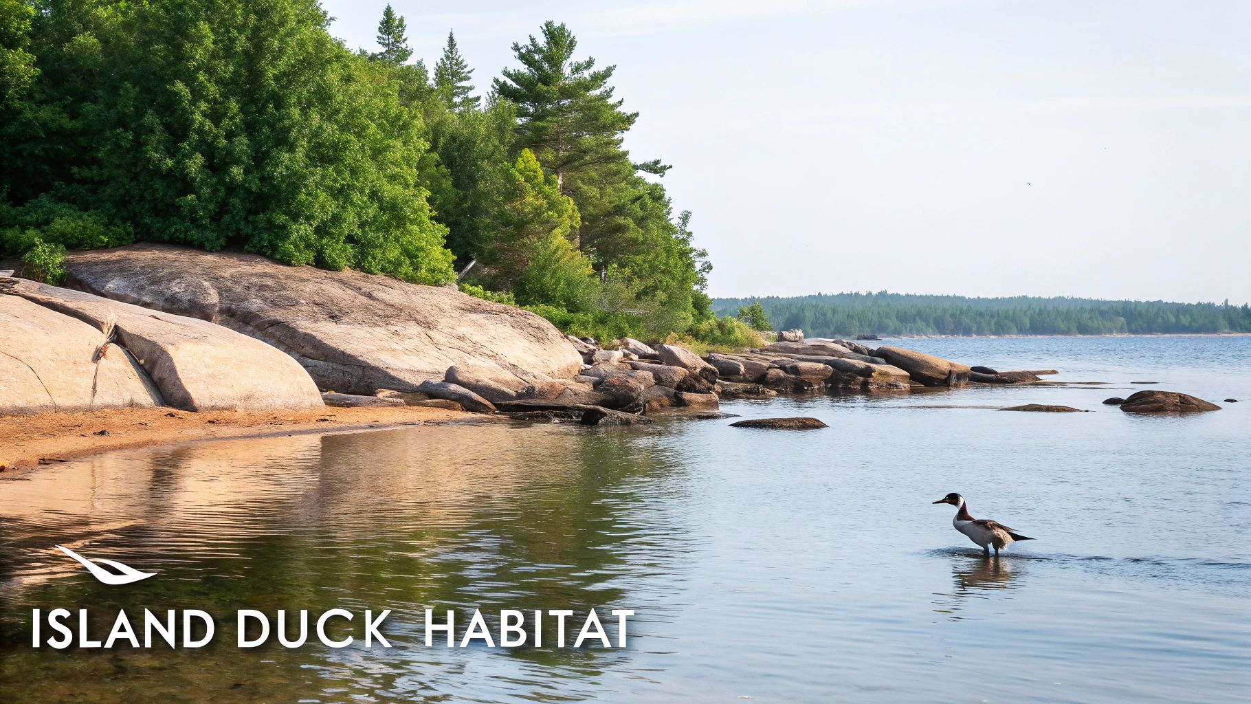
This landscape is a mosaic of public and private lands, demanding careful planning. Using HuntScout is essential for differentiating Crown land islands from private property and identifying public access points along the mainland. Focus your waterfowl scouting on key migration corridors like Sans Souci and Sturgeon Bay, and explore the mainland portions of WMUs 47, 49, and 51 for upland birds.
Strategic Planning & Execution
- Timing is Everything: Target peak waterfowl migration from mid-September for early arrivals and again in November for late-season divers. For upland game, scout for woodcock in young, moist forests during September before their main migration.
- Access & Navigation: Weather on Georgian Bay can change in an instant. Use HuntScout to save multiple offline waypoints for potential island campsites and boat launches. This provides critical backup options if wind and waves make your primary spot unsafe or inaccessible.
- Know Your WMU: Regulations for waterfowl and small game can differ significantly from big game seasons. Before heading out, use HuntScout’s WMU layers to confirm season dates, bag limits, and any specific firearm restrictions for the islands or mainland parcels you plan to hunt.
- Safety First: Boating safety is paramount. Always check marine forecasts, file a float plan, and ensure your vessel is equipped with all necessary safety gear. Be aware of changing water levels and submerged Canadian Shield rock formations, especially when navigating near shorelines.
6. Eastern Ontario Crown Land - Whitetail and Wild Turkey
For hunters seeking a classic mixed-bag experience, the rolling hills and mature hardwood forests of Eastern Ontario present premier opportunities. This region's mosaic of Crown land parcels intertwined with private agricultural properties creates an ideal habitat for thriving whitetail deer and wild turkey populations. The agricultural transition zones concentrate deer, while the diverse forest structure supports some of the healthiest turkey flocks in the province, making it one of the most dynamic hunting spots in Ontario.
This area is defined by accessible Crown land often bordering key food sources. Prime examples include the Frontenac Arch region, known for its mixed hardwood habitat, and productive areas like WMU 65 near Gananoque. The key to success here is pinpointing the corridors animals use to travel between public bedding areas and private feeding zones. Using HuntScout's satellite imagery and property line layers is crucial for identifying these funnels and legal access points.
Strategic Planning & Execution
- Boundary & Terrain Scouting: Use HuntScout's satellite view to meticulously trace Crown land boundaries and identify transition zones next to agricultural fields. Mark potential stand locations, food sources like oak flats, and travel corridors with waypoints before you ever set foot in the woods.
- Seasonal Approach: Plan early-season bow hunts in September before crops are harvested, when deer patterns are most predictable. For the firearms season, focus your efforts around the November rut. Time your spring turkey hunts for the peak gobbling periods in late April and early May.
- Access Routes: Map your entire approach using HuntScout's waypoint feature. This allows you to plan low-impact entry and exit routes to your stand or blind, minimizing pressure on local game populations and ensuring you stay within legal boundaries.
- Know Your WMU: Regulations for deer and turkey can be complex and vary by WMU. Double-check season dates, bag limits, and any specific firearm restrictions for your chosen unit directly within the HuntScout app to ensure full compliance.
7. Thunder Bay Region - Moose and Upland Game
For hunters seeking a diverse Northern Ontario experience, the Thunder Bay region offers a superb mix of big-game and upland opportunities. The vast tracts of Crown land surrounding the city are characterized by classic boreal forest and shield country, providing prime habitat for both moose and robust populations of grouse and woodcock. This area delivers a remote feel while still being relatively accessible via major highway corridors, making it one of the more logistically friendly hunting spots in Ontario.
The key to success here is using technology to dissect the landscape. Crown land parcels in WMUs 11A and 11B are reachable directly off Highway 17, but competition can be high. Use an app like HuntScout to explore secondary and tertiary logging roads branching off the main highway, which often lead to less-pressured pockets of moose and bird cover. The Nipigon River region and lands near Schreiber also present excellent multi-species prospects.
Strategic Planning & Execution
- Dual-Season Approach: Plan moose hunts for the mid-September to early October rut when bulls are most responsive to calls. Upland bird hunting, particularly for ruffed grouse, is also excellent during this period, allowing for combined-bag trips.
- Offline Navigation is Key: Cell service is unreliable once you leave the main highways. Before your trip, download detailed offline maps of your target WMU on HuntScout, marking access points, potential glassing knobs, and clearcuts that attract grouse.
- Scout and Verify: Use the summer months for scouting trips to identify moose sign like rubs and tracks. Use HuntScout's satellite and topo layers to locate promising funnels, wetland edges, and regenerating forest cuts that hold both moose and upland birds.
- Prepare for the North: Weather on the North Shore of Lake Superior can change in an instant. Pack for cold, wet conditions regardless of the forecast and ensure your vehicle is equipped for rough backroads. Always leave a detailed trip plan with someone back home.
8. Kawartha Highlands - White-tailed Deer and Black Bear
For hunters seeking productive grounds closer to Southern Ontario, the Kawartha Highlands region offers a rugged Canadian Shield landscape rich with opportunity. This area is a mosaic of Crown land, provincial parks with managed hunts, and private tracts, creating excellent habitat for both white-tailed deer and black bears. The glacially-formed terrain, with its countless lakes, wetlands, and mixed hardwood forests, provides the ideal cover and forage these species need to thrive.
The key to a successful hunt in the Kawarthas is navigating its mixed-access nature. Using an app like HuntScout is essential for differentiating between Crown land parcels and private property, especially in areas like WMU 60 near Peterborough or the transition zones around the Muskokas. This ensures you remain on legal hunting ground while targeting high-potential zones.
Strategic Planning & Execution
- Timing is Everything: Target the early archery season in September for less-pressured deer during the pre-rut. For black bears, the spring hunt (typically May and June) is highly effective as they emerge from dens in search of food.
- Access & Navigation: Much of the best terrain is accessible only by water or through challenging hikes. Use HuntScout's satellite imagery to identify hidden clearings, funnels between lakes, and potential stand locations before you go. Download offline maps and mark waypoints for your vehicle, stand sites, and property boundaries.
- Know Your WMU: Regulations for deer and bear can differ significantly across adjacent WMUs like 60, 61, and 59. Use HuntScout to confirm season dates, tag requirements, and any specific firearm or access restrictions for the exact area you plan to hunt.
- Scout Smarter: The rocky terrain makes sign less obvious. Focus your summer scouting efforts on identifying key food sources like oak ridges and beaver meadows. Mark travel corridors and potential bedding areas as waypoints in your app to build a hunt plan for the fall.
9. Nipissing District Crown Land - Moose and Multi-Species Opportunity
The Nipissing District serves as a prime transition zone between Ontario's southern hardwoods and the northern boreal forest, creating a diverse landscape that supports a variety of game. This unique ecological mix makes it one of the premier hunting spots in Ontario for multi-species pursuits. Hunters can target moose in the dense forests and wetlands while also finding excellent opportunities for black bear, whitetail deer, and abundant upland game birds like grouse.
This area is a mosaic of accessible Crown land, particularly around North Bay in WMU 48 and extending into the Temagami region. The key to a successful multi-species hunt here is identifying overlapping habitats. An app like HuntScout is invaluable for layering Crown land parcels with topographical features, allowing you to find areas where a moose-favoured swamp borders a bear-friendly berry patch or a deer-travelled hardwood ridge.
Strategic Planning & Execution
- Multi-Species Scouting: A single scouting trip can serve multiple goals. In the summer, look for moose sign near water sources, bear claw marks on beech trees, and deer trails along field edges. Mark these varied signs as waypoints in HuntScout to build a comprehensive map of animal activity.
- Timing Your Hunt: Plan your trip to coincide with overlapping seasons. An early-to-mid September hunt can align with the pre-rut for moose, the end of the summer feeding pattern for bears, and the early season for grouse, maximizing your opportunities.
- Know Your WMUs: Regulations for moose, bear, and deer can differ significantly even in adjacent WMUs. Use HuntScout to clearly see WMU boundaries as you travel and verify the specific open seasons and tag requirements for each species you intend to pursue in that unit.
- River Access: The French River and its tributaries offer excellent access to remote Crown land parcels. Use HuntScout to identify public boat launches and map a float plan to reach areas with less hunting pressure. Download your maps for offline use before losing service.
10. Grand River System Waterfowl - Upland Marsh and Creek Hunting
For hunters in Southern Ontario, the Grand River system offers a surprisingly diverse and accessible network for waterfowl and upland game. This vast watershed, stretching from the highlands of Dufferin County down to Lake Erie, creates a rich mosaic of marshlands, river corridors, and creek systems. These areas provide prime habitat for various duck species, Canada geese, and even upland birds like woodcock, making it one of the most versatile hunting spots in Ontario for those in the south.
This system isn't a single location but a series of opportunities spread across multiple Wildlife Management Units (WMUs), including 80, 81A, and 92B. Success here relies on pinpointing public access points along key tributaries like the Speed River or identifying concentration zones near the Grand River's mouth. An app like HuntScout is indispensable for navigating the patchwork of private and public lands, revealing hidden Waterfowl Management Areas (WMAs) and parking spots.
Strategic Planning & Execution
- Scout with Satellite Imagery: Before the season, use HuntScout's satellite view to identify promising river bends, hidden marshes, and secluded creek channels that birds will use as travel and feeding corridors. Mark potential setup locations and discreet entry routes as waypoints.
- Time the Migration: Plan your hunts around the two major migration windows. Mid-September to early October is excellent for local ducks and early migrants like wood ducks, while November brings the larger push of northern mallards and Canada geese.
- Know Your WMU Access: Public access is limited and specific. Use HuntScout to locate official WMA access points and clearly defined Crown land parcels along the river system. This prevents accidental trespassing and helps you find less-pressured spots.
- Upland Opportunities: Don't overlook the associated upland habitat. The damp, rich soil along the riverbanks and in adjacent thickets provides ideal cover for American woodcock. Time your hunt for their peak migration in late September and October for a fantastic mixed-bag opportunity.
11. Dryden-Kenora Region Remote Moose - True Wilderness Experience
For hunters seeking the pinnacle of a remote, demanding, and rewarding backcountry pursuit, the Dryden-Kenora region in Northwestern Ontario is a top-tier destination. This area embodies the true spirit of a wilderness moose hunt, characterized by vast, unbroken tracts of Crown land, pristine boreal forests, and countless lakes. The minimal hunting pressure and exceptional habitat combine to make this one of the most productive, albeit challenging, hunting spots in Ontario.
This hunt is an expedition, not just a trip. Success hinges on accessing remote areas within WMUs like 15A and 15B, often requiring fly-in services or extensive canoe routes through river systems like the English River. Using an app like HuntScout is non-negotiable for pre-scouting potential hotspots, studying topographical features to identify funnels and feeding areas, and planning logistics for an extended stay in a true wilderness setting.
Strategic Planning & Execution
- Timing is Everything: Focus your hunt during the peak rut, from late September to early October. In this remote setting, the effectiveness of calling is amplified, as bulls are highly responsive and face little competing pressure.
- Access & Navigation: Given the lack of roads and cell service, your primary tools are a GPS and offline maps. Before leaving, download detailed topographic and satellite maps of your target area in HuntScout. Mark waypoints for your base camp, potential calling locations, and extraction routes.
- Know Your WMU: Research is critical. Use HuntScout's WMU lookup to confirm season dates, tag requirements, and any specific regulations for units like 9B or 15A. Planning often involves coordination with an outfitter, so ensure all licensing is in order well in advance.
- Safety First: The physical demands of this hunt are extreme. Build your fitness level before you go. Your emergency plan must be comprehensive, including satellite communication devices, first-aid knowledge, and backup plans for weather delays that can ground floatplanes for days.
12. Hamilton-Brantford Region Managed Lands - Accessible Urban-Edge Hunting
For hunters based in Southern Ontario's urban centres, the Hamilton-Brantford region offers surprisingly productive opportunities without the multi-hour drive north. This area is a patchwork of private agricultural lands, managed forests, and smaller Crown parcels that create an ideal edge habitat. This mix of food sources and cover supports healthy populations of whitetail deer and wild turkey, making it a prime location for those seeking accessible hunting spots in Ontario.
Success here hinges on pinpointing access and understanding how game uses the fragmented landscape. Areas like the Flamborough township and lands within WMU 80 surrounding Guelph feature the agricultural transition zones deer prefer. Using an app like HuntScout is invaluable for differentiating between private and public lands and identifying potential travel corridors between feeding and bedding areas.
Strategic Planning & Execution
- Boundary Diligence: Trespassing is a serious issue in these populated areas. Use HuntScout's property line overlays and save waypoints along boundaries to ensure you remain on legally accessible land at all times.
- Scout Agricultural Edges: Focus scouting efforts on the transition zones between woodlots and farm fields. Look for deer trails, rubs, and scrapes, marking key locations in your app for a targeted approach during the season.
- Timing the Harvest: Deer patterns change dramatically once crops are harvested. Plan your hunts to coincide with this change, as deer will be pushed into remaining cover and become more predictable.
- Local Networking: Many of the best spots are on private land. Engaging with local hunting clubs or conservation authorities can provide mentorship and open doors to gaining permission for access. Be respectful and professional when approaching landowners.
Comparison of 12 Ontario Hunting Areas
| Location | 🔄 Complexity | ⚡ Resources required | ⭐ Expected quality/results | 💡 Ideal use cases | 📊 Key advantages |
|---|---|---|---|---|---|
| Northern Ontario Crown Land - Boreal Forest Moose | High — remote logistics, navigation and planning 🔄 | High — fly-ins, canoe gear, possible outfitter fees ⚡ | Excellent moose success and trophy potential ⭐ | Backcountry moose hunts where solitude and trophy bulls are sought 💡 | Pristine habitat, low hunter density, multi-species opportunity 📊 |
| Muskoka & Haliburton Highlands - Whitetail & Black Bear | Moderate — road access but private-land complexity 🔄 | Moderate — drive-in, local guides, possible private leases ⚡ | Good deer and bear results; reliable bucks and bears ⭐ | Accessible weekend trips, bow and firearms hunting near population centers 💡 | Easy access, established infrastructure and local knowledge 📊 |
| James Bay Lowlands - Waterfowl & Shorebird | Very high — fly-in, tidal/weather complexity 🔄 | Very high — specialized boats, cold-weather gear, outfitters ⚡ | Exceptional daily bird numbers during migration windows ⭐ | Peak spring/fall waterfowl migration hunts for experienced teams 💡 | Massive bird concentrations, minimal competition, pristine marshes 📊 |
| Algonquin Park Periphery - Moose & Black Bear | Moderate — lottery tags and seasonal crowding 🔄 | Moderate — day-access, guides, private leases available ⚡ | Strong moose and bear opportunities with reasonable success ⭐ | Day-hunts or guided moose/bear hunts leveraging park-protected populations 💡 | Park-supported populations, scenic access, established guide services 📊 |
| Georgian Bay Islands & Mainland - Waterfowl & Upland | Moderate — boat logistics and weather dependency 🔄 | Moderate — boat, island camping gear, safety equipment ⚡ | Good waterfowl and upland results during migration ⭐ | Island and boat-based waterfowl/upland hunts with flexible camps 💡 | Diverse island-mainland habitat, migration concentrations, solitude options 📊 |
| Eastern Ontario Crown Land - Whitetail & Turkey | Low–Moderate — mixed access, boundary checking 🔄 | Low–Moderate — drive-in, standard hunting gear, possible leases ⚡ | Reliable deer and turkey results in productive habitat ⭐ | Agricultural-edge early-season bow and spring turkey hunts 💡 | Mature hardwoods, productive mast, proximity to population centers 📊 |
| Thunder Bay Region - Moose & Upland Game | Moderate–High — distance and seasonal road issues 🔄 | Moderate — long drives, some remote roads, outfitter options ⚡ | Good moose populations and strong upland bird numbers ⭐ | Highway-access moose hunts combined with upland birding (Sept–Nov) 💡 | Quality moose habitat with moderate hunting pressure, upland diversity 📊 |
| Kawartha Highlands - White-tailed Deer & Black Bear | Low–Moderate — WMA rules and mixed parcels 🔄 | Moderate — camps, WMA permits, local guides ⚡ | Solid deer and growing bear populations; consistent results ⭐ | Weekend WMA hunts and mid-distance trips for deer/bear enthusiasts 💡 | Habitat diversity, public WMA access, improving populations 📊 |
| Nipissing District Crown Land - Multi-Species | Moderate — multiple WMUs, mixed remote areas 🔄 | Moderate — highway access, outfitters, canoe options ⚡ | Good multi-species success (moose, bear, deer, grouse) ⭐ | Efficient multi-species trips maximizing time and tags 💡 | Diverse habitats in one region, balanced logistics and opportunity 📊 |
| Grand River System Waterfowl - Marsh & Creek | Low — easy public access but high pressure 🔄 | Low — roadside access, boat launches, minimal gear ⚡ | Reliable daily bags depending on water levels and pressure ⭐ | Day trips for waterfowl near urban centers and WMA hunts 💡 | Proximity to cities, public WMA access, established hunting community 📊 |
| Dryden-Kenora Region Remote Moose - Wilderness | Very high — extreme backcountry logistics 🔄 | Very high — expensive fly-ins, outfitter packages, specialized gear ⚡ | Excellent trophy moose success and minimal competition ⭐ | Premium guided backcountry moose hunts for experienced clients 💡 | Lowest hunting pressure, pristine boreal lakes, top trophy potential 📊 |
| Hamilton–Brantford Region - Managed Urban-Edge | Low — urban-edge, managed leases and clubs 🔄 | Low–Moderate — short drives, club/lease fees, basic gear ⚡ | High opportunity for deer/turkey; good learning environment ⭐ | Urban-based hunters, mentorship-focused club hunts, new hunters 💡 | Exceptional accessibility, strong deer densities, established clubs 📊 |
From Plan to Pursuit: Making Your Ontario Hunt a Reality
The journey to a successful and ethical hunt begins long before you set foot in the wilderness. It's a process built on meticulous research, strategic planning, and an unwavering respect for the province's natural resources. We've explored twelve of the most promising public land hunting spots Ontario has to offer, from the remote moose country of the Boreal Forest to the accessible waterfowl marshes of the Grand River system. Each location presents a unique set of challenges and rewards, but they all share a common prerequisite for success: diligent preparation.
These locations are not just pins on a map; they are starting points for your own adventure. True success lies in the details-the careful study of topographical maps, the understanding of animal behaviour specific to each ecosystem, and the commitment to hunting safely and ethically.
Your Blueprint for Success
As you transition from reading this guide to planning your next outing, remember the core principles that separate a good hunt from a great one. The knowledge you’ve gained here is your foundation, but the execution is what truly matters.
- Embrace Digital Scouting: Gone are the days of relying solely on paper maps. Use technology like HuntScout to your advantage. Layer crown land data over high-resolution satellite imagery to identify promising funnels, clearings, and water sources before you even leave home. This digital reconnaissance saves valuable time in the field.
- Master the Regulations: Regulations are not suggestions; they are the law and the cornerstone of conservation. Ignorance is no excuse. Use the direct links within your mapping app to double-check season dates, tag requirements, and specific restrictions for your chosen Wildlife Management Unit (WMU). This is a non-negotiable step for every single hunt.
- Plan for the "What If": The Ontario backcountry can be unforgiving. Your planning must extend beyond the hunt itself. Pre-plan your entry and exit routes, drop waypoints for your vehicle and potential campsites, and most critically, download your maps for offline use. A lack of cell service should never compromise your safety or ability to navigate.
Key Takeaway: The most successful hunters are those who invest as much time in planning and preparation as they do in the actual pursuit. Your hunt begins at your desk, poring over maps and regulations, long before you shoulder your pack.
Turning Knowledge into Action
This guide has provided a comprehensive overview of diverse hunting opportunities across Ontario. From the whitetail deer of the Kawartha Highlands to the abundant waterfowl of the James Bay Lowlands, the potential for a memorable adventure is immense. But potential is only realised through action.
Choose a region that excites you. Dive deeper into the specific WMUs we've highlighted. Use the tools at your disposal to transform this broad information into a focused, actionable plan. Mark potential glassing points, identify likely bedding areas, and map out your approach. By combining the insights from this article with the powerful capabilities of modern mapping technology, you are equipping yourself not just for a successful hunt, but for a safe, ethical, and deeply rewarding experience in the Ontario wilderness. The vast landscapes are waiting-now it's your turn to do the work and make it happen.
Ready to turn your research into a real-world plan? HuntScout is the essential tool for every Ontario hunter, putting detailed crown land maps, WMU boundaries, offline navigation, and provincial regulations right at your fingertips. Start planning your next successful hunt today by visiting HuntScout and take the guesswork out of finding the best hunting spots Ontario has to offer.

