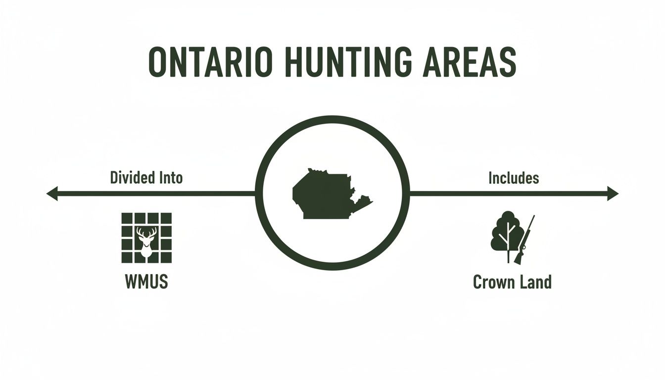
Ask any seasoned Ontario hunter where to go, and you'll likely get a simple two-part answer: Crown Land or private land (with permission, of course). While that’s true, the real secret to a successful hunt lies in the details—specifically, understanding the rules for the species you’re after within designated Wildlife Management Units (WMUs).
Crown land covers a staggering 87% of the province, offering vast opportunities for those willing to explore.
Your Starting Point for Finding Prime Hunting Land in Ontario
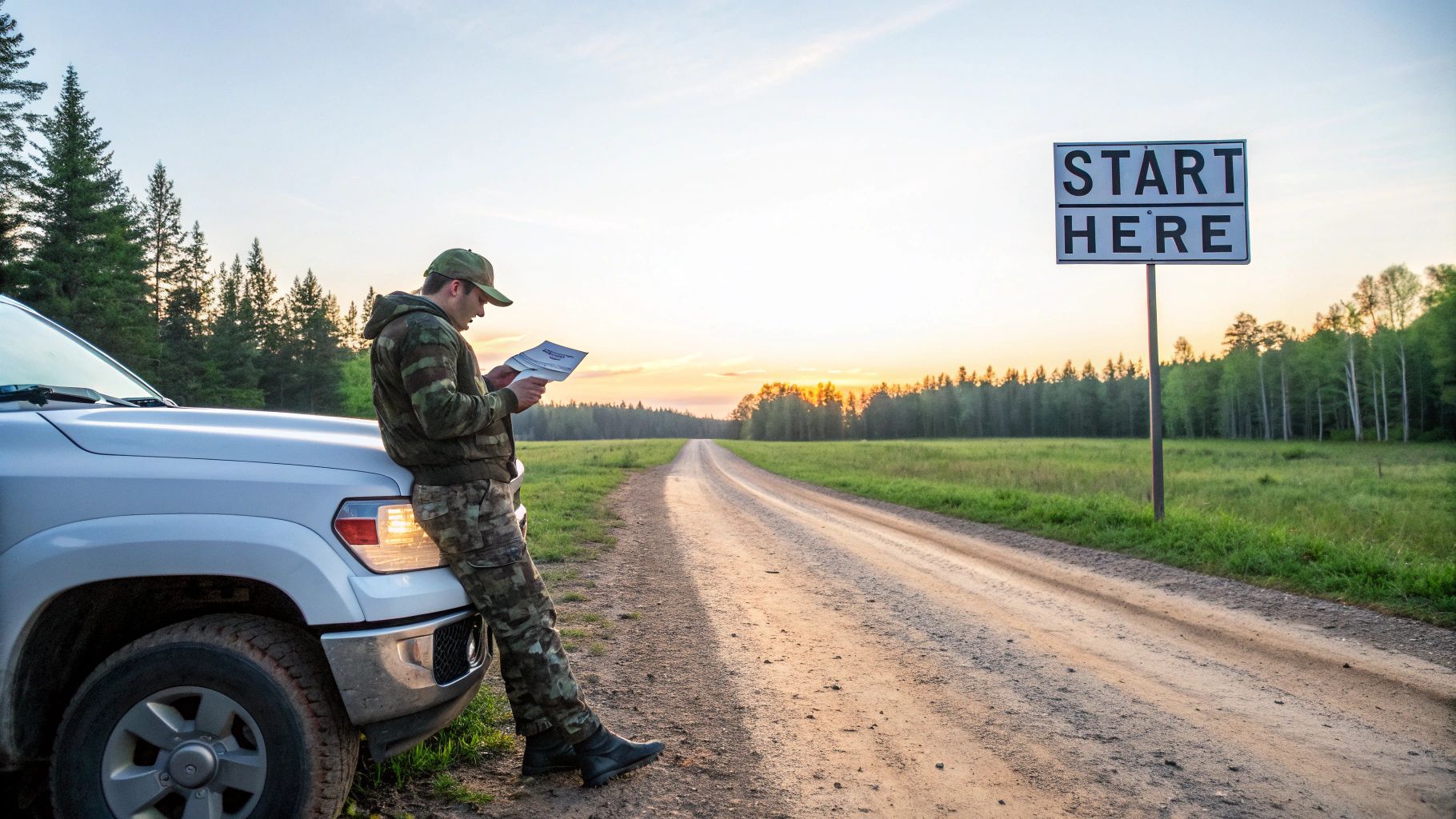
Ontario is a hunter's dream, but its immense scale can feel overwhelming at first. The very first challenge every hunter—new or experienced—faces is figuring out where you can legally, ethically, and productively set up for the season.
Before you even start thinking about scouting deer trails or picking the perfect spot for a blind, you need a firm grasp of the two basic types of hunting ground available: public land and private property.
Think of it like learning the rules of the road before you even turn the key. A great hunt doesn't begin in the bush; it starts with understanding the map. This foundational knowledge is your compass, making sure every step you take is safe, respectful, and ultimately, successful.
Understanding the Two Main Arenas
Every single hunting spot in Ontario falls into one of two categories. Each comes with its own unique set of opportunities, challenges, and unwritten rules.
Here's a quick look at how the two main types of hunting land stack up against each other.
Ontario Hunting Land At a Glance
| Attribute | Crown Land | Private Land |
|---|---|---|
| Accessibility | Generally open to all licensed hunters. | Requires explicit, direct permission from the landowner. |
| Hunter Density | Can be high, especially in easily accessible areas. | Often exclusive or limited to a few hunters. |
| Regulations | Governed by provincial regulations and WMU-specific rules. | Provincial rules still apply, plus any specific landowner rules. |
| Scouting | Requires more effort (maps, boots on the ground). | Can be easier with landowner guidance and less pressure. |
Ultimately, knowing how to navigate both Crown and private land will make you a far more versatile and successful hunter.
Crown Land vs. Private Land: The Nitty-Gritty
Crown Land: This is public land, managed by the province for everyone's use. It makes up the vast majority of Ontario and is generally fair game for hunting, though you need to be aware of specific restrictions in certain areas (like provincial parks or conservation reserves). Think of it as our massive, shared backyard.
Private Land: This covers everything else—from a farmer's fields and woodlots to large rural properties owned by individuals or companies. Access here is a privilege, never a right. It hinges entirely on getting clear permission from the landowner.
Building a solid hunting plan means knowing how to work within both of these systems. One offers almost endless space and freedom, while the other can provide exclusive access to prime habitat with less competition.
The core of a successful Ontario hunt isn't just about finding game; it's about mastering the landscape. Knowing the difference between General Use Crown Land and a farmer's back forty is non-negotiable for a safe and legal outing.
Your entire hunting strategy, from planning your season to packing your gear, will be built on this simple but absolutely critical distinction.
Decoding the Map: WMUs and Crown Land Explained
If you want to hunt successfully in Ontario, you need to learn the language of the land. That language starts with two core concepts that shape almost every decision you'll make: Wildlife Management Units (WMUs) and Crown Land. Getting a handle on these isn't just about following the rules—it’s about unlocking the province's incredible potential and finding those hidden gem hunting spots.
Think of these two systems as the essential layers on your hunting map. WMUs give you the rules of the game, while Crown Land provides the playing field. Understanding how they mesh together is the first real step from just being a licensed hunter to becoming a strategic one.
What Is a Wildlife Management Unit?
Picture Ontario as a massive quilt. A Wildlife Management Unit is simply one of the patches in that quilt. Each patch has its own unique pattern—its own set of local rules that are often different from the one right next to it. That's exactly how WMUs work for hunting.
The province is carved up into nearly 100 of these WMUs. Each one is a specific geographic area with its own hunting regulations, all tailored to the local wildlife populations and what’s needed to keep them healthy.
This means the regulations for hunting white-tailed deer down in WMU 82 near Lake Huron could be completely different from the rules up in WMU 47 near Sudbury. And trust me, those differences aren't suggestions; they're the law.
A WMU determines critical details like:
- Open Seasons: The exact dates you're legally allowed to hunt a specific animal.
- Bag Limits: How many animals you can legally harvest.
- Weapon Restrictions: What kind of firearm or bow you can use, and when.
- Tag Availability: Whether you need to enter a draw for a tag or can just buy one over the counter.
Before you even think about lacing up your boots, your first job is to figure out which WMU you'll be in. Everything else—your season dates, your gear, what you can legally take—flows from that one piece of information.
Navigating the Vastness of Crown Land
Once you've got your WMU sorted, the next question is obvious: where inside that boundary can you actually go? For most of us, the answer is Crown Land. Covering a staggering 87% of the province, this is land owned by the public, and for the most part, it's open for us to hunt and enjoy.
It’s the closest thing we have to a massive, shared backyard for hunters. But here's the catch—not all Crown Land is the same. The real trick is knowing the difference between areas where you're welcome to hunt and those that are restricted. This is where a lot of new hunters get tripped up.
Think of Crown Land like a giant public library. Most books (General Use Areas) are on the shelves, free for you to check out. But some sections, like the rare book room (Conservation Reserves) or the archives (Provincial Parks), have special rules or are off-limits entirely.
Knowing which "section" of the library you're in is absolutely crucial for a legal and ethical hunt.
The Different Types of Crown Land
The big distinction you need to make is between General Use Areas and places with specific rules. The government's official tool for this is the Crown Land Use Policy Atlas (CLUPA), but it can be a bit of a beast to navigate at first.
Here’s a simpler way to look at it:
- General Use Areas: This is the jackpot. These lands are managed for all sorts of activities, and hunting is widely permitted as long as you follow the WMU regulations. This is the bulk of Crown Land in Ontario.
- Provincial Parks & Conservation Reserves: Hunting is prohibited in most of these. However, there are exceptions. Some specific parks and reserves do allow hunting, but often with tight restrictions on seasons, access, or species. You absolutely have to check the status of a specific park before you even consider hunting there.
- Enhanced Management Areas: These are special zones set aside to protect important features, like a deer wintering yard. Hunting might be allowed, but it often comes with extra rules designed to protect that specific feature.
The sheer scale of our public lands can feel overwhelming, but modern mapping tools have made it much easier to see these boundaries. For a much deeper look into how these public lands work, you can learn more about what Crown Land in Canada really means and how to explore it responsibly.
At the end of the day, finding a great place to hunt in Ontario always comes back to these two pillars. First, use the WMU system to understand the rules. Then, use Crown Land maps to find the place. Get both of those right, and you're well on your way to a safe, legal, and memorable season.
Top Ontario Regions for Big Game Hunting
When you're chasing big game in Ontario, knowing where to go is half the battle. The province is a massive, diverse place, and your strategy for finding a trophy white-tail in the south will be completely different from tracking a bull moose through the northern bush.
It’s not one big hunting ground; it’s a mosaic of different habitats. The hunters who consistently fill their tags are the ones who understand this. They know the lay of the land and which regions consistently produce results. Getting that inside track gives you a serious advantage.
Northwestern Ontario: The Moose and Bear Heartland
For a lot of hunters, Northwestern Ontario is the dream. This is classic Canadian Shield country—a vast wilderness of boreal forest, rugged granite, and a seemingly endless number of lakes. It’s tough country, no doubt about it, but the rewards are second to none, especially if you’re after moose or black bear.
The sheer scale of this region, combined with its remoteness, means less hunting pressure and bigger, more mature animals. Places like Thunder Bay, Dryden, and Kenora are legendary for a reason. Their dense forests and swampy lowlands are perfect moose habitat. But to succeed up here, you need to know your way around with a map and compass, and often, you'll need a boat or an ATV to get away from the roads and into prime territory.
This map gives you a good visual of how Ontario is broken down into manageable Wildlife Management Units (WMUs) and shows the vast stretches of Crown Land available.
A smart hunt plan starts by layering these two things. You need to find a spot that’s not only legal to hunt but also falls within a WMU that has the right season and tags for the game you're after.
Central and Southern Ontario: A Whitetail Paradise
While the north is king for moose, Central and Southern Ontario are hands-down the best places for white-tailed deer. The landscape here is a world away from the northern shield. It’s a mix of farm fields, hardwood forests, and winding river valleys that creates the perfect "edge" habitat where deer absolutely thrive.
From the Bruce Peninsula all the way to the farmlands of Eastern Ontario, you’ll find some of the highest deer densities in the country. The challenge here isn’t so much about navigating rugged terrain, but about navigating access. It’s a patchwork of private and public land, and success often comes down to securing permission from a friendly farmer or finding those smaller, overlooked pockets of Crown land.
The harvest data backs this up. Ontario is covered in Crown land—about 87% of the province, in fact—and it offers incredible opportunities. For instance, recent numbers show hunters in WMU 47, near Sudbury, took around 4,000 white-tailed deer, which was a huge 15% jump from the year before. Up north, moose hunters in WMU 29 near Thunder Bay saw a 42% success rate on bull tags, which is well above the provincial average. This is exactly why a good mapping tool that clearly shows you huntable General Use Areas is so important; it helps you plan a legal, ethical, and productive hunt. You can dig into more of this government hunting data yourself over at the Open Government Portal.
Choosing Your Region Based on Data
Smart hunters don't just throw a dart at a map; they follow the numbers. The harvest reports and population surveys put out by the province are goldmines of information. They show you trends, highlight which WMUs are hot, and help you make a much more informed choice.
Here’s a quick breakdown:
- Moose: Zero in on the boreal forests of Northwestern and Northeastern Ontario. Look for WMUs that get a good number of tags and have consistently high success rates.
- White-Tailed Deer: Southern, Central, and Eastern Ontario are your best bets. The sweet spot is a WMU with a healthy mix of agriculture and forest.
- Black Bear: You can find bears almost anywhere, but the highest densities are in the north and central regions, often in the same areas that are great for moose.
The perfect hunting spot sits at the crossroads of three things: healthy game populations, accessible land (Crown or private), and regulations that match what you want to do. If you analyze these three factors, your chances of a successful season go way, way up.
Ultimately, the best region for you boils down to what you're hunting, your personal style, and how much of a challenge you're up for. Whether you're drawn to the solitude of the northern wilderness or the rich farmlands of the south, Ontario has an incredible big game experience waiting for you.
Chasing Feathers: Small Game, Waterfowl, and Upland Birds
Big game gets a lot of the glory, but some of the most memorable days afield in Ontario are spent in pursuit of smaller quarry. For small game, waterfowl, and upland birds, the game plan changes. You’re not looking for the vast, remote northern bush; instead, your focus shifts to fertile marshes, tangled field edges, and young, dense forests.
It’s a different kind of map reading. Success isn't about finding the biggest block of wilderness, but about spotting specific pockets of habitat. Knowing what to look for—and where—is what fills the game bag and extends your hunting season long after the big game rut has ended.
Following the Great Lakes Waterfowl Highways
For anyone who loves the sight of cupped wings over decoys, the Great Lakes shorelines are nothing short of legendary. These massive bodies of water create migration superhighways, funnelling hundreds of thousands of ducks and geese south every fall. The wetlands and bays along Lake Erie, Lake St. Clair, and Lake Ontario are absolute hotspots.
If you’re hunting on public land, these are the destinations that should be on your radar:
- Long Point Provincial Park: This spot on Lake Erie isn't just a park; it’s a UNESCO World Biosphere Reserve. It’s a critical pit stop for migrating waterfowl, and while access is managed through a controlled hunt, the sheer volume of birds makes it a bucket-list destination.
- St. Clair National Wildlife Area: Tucked in near Lake St. Clair, this managed wetland is a magnet for ducks and geese. You'll need to go through their permit and reservation system, but it grants you access to some of the most productive waterfowl habitat in the entire country.
- Provincial Wildlife Areas (PWAs): Don't overlook the PWAs. Places like Tiny Marsh or Wye Marsh are specifically managed to create prime wetland habitat. They're often easier to access and are fantastic spots to start, with a high probability of seeing action.
Waterfowl hunting is all about timing. The peak migration can bring waves of new birds in daily, transforming a quiet marsh into a chaotic, feathered spectacle overnight. You have to watch the migration reports and pay close attention to those big cold fronts pushing down from the north.
The real secret to incredible waterfowl hunting in Ontario is being in the right place when a weather front hits. A cold snap from Hudson Bay can fill the southern marshes with thousands of fresh birds in just a few hours.
Finding Prime Grouse and Woodcock Coverts
Once you move inland, the landscape changes, and so does the quarry. This is the heart of upland country. Ruffed grouse and American woodcock are creatures of the thick stuff—they thrive in young forests and the overgrown, scraggly edges where old farmland meets the woods. This dense cover is their home, their kitchen, and their protection from predators.
Start your search by looking for areas dominated by a mix of aspen, birch, and alder. Prime spots have often been logged or burned within the last 10 to 20 years, as the fresh, thick regrowth is exactly what these birds need.
Here are the regions where you'll find the best upland action:
- Central and Eastern Ontario: The huge expanses of Crown land around Bancroft, Parry Sound, and the Ottawa Valley are classic grouse country. The mosaic of regenerating forests and old logging roads gives you both the habitat and the access you need to be successful.
- The Great Clay Belt: Stretching across parts of Northeastern Ontario, this region’s unique soil grows incredibly dense stands of aspen. The result? Some of the best grouse and woodcock hunting you can find anywhere in North America.
Unlike waterfowl hunting, which often means sitting still and waiting, upland hunting is all about covering ground. Walk those old logging roads, push through the edges of clearcuts, and focus on the transition zones where one type of forest meets another. A great way to scout for the fall is to go out in the spring and listen for the unmistakable "drumming" of a male grouse claiming his territory. It’s a fantastic way to pinpoint promising spots long before the season opens.
A Modern Strategy for Scouting and Gaining Access
Knowing the best regions is a great start, but the real work begins when you zoom in on a specific piece of land. Success isn't just about being in the right WMU; it's about being in the right corner of that WMU. This is where a two-pronged attack comes in: digital reconnaissance from home followed by old-fashioned, boots-on-the-ground investigation.
This modern strategy blends cutting-edge technology with traditional woodsmanship. It lets you write off unproductive areas before you ever burn a litre of fuel and helps you walk into the woods with a solid, well-researched game plan. Think of it as doing your homework first so you can ace the test out in the field.
Phase 1: Digital Scouting From Your Couch
Long before you step foot in the bush, you can learn an incredible amount about a potential hunting spot using today’s mapping tools. This "e-scouting" is your first and most powerful filter. It saves you countless hours and lets you focus your energy where it actually matters.
The idea here is to pour over satellite imagery and topographic maps to spot promising terrain features—the kind of places where wildlife will naturally travel or gather.
Key Features to Look For:
- Funnels and Pinch Points: These are simply narrowings in the landscape that force animals down a predictable path. Look for saddles between ridges, tight strips of timber connecting two larger woodlots, or the inside corner of a field. Animals are lazy, just like us.
- Transition Zones: Critters love edges. Pinpoint where different types of habitat meet, like where a thick cedar swamp gives way to a hardwood ridge or where a marshy area meets high, dry ground. These are highways.
- Food and Water Sources: Locate obvious food sources like corn or soy fields, oak stands that will drop acorns, or recent clear-cuts buzzing with fresh growth. Just as important, mark every creek, pond, and river you see.
This digital deep dive is about more than just finding a spot; it's about understanding the "why." You’re building a theory about how animals use the landscape—a theory you'll later put to the test in person. For more tips on this, the HuntScout blog has great resources for Canadian hunters.
Phase 2: Boots-on-the-Ground Confirmation
Once you've marked up your digital map with promising locations, it's time to confirm your theories. Nothing—absolutely nothing—replaces the value of physically walking the land to see what story the ground tells you. This is where you hunt for fresh, current evidence that game is actively using the area right now.
Your goal is to find recent signs of life. A deer trail from last year is interesting, but fresh tracks in the mud are actionable intelligence.
What to Look For in the Field:
- Tracks and Trails: Look for well-worn paths, but pay closer attention to fresh tracks. Note their size and direction of travel.
- Scat: Fresh droppings are a dead giveaway that an animal has been there very recently.
- Rubs and Scrapes: For deer hunters, finding buck rubs on trees and scrapes on the ground during the pre-rut and rut is an undeniable sign of activity.
- Bedding Areas: Find that thick, nasty cover where a deer or moose would feel safe enough to bed down for the day.
Digital scouting tells you where the game should be. Boots-on-the-ground scouting tells you where the game is. A successful hunter never relies on just one without the other.
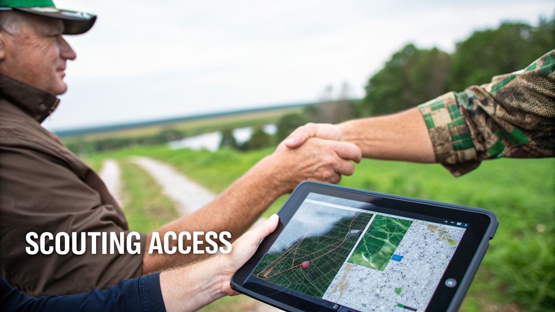
The Art of Gaining Private Land Access
For many hunters, the ultimate prize is getting permission to hunt on private land. These properties often hold prime habitat with significantly less pressure than public ground. Gaining access isn't about luck; it's about professionalism, respect, and building a genuine relationship.
Approaching a landowner can feel intimidating, but a thoughtful approach makes all the difference. Never, ever show up in your camo on opening weekend. Instead, try making contact well before the season starts. Dress presentably, be prepared to introduce yourself clearly, and show genuine respect for their time.
Your first conversation should be about building trust, not just asking for a favour. Offer to help with chores around the property, share a portion of your harvest, and always give them your name, number, and vehicle details. Assure them you will treat their property better than you treat your own—leaving gates as you found them, never driving on wet fields, and packing out every last piece of trash.
Often, securing permission is just the beginning of a long-term friendship built on mutual respect.
Essential Tools for the Modern Ontario Hunter
A successful hunt these days is about marrying time-honoured field skills with smart technology. Having the right digital tools isn't just about efficiency; it makes you a safer, more informed, and more ethical hunter. They’re just as critical as a good pair of boots.
The days of relying solely on a tattered paper map and a compass are behind us. Modern mapping apps have become the hunter’s command centre, turning your smartphone into an indispensable tool for figuring out exactly where to hunt in Ontario.
Your Digital Command Centre
The single biggest advantage you can give yourself is a high-quality mapping app built for Canadian hunters. These platforms overlay crucial data onto satellite maps, giving you a complete picture of the landscape before your boots ever touch the ground.
When choosing an app, there are a few features that are absolutely non-negotiable for any serious hunter in Ontario:
- WMU Boundary Overlays: You need to know which Wildlife Management Unit you’re standing in at a glance. A quick tap on the map should eliminate any guesswork about local regulations.
- Crown Land Layers: Being able to clearly see the difference between various types of Crown land is key. A solid app will show you General Use Areas and distinguish them from restricted zones like certain provincial parks or conservation reserves.
- Offline Maps: Let's be honest, the best hunting spots in Ontario rarely have cell service. The ability to download maps of your entire hunting area beforehand means you can always find your way, with or without a signal.
- Real-time Season Tracking: Look for an app that integrates up-to-date season information directly into the map. Knowing if a season is open or closed for a specific species in your exact location is a massive advantage.
An app is more than a map; it's a compliance tool. Knowing your exact location relative to a WMU boundary or a private property line isn't just convenient—it's your responsibility as a hunter.
Essential Government Resources
Beyond a good mapping app, there are two official resources every hunter should have bookmarked and saved to their phone. Think of these as the official rulebooks that your digital tools help you follow in the field.
First up is the Ontario Hunting Regulations Summary. This is the bible for every season date, bag limit, and legal requirement. Download the PDF and read the sections for your target species every single year. Rules change, and it’s on you to know them.
Second is the Crown Land Use Policy Atlas (CLUPA). It’s certainly more complex than a dedicated app, but this government tool offers the most granular detail on land use policies for specific parcels of Crown land. When you're doing deep-dive planning, it's the most authoritative source you can find.
By combining powerful tools like the purpose-built HuntScout mapping app with the official government summaries, you build a bulletproof system for planning and executing your hunt. This modern approach ensures every trip is built on a foundation of safety, legality, and confidence.
Your Top Questions About Ontario Hunting Spots Answered
Even with the best-laid plans, a few questions always seem to pop up when you're zeroing in on a new hunting spot. Let's tackle some of the most common ones I hear from fellow hunters, so you can head out with total confidence.
Can I Hunt on Unposted Land Without Permission?
This is a big one, and the answer is a firm no. In Ontario, all private property—whether it's a farmer's field, a back-forty woodlot, or just an empty lot—requires you to get direct permission from the landowner before you hunt.
Think of it this way: no sign doesn't mean "welcome." It just means "private property." Trespassing is a serious offence that can cost you dearly, and it damages the crucial relationship between the hunting community and landowners. Unless you've confirmed it's Crown land on a trusted map, always assume it's private.
How Close to Roads or Buildings Can I Hunt?
Safety comes first, and the rules are crystal clear here. You are strictly forbidden from shooting from, down, or across any public road. On top of that, both provincial regulations and local bylaws dictate how far you must be from buildings before discharging a firearm.
A core rule of hunter safety in Ontario is that it is illegal to discharge a firearm from or across the travelled portion of a public road. This is non-negotiable and heavily enforced.
These buffer zones can change from one municipality to the next, so it's your responsibility to check the local bylaws on top of the provincial hunting regulations. My advice? When in doubt, give yourself way more distance than you think you need.
How Do I Know if a Piece of Crown Land Is Actually Huntable?
Not all Crown land is created equal. The most reliable way to know for sure is by using a modern mapping app or the official Crown Land Use Policy Atlas (CLUPA). These tools are essential for telling the difference between huntable and non-huntable areas.
You’re looking for land designated as a General Use Area, where hunting is usually allowed. If a piece of Crown land is labelled as something else, like a provincial park or conservation reserve, you have to dig into the specific rules for that parcel. Just assuming all Crown land is fair game is a rookie mistake that can get you into hot water.
Finding the perfect spot is all about having the right information. With clear WMU boundaries, detailed Crown land layers, and up-to-date season data, HuntScout removes the guesswork from your hunt planning. Download the app and start exploring Ontario’s vast hunting opportunities today.

