Picture this: you've found the perfect hunting spot. It's remote, quiet, and miles from the nearest road. But just as you're settling in, a nagging doubt creeps in—are you sure you're not on private property? That single question can ruin a hunt, and it's a real risk in Manitoba's vast backcountry if you don't have the right tools. This is where Manitoba crown land maps become a hunter's most valuable asset, ensuring your trip is both successful and legal.
Your Roadmap to a Successful Manitoba Hunt
Think of this guide as your complete field manual for mastering crown land maps. We’re going to cut through the confusion of government websites and digital layers, turning them into a clear, actionable plan for your next hunt. We'll show you how to move from guesswork to confidence, using modern tools like HuntScout to plan your entire trip, scout new areas from your couch, and navigate with certainty when you're deep in the bush with no cell service.
Whether you’ve been hunting Manitoba your whole life or you’re just getting started, this guide will give you the skills to explore the wild with certainty. The goal isn’t just to find a map; it's to learn how to read it, trust it, and use it strategically to your advantage.
What This Guide Will Cover
We're building your knowledge from the ground up, focusing on the practical, must-know information every hunter needs. You won’t find dry, academic-style explanations here—just actionable advice you can put to use immediately.
Here's what we'll be tackling:
- Defining Crown Land: We'll break down what "crown land" actually means for you as a hunter and how to distinguish it from private and other restricted areas.
- Finding Official Maps: I'll point you to the official government map sources and, just as importantly, explain their limitations for practical use in the field.
- Reading Digital Layers: This is where it gets good. We'll show you how to read map symbols, filter information, and pinpoint those all-important Wildlife Management Unit (WMU) boundaries.
- Planning and Scouting: Learn how to leverage map tools to digitally scout promising locations, mark waypoints for glassing spots or water sources, and create a solid hunt plan before you even lace up your boots.
- Field Navigation Skills: Get crucial tips for using offline maps, conserving your device's battery life, and staying found when you're miles from the nearest cell tower.
By the end of this guide, you won't just have a map—you'll have the confidence to read the land, respect the boundaries, and focus on what you came to do: hunt.
Proper mapping isn't a chore; it's the foundation of every ethical and successful hunt. It’s the difference between hoping you’re in the right spot and knowing you are. Let's dive in.
Understanding What Crown Land Means for Hunters
Before you even think about booting up a GPS or unfolding a map, let's get one thing straight: you need to know what crown land actually is. The simplest way to think of it is as Manitoba’s massive, shared backyard. It’s not just empty space on the map; it’s a public resource managed by the province for everyone, and that includes us hunters. Knowing the rules of this shared space is the absolute first step to any successful—and legal—hunt.
At its heart, crown land is just territory owned by the provincial government, which holds it in trust for all of us. For a hunter, that means opportunity. It’s your ticket to accessing some of the best hunting ground in the country, as long as you know where you stand and what the local rules allow. This access is a huge part of Manitoba's hunting culture.
The sheer scale is hard to wrap your head around. A staggering 90% of Manitoba's land base is Crown or public land. This isn't an accident; it's a direct result of history, tracing back to when the government bought Rupert’s Land from the Hudson’s Bay Company in 1869. After that, in 1930, the province took over management of the remaining Crown lands under The Crown Lands Act. You can explore more about what is crown land in Canada to see the bigger picture.
Think about that for a second. For every ten square kilometres you see, nine of them are likely public. But—and this is a big but—not all crown land is the same. This is precisely why having a reliable map isn't just a good idea; it's essential.
Distinguishing Land Types
The single biggest mistake a hunter can make is seeing a patch of undeveloped land and assuming it’s fair game. That's a fast track to a trespassing charge and some very unhappy landowners. A good map’s first job is to stop that from happening by helping you tell the difference between land types.
You'll need to be able to identify three main categories:
- General Use Crown Land: This is the bread and butter for most hunters. It's public land with very few access restrictions for activities like hunting, fishing, and trapping, provided you're following all the provincial regulations.
- Private Land: Exactly what it sounds like—property owned by a person or a company. You need explicit permission from the landowner to set foot on it for any reason. No exceptions.
- Restricted and Special Use Areas: This is a catch-all for places with specific rules. Think provincial parks, wildlife management areas (WMAs) with their own unique regulations, First Nations Reserve lands, and agricultural crown land that's been leased out. Access here is often limited or requires special permits.
Understanding these differences isn't just about avoiding a fine. It's about respect—for landowners, for Indigenous communities, and for the shared resources that keep hunting alive in Manitoba for all of us. One accidental trespass can sour relationships and slam the door on future access for everyone.
Getting these fundamentals down is the "why" behind needing accurate crown land maps in Manitoba. A great map does more than show you where to go; it tells you where you can go, legally and ethically. It takes the guesswork out of the equation so you can plan your hunt with confidence and focus on what you're out there to do. This foundational knowledge is your first and most important piece of gear.
How to Find Official Manitoba Crown Land Maps
Knowing you need a map is one thing; actually finding the right one can feel like a hunt in itself. The official, authoritative data on Manitoba crown land comes straight from the provincial government, but getting your hands on it in a useful format can be a real headache.
The main source for this information is the Manitovo government's official geographic information system (GIS) portals. Think of these as the master libraries for all things land-related. They are the definitive source for property boundaries, packed with data layers covering everything from Crown land parcels to survey grids and registered traplines. This is where you find the raw, unfiltered truth about who owns what.
Unfortunately, "raw and unfiltered" often means clunky and confusing for the average person. These tools feel like they were designed for government surveyors and land managers, not for a hunter trying to plan a deer hunt from their kitchen table.
Navigating the Official Government Portals
When you first load up one of these official maps, it's easy to feel overwhelmed. You're usually greeted with a complex interface, a dizzying array of checkbox layers, and a lot of technical jargon. The trick is knowing which layers to turn on to get the picture you need. You'll generally be looking for layers with names like "Crown Land," "Parcels," or "Disposition."
Get ready for a few common frustrations:
- Painfully Slow: These maps are loaded with heavy data, so they can be incredibly slow to load, pan, and zoom.
- Confusing to Use: The user experience is rarely straightforward. Just trying to get Crown land to show up clearly over a satellite image can feel like a frustrating guessing game.
- No Offline Use: This is the real deal-breaker. The second you lose cell service, these web-based maps are completely useless. You can't download them for the backcountry, which is exactly where you need them most.
The bottom line is simple: these government portals provide data, not a user-friendly tool. They show you the what (land boundaries) but offer very little help with the how (actually navigating and planning in the field).
This is where understanding the map's history helps. The grid you see is a modern version of the old Dominion Land Survey system from the 1870s, which carved up the prairies into a rigid system of townships and ranges. Modern apps simply overlay this foundational grid onto satellite imagery, making it much easier to see where you can legally be.
Why a Specialized Tool is a Better Choice
While it’s smart to know where the official data lives, trying to rely solely on government portals for your hunting trips is setting yourself up for a frustrating time. This is where a dedicated hunting app like HuntScout becomes absolutely essential. It takes the very same authoritative Crown land data and packages it into a tool built by hunters, for hunters. You can see the difference immediately when you look at something like our guide on using a Wildlife Management Unit map tool.
To put it plainly, the difference between using a government website and a dedicated hunting app is night and day.
Official vs. App-Based Crown Land Map Sources
| Feature | Official Government Portals | HuntScout App |
|---|---|---|
| Ease of Use | Complex interface with a steep learning curve. | Intuitive, user-friendly design made for hunters. |
| Offline Access | None. Requires a constant internet connection. | Full offline map capability for remote field use. |
| Speed | Often slow to load and navigate. | Fast and responsive, even with multiple layers active. |
| Hunting Layers | Basic land data only. | Integrated WMU boundaries, seasons, and more. |
At the end of the day, the official Manitoba crown land maps are the source of truth, but they simply aren't a practical tool for use in the field. Think of them as the starting point, not the final solution. For planning, scouting, and navigating with real confidence, you need a system that translates all that raw data into clear, actionable information you can carry right in your pocket.
Learning to Read Your Digital Hunting Map
Getting your hands on a good map is one thing, but actually knowing how to read it is what separates a successful hunt from a frustrating one. At first glance, a digital map packed with crown land maps manitoba data can look like a total mess of colours and lines. The trick is learning to see through the clutter and turn that information into a clear picture of the terrain and its rules.
Think of your map like a stack of transparent sheets. Each sheet, or layer, shows a specific piece of information—one for water, another for property lines, a third for roads. When you stack them up, you get the full story. The real magic of a modern hunting app is that it lets you toggle these layers on and off, so you only see what’s important for the task at hand.
For example, you could start with a satellite view to get a feel for the forest cover, then overlay the crown land layer to see exactly where public land starts. Throw on the water layer next to pinpoint potential game crossings. This is how you start building a real, strategic hunt plan.
Decoding the Essential Layers
While you might have dozens of layers to choose from, there are a handful that are absolutely critical for any Manitoba hunter. Get comfortable with these, and you'll have all the core information you need for a safe and legal trip.
- Crown Land Layer: This is your bread and butter. It uses a specific colour, often green, to shade all the public land, instantly showing you where you have the right to be.
- Private Land Layer: Just as important, this layer marks out all the privately owned parcels. It’s your best defence against accidentally trespassing.
- WMU Boundary Layer: Wildlife Management Unit boundaries are non-negotiable. This layer draws the exact lines for each WMU, so you know precisely which set of regulations you're hunting under.
- Topographic Layer: This one shows you the lay of the land using contour lines. The closer the lines, the steeper the country—perfect for spotting ridges, gullies, and good glassing spots.
- Satellite Imagery: This is your bird's-eye view. It helps you see clearings, potential game trails, and changes in the bush long before you ever set foot there.
This diagram helps visualize where all this map information actually comes from.

As you can see, the official government sources provide the raw data, but specialized hunting apps are what make that information truly usable out in the field.
Understanding Crown Land Designations
Here’s a crucial detail many hunters overlook: not all crown land is the same. Your map will often show subtle differences that have huge implications for your hunt. It's not enough to just find a green blob on the map; you have to understand what that specific type of green means.
General Use Crown Land, for instance, is usually the wide-open, huntable territory you’re looking for. But you’ll also come across areas marked as Agricultural Lease or Crown Land Grazing Leases. This is still public land, but a farmer or rancher has specific rights to use it. While hunting is often allowed, you have to be respectful of their operation—that means watching out for livestock and leaving gates as you found them. A good map will clearly distinguish between these different types.
Your map is your guide to staying compliant. The ability to identify not just WMUs but also the specific type of crown land you are on is fundamental to ethical hunting. It ensures you respect both the law and the other users of Manitoba's shared backcountry.
Knowing these details is as important as knowing your game regulations. The legal framework for hunting in Manitoba is tied directly to WMUs, which are a lot like the hunting zones in Saskatchewan. If you want to dive deeper into how these management areas work, you can learn more in our guide to Saskatchewan hunting zones. Building this knowledge gives you the confidence to look at any map, understand the landscape instantly, and hunt with total certainty.
Building Your Hunt Plan with Digital Scouting
A good map isn't just for finding your way back to the truck. When you start building your hunt plan from home, it becomes your single most powerful strategic tool. This is what digital scouting is all about: analyzing terrain, zeroing in on promising locations, and mapping out your entire hunt before you even lace up your boots. It’s the kind of preparation that makes the difference between a long walk in the woods and a successful hunt.
It all starts with high-resolution satellite imagery. Think of it as your own personal drone, giving you a detailed preview of the landscape you plan to hunt. Instead of showing up blind, you can spend hours poring over crown land maps manitoba, looking for the subtle features that attract and hold game.
This first phase is all about finding the right ingredients. You're searching for that perfect recipe of food, water, and cover that creates an ideal habitat for whatever you're pursuing.
Pinpointing Hotspots from Home
The real work of digital scouting begins when you start identifying promising terrain features on crown land. By toggling between satellite views and topographic layers, you can spot key areas that naturally funnel animal movement or offer the perfect vantage point for glassing.
So, what should you be marking on your map?
- Game Funnels: Look for saddles in ridges, narrow fingers of timber connecting two woodlots, or creek bottoms that squeeze animal movement into a predictable path.
- Water Sources: Ponds, creeks, and even subtle swampy areas are magnets for wildlife, especially when it’s dry. Mark every single one you can find.
- Feeding Areas: Spot clearings, burns, or the edges of agricultural leases on crown land. These changes in vegetation often mean a reliable food source is nearby.
- Bedding Areas: Scan for thick, nasty cover, especially on secluded hillsides that offer a break from the prevailing wind. These are the places game will feel safe.
Digital scouting isn't just about finding a dot on a map; it's about understanding why an animal would choose to be there. When you start dropping waypoints on these features, you’re piecing together the story of how game moves through that landscape.
This is where a tool like HuntScout really shines. You can drop custom waypoints, colour-code them (maybe red for a potential stand, blue for water), and add detailed notes. Before you know it, you've built a personalized, strategic map of your hunt area.
Charting Your Access and Routes
Once you’ve marked a few promising spots, the next question is brutally practical: how are you going to get there? A perfect-looking location is worthless if you can’t access it legally and safely. Use your map to trace your path from the nearest public road.
Look for unmaintained forestry roads, old ATV trails, or natural clearings that offer a path of least resistance. Mark potential parking spots and the exact point where you'll start your hike. This is also your chance to spot deal-breakers like steep ravines, major creek crossings, or impassable thickets that could stop you in your tracks.
Planning your route ahead of time means you won’t waste precious hunting hours fumbling around in the dark. More importantly, it ensures your entire route—from truck to stand—is on crown land, keeping you clear of any accidental trespassing.
The sheer scale of Manitoba's crown land supports an incredible amount of wildlife. In fact, the total estimated carrying capacity of agricultural Crown land in Manitoba is 662,014 Animal Unit Months (AUMs), a number that's about 10% higher than previous estimates. This shows just how productive these lands are for big-game animals like deer and moose, which thrive alongside managed grazing. You can dig into the numbers in the full research paper.
By layering all this information—hotspots, access routes, WMU boundaries, and species data—you create a complete, all-in-one hunt plan. This is the advantage of modern scouting. Doing the homework from your couch gives you a massive head start, letting you hunt smarter, safer, and with a whole lot more confidence.
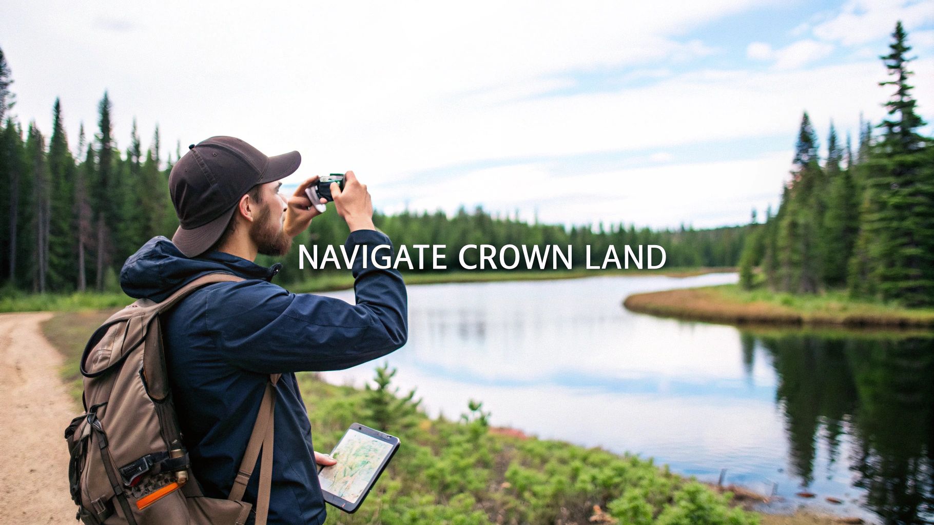
Essential Skills for In-Field Navigation
All the digital scouting you do from your couch means nothing if you can’t find your way in the backcountry. Let's be real: many of Manitoba’s best hunting spots are complete cellular dead zones. Your online crown land maps manitoba will be useless the second you lose signal. This is where solid in-field navigation skills go from being a nice-to-have to an absolute necessity.
Your smartphone, armed with the right app, is your command centre. But to make it work where it counts, you need to think ahead and download your maps for offline use before you leave home. This crucial step saves all the important layers—satellite imagery, property boundaries, and your custom waypoints—right onto your device’s storage. Once you're out there, your phone's GPS will pinpoint your location on that saved map, no cell service required.
Mastering Your Technology in the Field
Relying on a digital device in the wild requires a bit of discipline. Battery life becomes your most valuable commodity; a dead phone can turn an awesome hunt into a dangerous ordeal in a hurry. You have to actively manage your power to make sure your navigation tools last the whole trip.
Here are a few non-negotiable tips for keeping your phone alive:
- Go into Airplane Mode: This is the single biggest power-saver. Your GPS will still work perfectly, but your phone won’t burn through its battery searching for a signal that isn’t there.
- Dim Your Screen: A bright screen is a huge power hog. Turn it down to the lowest level you can comfortably see.
- Pack a Power Bank: A small, fully charged portable battery is a critical piece of safety gear. Think of it as a cheap insurance policy that can bring your phone back from the dead multiple times.
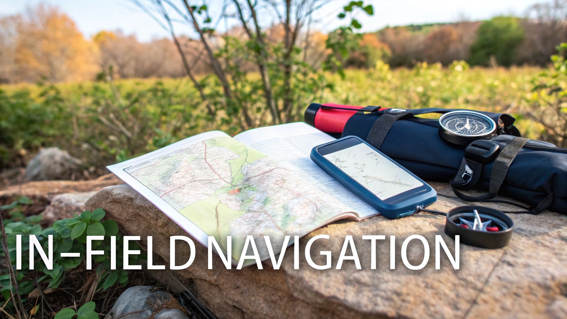
Technology is an incredible tool, but it should never be your only plan. A dead battery, a cracked screen, or a software bug can strike at any time. Being truly prepared means having a reliable, old-school backup you can count on.
The Importance of Analogue Backups
Even with perfect preparation, tech can fail. It’s why every single hunter should carry a physical map of their area and a simple magnetic compass—and, more importantly, know how to use them together. This classic combo is bulletproof and needs no batteries. It’s your ultimate safety net when things go sideways.
Finally, the most important safety step has nothing to do with gear at all. Before you head out, share your plan. Leave a copy of your map with a reliable contact, marking up your intended route, where you’ll park, and the general zones you plan to hunt. Give them a firm time to expect you back. This simple act ensures that if something goes wrong, someone knows exactly where to start looking. Using technology to hunt smarter also means using it to hunt safer, giving you the confidence to explore any corner of Manitoba’s backcountry.
Common Questions About Manitoba Crown Land
Even with the best maps in hand, you’re bound to have questions once your boots are on the ground. Let's tackle some of the most common things hunters ask when navigating the rules of crown land in Manitoba.
Can I Camp Anywhere on Crown Land?
For the most part, yes—but there are rules. As a Canadian citizen or permanent resident, you can camp on general-use crown land for up to 21 days in one spot during a calendar year, completely free of charge. Once those 21 days are up, you need to pack up and move your camp at least 100 metres away.
Keep in mind, this is for temporary, recreational camping. You can't build a permanent shack or cabin. Always follow leave-no-trace principles; the goal is to leave the spot looking like you were never there.
Are Motorized Vehicles Allowed on Crown Land?
This is where things can get tricky. Just because you're on crown land doesn't mean it's a free-for-all for your truck or quad. Many forestry roads and trails are open, but driving off-trail is a huge no-go and can damage sensitive habitats.
Rule of Thumb: Your map is your guide. If a road or trail isn't specifically marked for vehicle use, assume you can't drive on it. Venturing off-trail can land you with a hefty fine.
How Close to Private Property Can I Hunt?
This one is absolutely critical. The official Manitoba Hunting Guide states you cannot discharge a firearm within 150 metres of an occupied building on private land unless you have the owner's permission. But honestly, you should give people a much wider berth than that.
A great habit to get into is using your digital map’s measuring tool to mark a buffer zone. Drawing a 200- or 300-metre perimeter around all private property lines is a smart, respectful way to ensure you never even get close to breaking the law.
What if I Accidentally Trespass?
It can happen, but claiming you didn't know you were on private land won't hold up. If you find yourself on the wrong side of a property line, the protocol is simple: unload your firearm, make it safe, and walk directly back to crown land. Your hunt in that spot is over.
This is exactly why a modern mapping app with GPS is essential. Seeing your real-time location pinpointed on a map with clear property lines removes all the guesswork. It’s the single best tool for preventing a simple mistake from ruining your hunting trip.
Ready to take the guesswork out of your next hunt? HuntScout gives you the most reliable crown land maps, WMU boundaries, and offline navigation tools right on your phone. Plan smarter and hunt with confidence.
Download HuntScout today: https://huntscout.app

