Welcome to your field guide for hunting in New Brunswick. The province is carved up into 27 distinct Wildlife Management Zones (WMUs), and knowing them is the first step to any successful hunt here. These zones are the backbone of NB's wildlife conservation, ensuring healthy animal populations for generations to come.
Your Starting Point for NB Hunting Success
Think of New Brunswick's hunting landscape like a puzzle, with the WMU system as its key. Those 27 zones aren’t just random lines on a map; they’re carefully drawn areas that let wildlife biologists manage populations like deer and moose based on hard, local data. This is why season dates and bag limits are tailored to what each local ecosystem can handle.
Your most important job as a hunter is to know exactly which zone you're in, all the time. The rules for someone hunting way up in WMU 2 can be drastically different from what a hunter down in WMU 23 along the Fundy coast has to follow. Get this wrong, and your hunt could be over before it even starts.
Key Concepts to Grasp
Before you even think about stepping into the woods, make sure you’ve got a handle on these fundamentals:
- Wildlife Management Zones (WMUs): These are the 27 designated areas, each with its own set of specific hunting rules.
- Crown Land: This is public land, and thankfully, a lot of it is open to hunting. Just be aware of restricted areas like provincial parks. You can learn more by checking out our detailed guide on what Crown land is in Canada.
- Private Land: Simple rule here: you need explicit, direct permission from the landowner to hunt. No exceptions.
- The NB Hunting & Trapping Summary: This is your official rulebook. It’s updated every year with the latest season dates, bag limits, and regulations for each specific WMU.
To help you get started, here's a quick rundown of the essential resources every New Brunswick hunter should have at their fingertips.
Essential Resources for NB Hunting Zones
This table summarizes the core tools you'll need to identify your hunting zone and understand its specific rules. Keeping these resources handy will save you a ton of headaches in the field.
| Resource | What It Provides | Where To Find It |
|---|---|---|
| NB Hunting & Trapping Summary | Official, up-to-date regulations, season dates, bag limits, and legal descriptions for all 27 WMUs. | NB Department of Natural Resources and Energy Development website or printed copies from license vendors. |
| GeoNB Map Viewer | Interactive online maps showing property boundaries, including Crown land and private parcels. | The official GeoNB provincial government website. |
| HuntScout App | Digital mapping tool with live GPS tracking that shows WMU boundaries, Crown land layers, and property lines. | Available for download on iOS and Android devices. |
| Paper Topographic Maps | Detailed physical maps for offline navigation, showing terrain, water bodies, and access roads. | Outdoor supply stores or government map services. |
Having a mix of these tools—especially a digital app backed up by a paper map—is the smartest way to ensure you're always compliant and hunting in the right spot.
A critical mistake I see new hunters make is assuming the rules are the same across the province. Always, always verify your zone and double-check the regulations for that specific WMU before you even think about loading your firearm.
This is where modern tools really shine. Digital mapping apps like HuntScout are built for this exact purpose. They show you precisely which of the hunting zones in NB you're standing in by overlaying WMU boundaries on satellite maps. This takes the guesswork out of the equation and lets you focus on what really matters—having a safe, ethical, and successful hunt.
How to Pinpoint Your Exact WMU Location
Knowing which Wildlife Management Zone you're in isn't just a good idea for a successful hunt—it's the law. Get it wrong, and you could be facing serious fines. Nailing down your exact WMU is one of the most fundamental skills for any hunter in New Brunswick, so let's get it right.
Luckily, you've got options, from old-school map-and-compass work to modern tech. Both have their place, whether you're plotting your hunt from the kitchen table or confirming your spot deep in the bush.
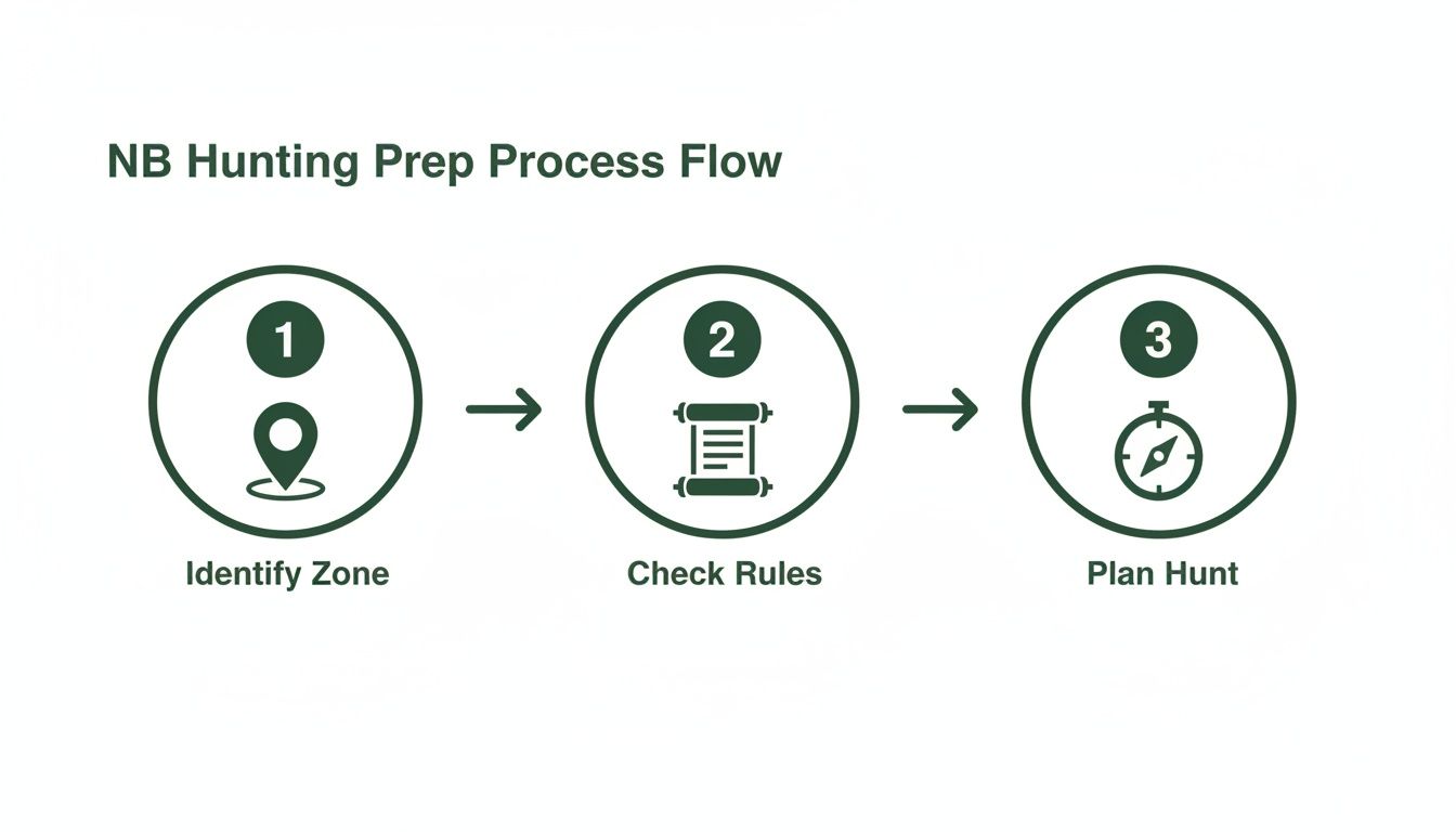
This simple breakdown shows the core of any good hunt plan in New Brunswick: figure out your zone first, then check the rules for that specific area before you even think about heading out.
Using Traditional Maps and Landmarks
The classic way to do this is with the official WMU maps, which you can usually find as PDFs from the Department of Natural Resources and Energy Development. These maps outline all 27 different hunting zones in NB using permanent, easy-to-spot features on the ground.
Think of the boundaries as lines drawn by rivers, roads, and railways. A zone's edge might follow the Miramichi River for a few clicks, then jump to a specific highway, and finish along an old railbed. To make this work, you need to be comfortable with a map and compass, constantly orienting yourself with these major landmarks. For example, if you know you're west of the Saint John River but east of Route 105, you can start to zero in on your WMU pretty quickly.
This method takes some skill and constant awareness of your surroundings. It's solid, but it can get tricky in thick woods or unfamiliar country where you can't easily see those key features.
Leveraging Modern Digital Tools
For dead-on certainty, nothing beats the technology you're already carrying. Modern hunting apps take all the guesswork out of finding your position within New Brunswick's hunting zones.
My Two Cents: Using a GPS-enabled app is the single best way to avoid an accidental zone violation. It gives you instant, undeniable proof of where you are in relation to WMU boundaries. That peace of mind is priceless when you're focused on the hunt.
Apps like HuntScout use your phone’s GPS to drop a "you are here" pin right onto a detailed map. But it's not just a satellite image—it's overlaid with all 27 WMU boundaries. A quick glance tells you exactly which zone you're in, how close you are to the next one, and what’s over the next ridge.
The best part? It works without cell service. Before you even leave the driveway, you can download the maps for your area. Once you're out there, your phone's GPS will keep tracking your location on those saved maps. It doesn't matter if you're in a remote clearcut in WMU 4 or on the edge of farmland in WMU 22; you'll always know where you stand. This is how hunters across the country are adapting, and you can see how other provinces do it in our guide to Saskatchewan hunting zones.
Getting to Grips with Zone-Specific Hunting Rules
Alright, so you’ve pinpointed your Wildlife Management Zone (WMU) on the map. That’s a great first step, but the real homework starts now: digging into the specific rules for that exact piece of ground.
This is where things can get tricky. The regulations are not a one-size-fits-all deal across New Brunswick. They’re fine-tuned for each of the province's 27 WMUs to properly manage local wildlife populations. What’s perfectly legal in one zone could land you in serious hot water just a few kilometres down the road in another.
A lot of hunters, especially if they’re new to an area, get tripped up here. They’ll see the deer season is open in their home zone and just assume it’s open everywhere else. That’s a costly and dangerous assumption to make.
Learning to Read the Fine Print
Your bible for all this is the official NB Hunting & Trapping Summary. It lays out everything from season dates to weapon restrictions for every single WMU. For instance, you might find the rifle season for deer kicks off a full week earlier in a northern zone like WMU 3 compared to a southern one like WMU 25. This isn't random; it's a calculated decision based on things like herd dynamics and typical weather patterns in each area.
Beyond just the dates, you need to be laser-focused on a few key details:
- Bag Limits: How many animals can you legally take? A zone with a healthy, growing bear population might let you harvest more than a zone where numbers are a bit lower.
- Special Permits: This is a big one. Certain hunts, particularly for moose or antlerless deer, demand special permits or draw tags that are valid only for one specific WMU. An antlerless deer tag for WMU 11 is just a piece of paper if you’re actually hunting in WMU 12.
- Weapon Restrictions: Some areas, especially those closer to towns or with higher population density, might have specific rules. You could find yourself in a shotgun-only or bow-only period, so you need to know before you go.
Here’s a classic mistake I see all the time: misinterpreting the Antlerless Deer Validation. If your tag says WMU 15, that is the only place you can legally harvest an antlerless deer. It doesn't matter how tempting that doe looks just across the boundary line—that tag is non-transferable.
Comparing Regulations Across Different NB Hunting Zones
To see just how different the rules can be, let’s look at a quick comparison. It’s a simplified example, but it shows why you can't make assumptions.
| Regulation Detail | Sample WMU A (e.g., Northern, Rural) | Sample WMU B (e.g., Southern, More Populated) |
|---|---|---|
| Antlerless Deer Tag | Available via draw | Limited draw or archery-only |
| Sunday Hunting | Permitted for specific species | Often more restricted or not allowed |
| Bear Season Dates | Longer season, starts earlier | Shorter season, starts later |
This table hammers home the point: the rules you hunt by in one part of the province are likely different from another. Always check the official summary for the exact zone you'll be in.
A Real-World Example
Let's imagine a hunter from the Moncton area (WMU 20) is planning a weekend trip up north to hunt near Mount Carleton Provincial Park, which is in WMU 3.
These two zones might as well be in different provinces when it comes to the rulebook. In any given year, the moose season in WMU 3 could be longer, the bear season might have completely different dates, and the number of antlerless deer tags available will almost certainly vary. That hunter absolutely must check the regulations for WMU 3. Relying on what they know from their local spot back in WMU 20 would be both illegal and unethical.
There's a good reason for all this complexity. These targeted rules are what make effective wildlife management possible. For example, research on New Brunswick's deer management strategies between 2001 and 2007 showed how this works. By carefully reducing antlerless permits in certain zones, wildlife managers were able to help local deer herds rebound, leading to harvest rates jumping by more than 100 percent in many of those areas. You can read the research to see how these conservation strategies paid off.
Modern Tools for Staying Compliant
While the printed summary is the final word, nobody wants to be fumbling through charts and tables out in the bush. This is where a modern tool like the HuntScout app really shines. It takes all that official information and presents it in a clean, easy-to-read format that’s tied directly to your GPS location.
When you’re in the field, you can just tap on your WMU on the map, and the app instantly shows you the key season dates and rules for that exact spot. It gives you immediate clarity to make the right call, ensuring you stay legal and can keep your focus where it belongs: on a safe, ethical, and successful hunt.
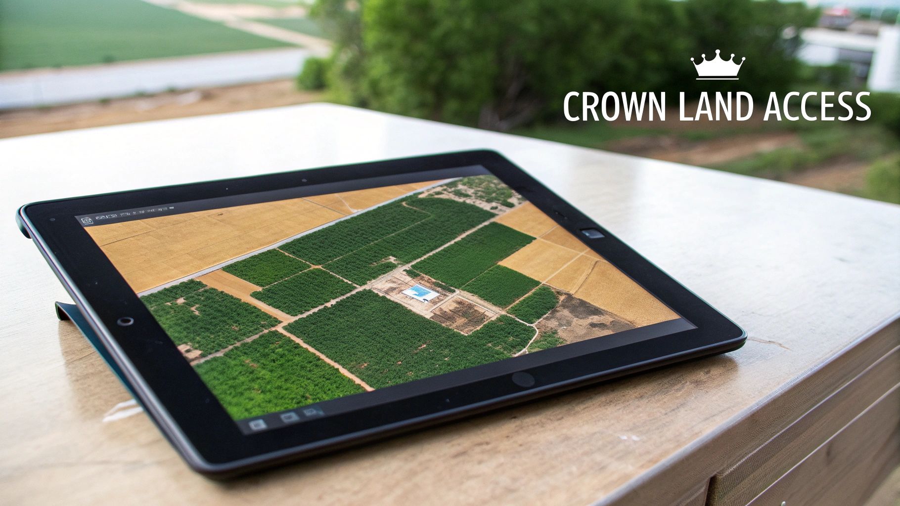
Navigating Crown Land And Restricted Areas
So, you’ve pinpointed your WMU. That’s a great first step, but it's only half the battle. The other half is knowing exactly what kind of ground is under your boots. New Brunswick is blessed with a staggering amount of Crown land—it covers nearly half the province—but one of the costliest mistakes a hunter can make is assuming it's all fair game. It's just not that simple.
Understanding the different public land designations is absolutely crucial for keeping your hunt legal and ethical. Most Crown land is what's called General Use Crown Land, which is typically open for hunting. The trouble is, there are some pretty significant exceptions you need to be able to spot, both on your map and on the ground.
These restricted areas are often set aside for conservation, and hunting inside them is strictly prohibited. Out in the woods, the line between huntable land and a no-go zone can be nothing more than a few feet of moss—which makes a reliable map your single most important piece of gear.
Distinguishing Huntable Land from No-Go Zones
The real challenge for many hunters, new and old, is accurately identifying these boundaries. Sure, government PDF maps show these zones, but learning to interpret them in the field takes a lot of practice. This is where modern digital tools have completely changed the game.
Hunting apps with detailed land ownership layers, like HuntScout, cut right through the confusion. They overlay clean, colour-coded boundaries directly onto your satellite or topo map, making it instantly obvious where one designation ends and another begins. With just a quick glance at your phone, you can see if that promising-looking ridge is on accessible Crown land or sits inside a protected area.
When you're scouting your zones in NB, here’s what you need to keep an eye out for:
- Provincial Parks: This one's easy—all hunting is strictly forbidden. No exceptions.
- Protected Natural Areas (PNAs): These areas are set aside to protect unique ecosystems. Hunting is not permitted here either.
- Industrial Leases: Some Crown land is leased out for things like forestry or mining. Access here can be restricted or might require special permission from the leaseholder.
- Private Land Inholdings: It's common to find pockets of private property tucked inside huge tracts of Crown land. You absolutely must have landowner permission to set foot on these parcels.
For a much deeper dive into this, check out our complete guide to navigating the Crown land map for New Brunswick.
On-The-Ground Etiquette and Legal Access
Knowing the map is one thing; navigating the actual terrain legally and respectfully is another ball game entirely. Just because you can see a block of Crown land on your map doesn't grant you a magical right to walk onto it from anywhere.
Access is everything. If you can't legally get to a piece of Crown land because it's surrounded by private property, it's effectively off-limits. Never cross private land to reach a public area without explicit, clear permission from the landowner.
Always be mindful of safety buffers. It is illegal to discharge a firearm within 400 metres of a dwelling, school, or playground. This is a hard-and-fast rule with no wiggle room.
Pay close attention to any posted signs. They are there for a reason, whether it’s marking a private property line, a safety zone, or a restricted industrial area. A 'No Hunting' sign must always be respected, even if your map says you're on public land. It could be there to signal a local restriction or safety concern you’re not aware of.
Tips for Staying on the Right Side of the Line
Knowing the rules for New Brunswick's hunting zones on paper is one thing, but putting them into practice when you're deep in the bush is what really counts. Good habits in the field aren't just about staying legal; they're about staying safe and making the most of your time out there. It all boils down to one simple rule: always know exactly where you are.
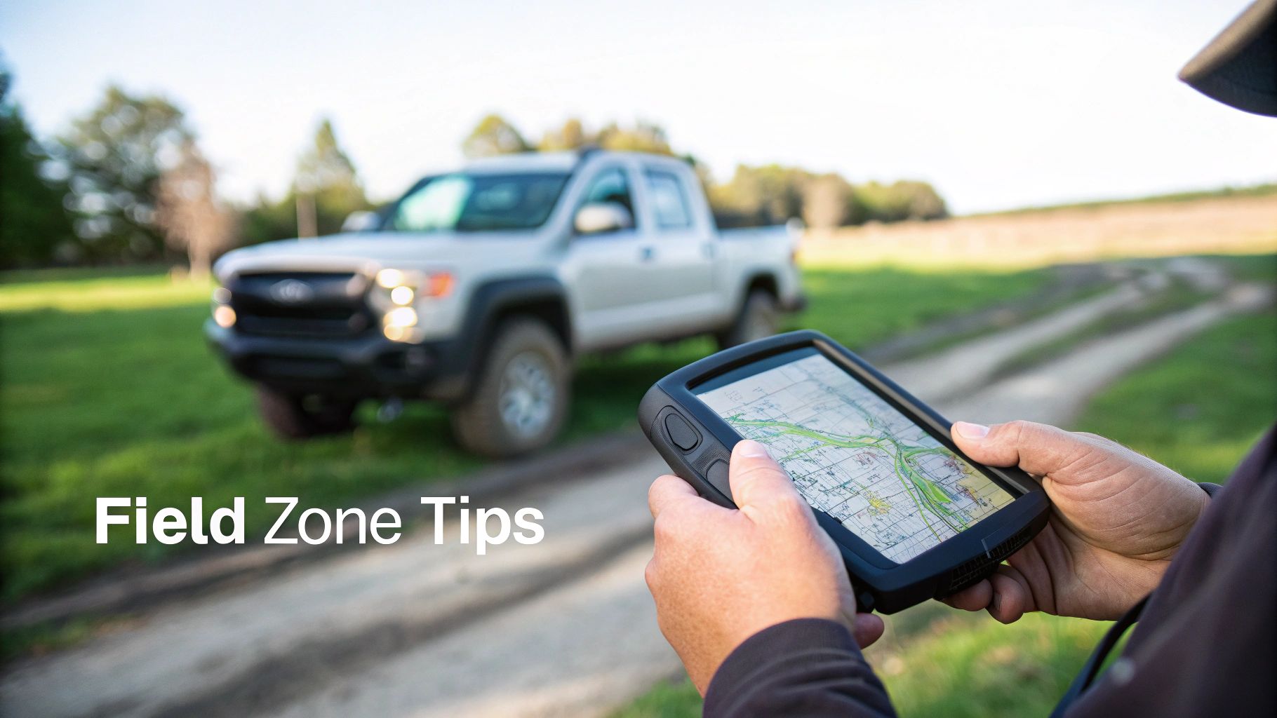
Let's be honest, many of the best hunting spots in NB have spotty cell service at best. Counting on a live internet connection to pull up a map is a rookie mistake and a recipe for getting lost or straying where you shouldn't. This is precisely why offline maps are non-negotiable. Before you even think about leaving the driveway, download the maps for your WMU right onto your phone. That way, your GPS will keep tracking your location on the map, showing you exactly where you stand in relation to property lines and zone boundaries, even when you're completely off-grid.
Create Your Own Personal Hunt Map
One of the most effective ways to truly master an area is to build your own custom map as you go. Think of it as your personal hunting journal. As you scout and hunt, get in the habit of using your mapping app to drop waypoints for anything and everything important. This transforms a generic map into your secret weapon.
Start by marking these key points:
- Your Truck: This is the most important pin you'll drop all day. Always mark where you park. It guarantees you can find your way back after a long trek.
- Stand or Blind Locations: Pin every potential setup. You can even add notes later about which wind is best for each spot or what time of day you saw activity.
- Game Sign: Stumble upon a major deer trail, a fresh moose rub, or some bear scat? Pin it. Over time, these points start to paint a clear picture of how animals are using the area.
- Property Lines: If you're hunting anywhere near private land, drop a few pins along the boundary. It’s a simple visual cue that keeps you a safe and legal distance away.
The real payoff from in-field mapping isn't just about staying legal today. It's about building your own book of knowledge. That waypoint you drop on a buck rub this fall becomes a crucial piece of intel for planning next year's hunt.
Safety and Ethics in the Field
Being compliant is about more than just your GPS location; it’s about constant awareness. You must be 100% certain of your target and what lies beyond it. A clear line of sight isn't enough—you have to know your backstop is safe. This is especially critical when hunting in popular hunting zones in NB where you're likely not the only one out there.
So, what happens if you make a mistake and realize you’ve wandered onto private property? Stop. Right there. Unload your firearm, turn around, and backtrack to where you were last on legal ground. The only right move is to contact the landowner, apologize, and ask for permission if you need to retrieve gear or an animal.
This kind of careful, zone-specific management is vital because wildlife populations are always in flux. For example, New Brunswick's white-tailed deer harvests hit a high of around 46,000 in the late 1970s. Just a decade before that, the annual harvest was only 20,000, a huge drop caused by changes in habitat and hunting pressure. You can dig deeper into these historical trends and find further insights into NB's deer population dynamics. These numbers show exactly why following the WMU rules is so critical for keeping our hunts sustainable for years to come.
Got Questions About NB Hunting Zones? You're Not Alone.
Even the most seasoned hunters run into questions when they're out in the woods or planning a trip. Getting a clear answer, especially when you're in the field, is crucial for staying legal and having a good hunt. Let's walk through some of the most common questions that pop up.
How Can I Be 100% Sure Which Hunting Zone I’m In?
When you're out there, the best way to know your exact location is with a GPS-powered app on your phone. These tools use your phone’s GPS to pinpoint you on a map that clearly shows the WMU boundaries. It takes all the guesswork out of the equation. Even if you lose cell service, a pre-downloaded map will keep working just fine.
The old-school way involves a physical map and a compass. You’d need to triangulate your position using landmarks like rivers, roads, or hills. It’s a great skill to have as a backup, no doubt, but it's much slower and far less precise for that immediate, "am I in the right spot?" confirmation.
What If I Realize I'm in the Wrong WMU?
This is a serious situation. Hunting in a zone where your tag isn't valid is a major violation of the Fish and Wildlife Act. The penalties are steep—we're talking significant fines, having your firearm and maybe even your truck seized, and losing your hunting licence for a period of time.
If you find yourself in this spot, the absolute best thing you can do is unload your firearm and immediately self-report to the nearest conservation officer. To prevent it from ever happening, make a habit of double-checking your location before you start hunting, and especially before you take a shot.
Here's the bottom line: if you aren't 100% certain you're in the right zone, don't hunt. That moment of hesitation isn't worth the legal and financial headache that comes with being wrong.
Can I Hunt on Any Piece of Crown Land I See?
Definitely not. While New Brunswick has a huge amount of General Use Crown Land that’s open to hunters, plenty of parcels are off-limits. This includes protected areas like provincial parks and Protected Natural Areas (PNAs), along with some industrial lands leased from the Crown.
As a hunter, the responsibility is on you to know the rules for the specific piece of land you’re standing on. This is where modern mapping tools really shine; they colour-code the different land types, making it easy to see at a glance what’s huntable public land and what’s a no-go zone.
How Often Do the Hunting Rules Actually Change?
The WMU boundaries themselves are quite stable—they almost never change. What does change, often every single year, are the regulations within those zones. Things like season dates, bag limits, and the number of antlerless deer tags available for a specific WMU are reviewed annually based on wildlife population studies.
Before every season, make it a point to review the latest NB Hunting & Trapping Summary. An even better approach is to use a digital app that updates automatically. That way, you know the information you're relying on is always the most current.
Figuring out the ins and outs of hunting zones in NB is a lot easier with the right gear. HuntScout brings everything together, layering WMU boundaries, Crown land data, and current regulations onto a single map. You can plan your hunt with total confidence and stay on the right side of the law. Get started by downloading the app at https://huntscout.app.

