If you're hunting in Ontario, your Wildlife Management Unit (WMU) map is your bible. It’s not just a piece of paper with lines on it; it’s the strategic playbook that dictates every move you make, from when you can hunt to what you can harvest. Getting this right is step one for any successful season.
Understanding the Ontario Hunting WMU Map System
Think of a WMU as a specific geographical zone with its own unique rulebook. The province is carved up into these units to manage wildlife populations at a local level, which makes a ton of sense when you think about it.
This system allows biologists to set regulations that actually fit the local wildlife and habitat. Instead of a blanket, one-size-fits-all rule for a province as massive as Ontario, the WMU system keeps management smart and sustainable. It’s also why the rules can change dramatically just by crossing a small river or a back road that happens to be a boundary line.
Why Your WMU Is Your Strategic Playbook
Once you get the hang of it, the WMU system isn't just a bunch of rules—it becomes a huge advantage for planning your hunt. Everything you need to know is tied directly to that WMU number.
This includes critical details like:
- Open and Closed Seasons: The dates you can legally hunt deer, moose, or bear can be completely different in neighbouring WMUs.
- Weapon Restrictions: Your trusty rifle might be legal in one unit, but the one right next door could be bows-only for that same week.
- Bag Limits: How many animals you can harvest is set specifically for your WMU.
- Tag Availability: The number of tags for controlled hunts, like moose or antlerless deer, is all based on population data within that single unit.
Key Takeaway: The whole point of the WMU system is to manage wildlife populations for the long haul. By knowing your unit inside and out, you’re not just staying on the right side of the law—you're an active participant in conservation.
Every WMU is a piece of a larger puzzle. They are the core administrative blocks for wildlife research and managing the harvest across Ontario. These zones are how the government tracks hunter numbers and harvest data each year, giving us a clear picture of population trends and hunting pressure.
If you really want to dig into the data, you can explore the official government datasets to see everything from white-tailed deer stats to moose harvest reports. It’s a great way to get a deeper understanding of what's happening in your specific corner of the province.
Getting Your Hands on WMU Maps: Official Sources vs. Modern Tech
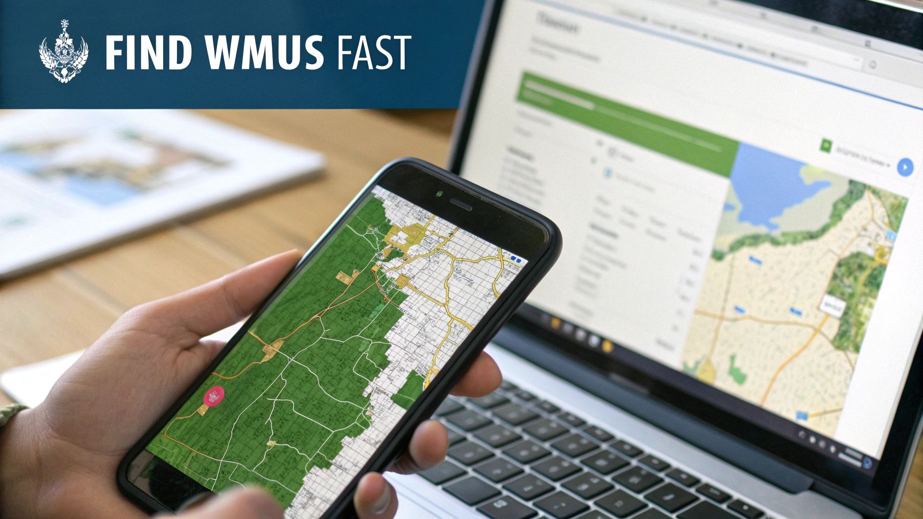
Long gone are the days of wrestling with a giant, crinkled paper map to figure out your WMU. Today's digital tools have made life much easier, but the key is knowing which tool to use for the job—planning at your desk is a different beast than navigating in the field.
The official, definitive source is always the Ontario government’s web-based tool, Make-a-Map: Hunt. Think of this as your primary reference. It's fantastic for pre-hunt planning where you can browse the province, search by address, and see the official WMU boundaries. It also includes other useful layers like Crown Land and provincial parks.
But here’s the catch: Make-a-Map is a web tool, not a field tool. It’s clunky on a phone, slow to load, and completely useless once you lose cell service. That’s where a good hunting app becomes your best friend in the bush.
Comparing Official vs App-Based WMU Map Tools
When it comes to actually being out on a hunt, the difference between the government portal and a dedicated hunting app is night and day. Apps are built specifically for hunters on the move.
The table below breaks down the main distinctions between the two, helping you see where each tool really shines.
| Feature | Government 'Make-a-Map: Hunt' | Hunting Apps (e.g., HuntScout) |
|---|---|---|
| Primary Use | Pre-hunt planning on a desktop | In-field navigation and planning |
| WMU Identification | Search or manual browsing | Instant tap-to-ID with GPS |
| Offline Capability | Not available; requires internet | Yes, download maps for offline use |
| Map Layers | Basic layers (Crown Land, parks) | Advanced layers (satellite, topo, private) |
| Usability | Can be slow and complex on mobile | Fast, intuitive mobile interface |
As you can see, each has its purpose. The government site is the official word, but an app gives you that information in a much more practical and field-ready package.
Why a Dedicated App Gives You an Edge
Hunting apps like HuntScout are designed from the ground up for real-world scenarios. They don’t just show you a line on a map; they overlay those crucial WMU boundaries onto high-resolution satellite imagery. This gives you vital context that a simple government map can't.
Imagine you’re tracking a buck along a creek bed that happens to form a WMU boundary. With an app, you can see your exact GPS dot moving along that creek on a satellite image, with the bright red boundary line right there. There's zero guesswork about which side you're on.
This instant identification is a game-changer. Just tap anywhere on the map, and the app tells you what WMU you’re in. It's that simple.
Plus, these apps pack in other layers that are just as important as your WMU. You can toggle property lines and, critically, view the different types of Crown Land. Knowing where you can legally hunt is half the battle. If you're looking to explore more public land, our guide on how to find Crown Land in Ontario is a great resource.
The best approach? Use both. Double-check your plans against the official Make-a-Map site from your computer, but for confident, legal, and stress-free navigation in the field, a dedicated hunting app with offline maps is an essential piece of gear.
Alright, you've pinpointed your spot on the map and found its WMU number. So, what's next? This is where we turn those lines and colours on a screen into practical, boots-on-the-ground knowledge. It’s what separates a successful—and legal—hunt from a frustrating one.
Think of your map as telling you where you are. The official regulations tell you the what, when, and how.
WMU boundaries aren’t just random lines drawn by a bureaucrat. They almost always follow real, tangible features you can actually see in the bush. This is done on purpose, to make it easier for hunters to know exactly where they stand without constantly staring at a GPS.
For example, the dividing line between WMU 82A and 84 might be a major highway you can see from a kilometre away. The border between WMU 55A and 55B could be a river that snakes through the landscape. When you start to see the map this way, it clicks. You can visualize your location much better.
Connecting Your Map to the Rules
Knowing you're standing in WMU 76B is only half the puzzle. That number is your key to unlocking the very specific set of rules for that exact piece of dirt. Now it's time to cross-reference your map with the official Ontario Hunting Regulations Summary. Your map gets you to the spot; the summary keeps you out of trouble.
Let's walk through a real-world example. Say you've been e-scouting a great-looking piece of Crown Land on your map and you've confirmed it's deep inside WMU 47. Before you even think about packing the truck, you have to dig into the regulations for that specific unit.
Here’s what you absolutely need to verify:
- Open Seasons: Is deer season actually open in WMU 47 for the dates you plan to go? A bow season might be open in the unit next door, but that means nothing for where you'll be.
- Firearm Restrictions: Is it a rifle season? Or is it restricted to shotgun, muzzleloader, or bow only? This is a huge one, and getting it wrong is a costly mistake.
- Bag Limits: How many deer can you legally harvest? Can you even get an antlerless tag for WMU 47, or is it bucks only this year?
- Sunday Gun Hunting: This is a big one in southern Ontario. Can you legally hunt with a gun on a Sunday in the specific municipality your spot is in? It varies from one township to the next.
Hunter's Tip: Treat your WMU number and the Hunting Regulations Summary as two halves of the same tool. One is pretty useless without the other. I make it a habit to check the summary for my specific WMU before every single hunt, even in my old stomping grounds. Rules change more often than you think.
Telling Different Types of Land Apart
A good map layer does more than just show you WMU lines; it helps you see the difference between Crown Land, private property, and parks. The line marking a WMU boundary will look different from one showing a property line.
Being able to read these layers is critical. Knowing the precise edge of a Crown Land parcel within your WMU is what keeps you from accidentally trespassing—a massive headache you don't want. It’s this deep understanding of boundaries, both for your WMU and for property ownership, that defines a well-planned, ethical, and legal hunt.
To dig deeper into this, check out our guide on the importance of hunting boundaries for staying legal in Ontario and Alberta.
Turning WMU Data Into Your Secret Weapon
Knowing your WMU boundaries keeps you legal, but that's just scratching the surface. The real power comes when you stop thinking about compliance and start thinking about strategy. This is the moment your Ontario hunting WMU map transforms from a simple reference into one of your most valuable planning tools. By digging into the data that’s freely available, you can turn those lines on a map into a real-world advantage.
It's a pretty straightforward process when you break it down.
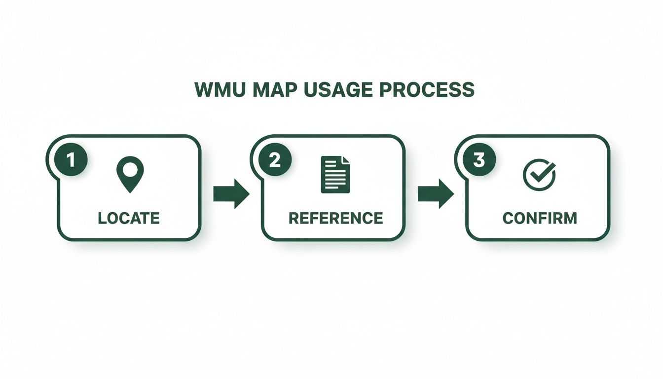
This isn't just about following the rules. It's about looking at the story behind your WMU to find better opportunities. The goal is to move past simply knowing where you are and start understanding why you should be there in the first place.
Reading Between the Lines of Harvest Data
Every single year, the Ontario government releases a pile of harvest reports. For a savvy hunter, this information is pure gold. It lets you spot trends over several years, giving you a read on hunting pressure, the health of local wildlife populations, and where your odds might be best.
Instead of just picking a spot on the map that "looks good," you can start asking pointed questions based on hard numbers:
- Has the deer harvest in WMU 76D been climbing or dropping over the last five years?
- How does the success rate in a popular, easy-to-access unit stack up against a less-travelled one right next door?
- Are hunters in WMU 48 reporting more moose than they were a few seasons ago?
Answering questions like these helps you decide if a well-known WMU is actually worth the competition, or if a quieter unit might offer a better experience. Doing this homework is a crucial first step when figuring out where to hunt in Ontario and can save you a ton of wasted time and fuel.
Decoding Hunter Success Rates
One of the most powerful stats you can look at is 'Harvested per hunter'. This cuts through the noise of raw harvest numbers. The Ontario Hunting Data Map platform, for instance, breaks down this information year-by-year, showing you how many animals were taken for every active hunter in a specific WMU.
Why does this matter? It helps you figure out if a low harvest number is a red flag (declining animal population) or an opportunity (just fewer hunters in the woods that year).
Strategic Takeaway: A WMU with a high 'Harvested per hunter' rate but low total harvest numbers could be an absolute gem. It often points to a healthy animal population with very little hunting pressure—the perfect recipe for a memorable hunt.
This data-driven approach hooks directly into your on-the-ground planning. Once you've identified a WMU with promising trends, you can zero in on it for your e-scouting. Start dropping waypoints on your digital map in areas within that unit that show promise. You're no longer just looking at abstract stats; you're building a focused, boots-on-the-ground hunting plan.
It’s how the ontario hunting wmu map goes from being a regulatory document to your personal strategic blueprint.
Advanced Tactics for In-Field and Offline Navigation
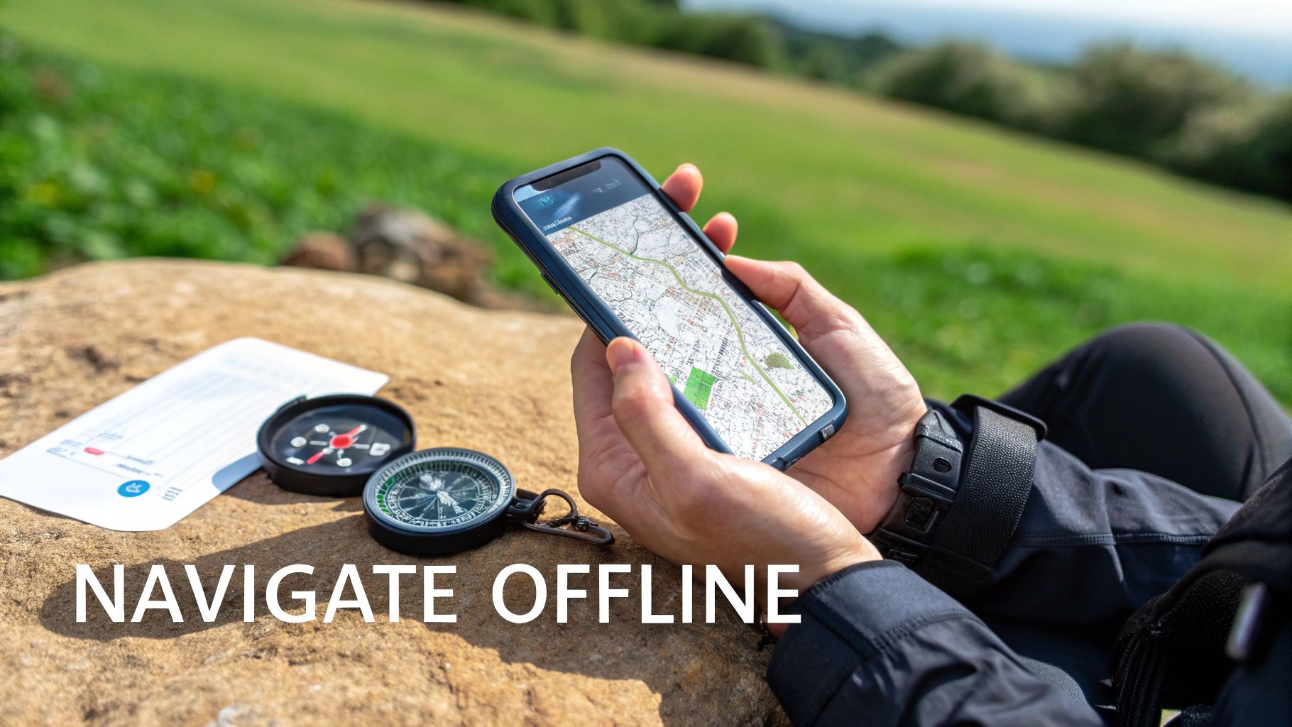
Let’s be honest: your perfect hunt plan is completely useless if you can't navigate once you're out in the bush. Cell service is a luxury you just can't count on in the backcountry. This is where the real work begins, and having a reliable offline map on your phone isn't just a nice-to-have—it's essential.
The idea is straightforward but incredibly effective. Before you even think about losing service, you download all the map data you'll need right onto your device. We’re not talking about a grainy screenshot here; this is the full, interactive map, ready to go completely off-grid.
Building Your Offline Map Package
Think of it as packing a digital go-bag for your hunt. Most quality hunting apps let you select and save entire areas for offline use, creating a custom map package tailored specifically for your trip.
Before you head out, double-check that you've downloaded these crucial layers:
- High-Resolution Satellite Imagery: This is your eye in the sky. It lets you see the actual terrain—clearings, creek beds, timber changes, and access roads.
- WMU Boundary Layer: This is non-negotiable. You must be able to see the exact WMU lines in real-time, especially when you’re on the move.
- Crown Land and Private Property Layers: Knowing precisely where you stand is everything. This layer keeps you on the right side of the law.
- Your Personal Waypoints: Don’t lose all that e-scouting work. Make sure every pin you dropped—glassing points, potential bedding areas, treestand locations, and trailheads—is saved for offline access.
Once your map package is saved, your phone’s internal GPS will work perfectly without any cell signal. That means you’ll see your location as a little blue dot moving across your downloaded map. No more second-guessing whether you’ve crossed a property line or strayed into the wrong WMU. You'll know for sure.
Mastering In-Field Navigation and Battery Life
With your offline Ontario WMU map loaded up, your phone transforms into your most powerful navigation tool. The trick is using it wisely to preserve that precious battery life. A dead phone is no better than a map left at home.
First thing you do when you leave the truck? Switch your phone to Airplane Mode. This one move makes a massive difference, stopping the device from constantly searching for a signal it will never find. Your GPS will still work just fine.
Next, turn your screen brightness way down. Your screen is the number one battery hog. Get in the habit of only turning it on to confirm your position or check your next move, then put it right back to sleep.
Field Tip: Never, ever trust a single piece of electronics with your safety. Always carry a physical compass and a paper map of your area, and more importantly, know how to use them together. A dead battery or a cracked screen should be an inconvenience, not a crisis. That compass is a lightweight, bomb-proof backup that might just be the most important tool in your pack.
Got Questions About Ontario WMU Maps? We've Got Answers.
Even with the best maps and apps, you're bound to run into some head-scratchers when you're out in the field. Getting the small details right is what keeps you hunting legally and with confidence. Let's tackle some of the most common questions Ontario hunters ask.
How Do I Figure Out Which WMU My Property Is In?
This is probably the number one question I hear, especially from folks who own land or have permission to hunt a private spot. The government's Make-a-Map tool works, but honestly, a modern hunting app is quicker and much more intuitive.
Just pull up the map on your phone, zoom in on your property, and tap the screen. The app will instantly tell you which WMU you're looking at. This is a game-changer for properties that straddle a boundary, where being off by 20 metres could put you in a completely different zone with different rules.
Can I Hunt in More Than One WMU During the Same Season?
You sure can, but you have to be incredibly careful. Think of each WMU as its own little province with its own set of laws. The rules for one don't just follow you when you cross a road into another.
For example, you might be in WMU 58 where the rifle season for deer is wide open. But just across the boundary, WMU 57 might be bows-only for that week, or the season might be closed altogether. You need the right tag for the specific WMU you're standing in at that moment. Using a GPS-enabled app that shows your live location against the WMU boundaries is the best way to avoid a simple mistake that could end up costing you big time.
Key Takeaway: "I didn't know where the line was" won't get you out of a ticket. As the hunter, the responsibility is 100% on you to know exactly where you are and what the rules are for that spot.
What Happens if I Shoot an Animal Right on a WMU Border?
This is where knowing the rules inside and out really matters. The law is very specific: the harvest is recorded in the WMU where the animal was located when you took the shot, not where you were standing.
So, if you’re in WMU 48 but that buck is standing across the creek in WMU 49, you are legally hunting in WMU 49. That means you need to follow all of WMU 49's regulations and punch a valid WMU 49 tag. Never guess on this one—misreporting the harvest location is a serious offence. Always confirm your target's location before you even think about pulling the trigger.
Are the Rules for Crown Land the Same Everywhere?
Nope, not always. While the big-picture rules for using Crown Land are consistent across Ontario, you'll find plenty of local regulations that vary by WMU.
A few things to watch out for:
- Access Rules: Some Crown parcels might ban ATVs or even trucks, restricting you to foot access only.
- Firearm Restrictions: You could find a specific block of Crown Land that's designated as bows-only, even if rifles are allowed in the rest of the WMU.
- Local Bylaws: Don't forget that municipalities can add their own layers of rules, like restrictions on Sunday gun hunting, which often apply to Crown Land within their jurisdiction.
Your best bet is to use an Ontario hunting map that not only shows you the Crown Land but also helps you check the Hunting Regulations Summary for any WMU-specific rules that apply to public areas.
Planning your hunt shouldn't feel like you're studying for a legal exam. HuntScout takes the headache out of it by putting accurate WMU boundaries, Crown Land layers, and current season dates right on your phone. Download our app for free and spend less time guessing and more time hunting. Get HuntScout today.

