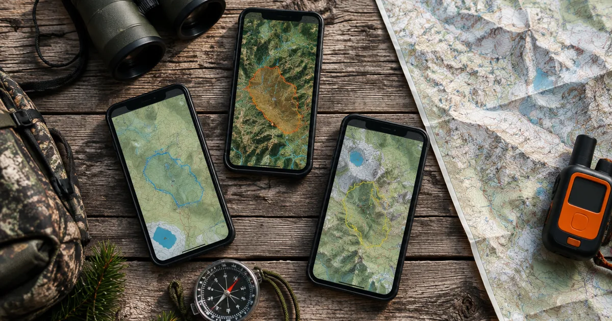
Quick answer: There's no single best hunting app for every Australian and New Zealand hunter, because the official maps are state by state. In NSW, carry the free official Hunt NSW app: it holds your written permissions and meets the GPS map rule. In Victoria, the free More to Explore app has the official hunting layers. For New Zealand, NZ Topo Maps is a popular free topo app that shows DOC hunting areas. If you hunt across several states, or across both countries, an all-in-one hunting map such as HuntScout, WildMap or The Hunting App saves juggling apps. HuntScout is the one of those that covers New Zealand's DOC blocks and roar ballots as well as VIC, NSW and TAS. onX Hunt works for GPS and waypoints here, but its land layers are US and Canada only.
Disclosure: HuntScout publishes this blog. We've tried to be fair: every claim about another app comes from its App Store listing or its own support pages, checked on 15 October 2026. If something's wrong or out of date, tell us and we'll fix it.
What to look for in a hunting app here
Hunting in Australia and New Zealand is regulated by land type and agency, so the features that matter are different from North America:
- Official public land layers for where you hunt. DOC hunting areas in NZ, DEECA parcels in Victoria, declared State forests in NSW, the deer areas and STT land in Tasmania. Check the app uses the agency's data and shows when it was updated.
- Rules on tap. Species allowed, dogs, ballot or booking, closures. A polygon without its rules is half the answer.
- Offline maps. Most good hunting country has no reception.
- Compliance where it's required. NSW requires the official DPIRD maps on a GPS device. No third-party app replaces that.
- Price in your currency, and what's actually free.
- Your own data. Waypoints, tracks, sharing with your mates.
The apps at a glance
| App | Australia | New Zealand | Hunting layers | Offline | Price | Platforms |
|---|
| HuntScout | VIC, NSW, TAS, SA game reserves, NT hunting reserves | All DOC hunting areas, roar and ballot blocks, huts, tracks | Yes, from agency data, with rules on tap | Yes | Free download; Australia & NZ Pro A$39.99/yr (NZ$39.99) on the web | iOS, Android, web |
| WildMap | VIC, NSW, TAS; cadastral tenure incl. QLD | Not listed | VIC GMA zones, NSW R-Licence forests with booking links, TAS game reserves | Yes | Free, in-app purchases (Premium) | iOS, Android |
| The Hunting App | Base maps everywhere; premium hunting overlays | Base maps | Plus subscription: public land and hunting area boundaries | Yes | Free; Plus subscription | iOS, Android, web planner |
| Hunt NSW (official, NSW DPIRD) | NSW only | No | Official State forest hunting and exclusion maps attached to your permission | Yes (map features) | Free | iOS, Android |
| More to Explore (official, Vic Government) | Victoria only | No | Official hunting layers: species per area, dogs | Yes, up to 15,000 km² | Free | iOS, Android |
| NZ Topo Maps | No | Topo50/Topo250 from LINZ | DOC recreational hunting areas, DOC huts and campsites | Yes | Free download | iOS |
| onX Hunt | GPS tools only | GPS tools only | Land layers US and Canada only | Yes | Subscription | iOS, Android |
Prices change, and the app stores show the local price before you pay.
The apps in detail
HuntScout
Best for: hunters who hunt in more than one state, or in both Australia and New Zealand, and want the rules for each area on tap.
HuntScout loads each agency's own data: DOC's hunting areas (with status, block type, and date, access, dog and special conditions), roar and balloted roar blocks, huts, tracks and air access zones in NZ; DEECA's 15,900 hunting parcels with species and dog rules in Victoria; Forestry Corporation's State forests and exclusion layers in NSW; and the deer areas, deer zones, STT land and Parks and Wildlife wallaby and duck areas in Tasmania. Season dates are shown for every species with a link to the agency page they were checked against. Maps download for offline use, and you get waypoints, routes, shared folders and an AI assistant.
Limitations: no private land boundaries or owner names in Australia or NZ (unlike in Canada and the US); no Queensland or WA hunting layers; not an approved map for NSW permissions; NZ game bird region boundaries not yet on the map; and the hunting layers need the paid Australia & NZ plan (DOC huts, tracks and campsites and Tasmania's deer zones are free).
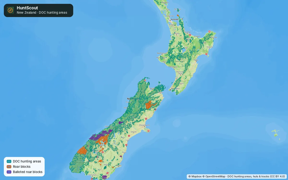 HuntScout's New Zealand coverage: every DOC hunting area, with roar and balloted roar blocks.
WildMap
Best for: Australian hunters who want land tenure and terrain tools in one app.
WildMap describes itself as "the dedicated hunting map for Australian hunters". Its App Store listing covers colour-coded cadastral tenure across VIC, NSW, TAS and QLD (with owner and tenure lookup in Victoria), Victorian GMA zones with species tables, NSW R-Licence forests with booking categories and DPIRD booking links, and Tasmanian game reserves. It adds terrain tools such as thermal flow, a scent cone and line of sight, plus offline maps and GPS tracking. WildMap is clear that it's an independent app, not a government one.
Limitations: no New Zealand coverage listed. It's a newer app (first released July 2026), so it has few ratings so far.
The Hunting App
Best for: a solid offline GPS and mapping app with strong group features.
The Hunting App's free tier includes topographic and satellite base maps with offline download, waypoints, track recording, and import of KMZ, GPX, GeoJSON and GeoPDF files. That last one is handy for loading official maps. Its Plus subscription adds cloud sync, hunting groups with chat and live location, hunt planning tools and premium layers, including public land and hunting area boundaries.
Limitations: the hunting layers are behind Plus. Check the coverage list for your state before you subscribe.
Hunt NSW (official)
Best for: anyone hunting NSW State forests. If you hunt NSW public land, you need this one.
DPIRD's app lets R-Licence holders book hunts, store written permissions, access current hunting maps (updated quarterly, with offline map features) and submit harvest returns. DPIRD says it meets the written permission requirement to carry a GPS-enabled device with the current hunting and exclusion maps (DPIRD GPS guide).
Limitations: NSW only, and the hunt map is only usable once a written permission has started. It's a compliance tool, not a planning or scouting map.
More to Explore (official, Victoria)
Best for: Victorian hunters who want the official map, free.
DEECA's More to Explore app shows public land open to hunting, with the species allowed in each area and where dogs are allowed, and saves up to 15,000 km² for offline use. GMA explains how to use it on its hunting maps page.
Limitations: Victoria only, and it's a general State forest app first, so hunting is one layer among many. It has no season dates beside the map.
NZ Topo Maps
Best for: Kiwi hunters and trampers who want fast, free NZ topo maps.
A long-running, well-rated New Zealand app with LINZ Topo50 and Topo250 maps you download area by area, DOC huts and campsites with alerts, and DOC recreational hunting areas. It's simple and quick.
Limitations: NZ only, and it's a topo app rather than a hunting app: no roar ballot layer, season dates or block rules on tap. It's listed on the App Store; check Google Play for an Android version.
onX Hunt
onX is the biggest hunting app in North America, and people do search "onX Hunt Australia". onX's own support page says the app works almost anywhere for live GPS, waypoints, drawing and tracking, but its land ownership, trail and recreation layers are only available in the US and Canada (onX support). In Australia and New Zealand you'd be paying for a GPS app with satellite imagery.
Garmin and other GPS hardware
A dedicated GPS or satellite messenger is not a replacement for a map app, and the reverse is also true. Garmin's inReach range adds two-way satellite messaging and SOS, and a personal locator beacon (PLB) is the minimum for remote country. Many hunters pair a phone app for planning with a PLB or inReach for safety.
Which should you use?
- NSW only: Hunt NSW (required on the day), plus a planning map such as HuntScout or WildMap to compare forests.
- Victoria only: More to Explore is free and official. Add HuntScout or WildMap if you want season dates and rules on tap, or other states.
- Tasmania: HuntScout shows the deer areas with booking links, STT and PWS areas together. WildMap covers Tasmanian game reserves and tenure.
- New Zealand: NZ Topo Maps for free topo maps; HuntScout if you want DOC blocks with their conditions, roar and ballot blocks, and season dates.
- Australia and New Zealand: of the apps compared here, HuntScout is the only one whose listing covers hunting layers in both countries.
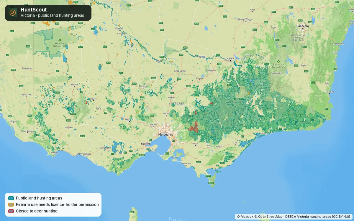 Victoria's public land hunting parcels in HuntScout, from DEECA's open data.
Whichever you choose, check the official source. A hunting area on any app is not a permit, a permission or a booking.
Try HuntScout
Region guides: DOC hunting permits · Where to hunt in NZ · NSW State forests · Victoria hunting maps · Tasmania · HuntScout in Australia and New Zealand. Hunting in Canada? See the best hunting apps in Canada.
Last checked: 15 October 2026, from each app's App Store listing and the developers' and agencies' own pages. Features and prices change; check the app store listing before you buy, and confirm hunting rules with the relevant agency.
Frequently asked questions
What is the best hunting app in Australia?
It depends on your state. Hunt NSW is required for NSW State forests and More to Explore is the free official map in Victoria. For more than one state, all-in-one apps include HuntScout (VIC, NSW, TAS, SA, NT and NZ), WildMap (VIC, NSW, TAS) and The Hunting App (premium hunting layers).
What is the best hunting app in New Zealand?
NZ Topo Maps is a popular free topo app with DOC hunting areas. HuntScout shows DOC hunting areas with their status and conditions, roar and balloted roar blocks, huts and tracks, plus game bird season dates by Fish & Game region.
Does onX Hunt work in Australia or New Zealand?
Only partly. onX says live GPS, waypoints, drawing and tracking work almost anywhere, but its land ownership and trail layers are only available in the US and Canada. See onX support.
Is there a free hunting map app for Victoria?
Yes. DEECA's More to Explore app is free and has the official hunting layers, showing the species allowed in each area and where dogs are allowed. You can save areas for offline use.
Can I use any hunting app in NSW State forests?
You can use any app to plan, but your written permission requires the current DPIRD hunting and exclusion maps on a GPS-enabled device. The free Hunt NSW app meets that requirement.