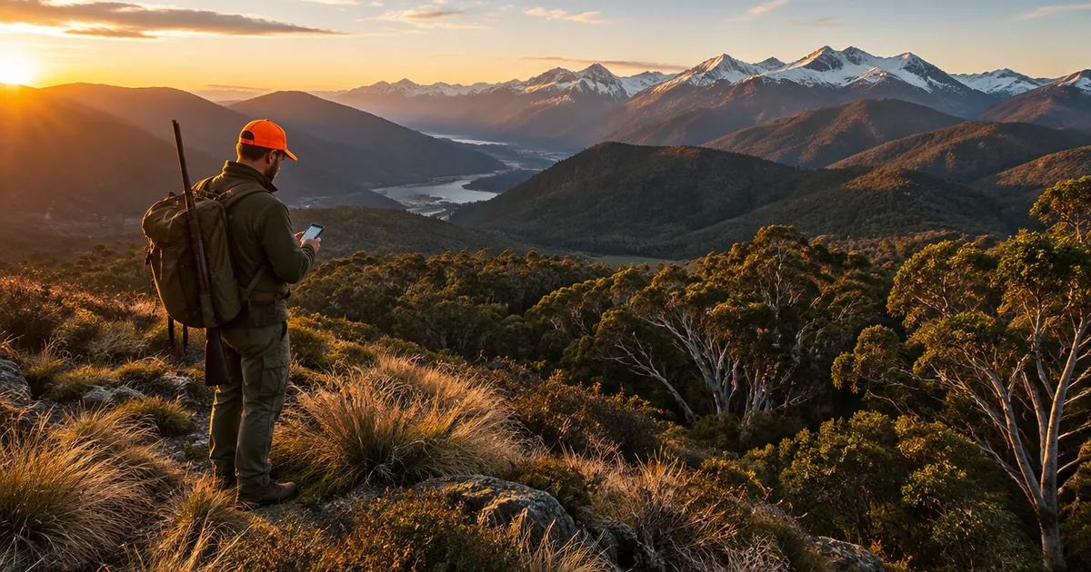
Quick answer: HuntScout now works in Australia and New Zealand. On iPhone, Android and the web it maps the public land you can hunt in Victoria, New South Wales, Tasmania, South Australia (game reserves) and the Northern Territory (hunting reserves), plus every Department of Conservation (DOC) hunting area in New Zealand, including roar and balloted roar blocks. Season dates are checked against each state agency, DOC and Fish & Game, and the maps download for offline use. Private land boundaries are not available in Australia or New Zealand.
Until now HuntScout was a Canadian and US app. Hunters there use it to answer one question before every trip: can I legally hunt here, and what is open? Australia and New Zealand have the same question with a different answer in every state. A Victorian deer parcel, a NSW State forest booking and a DOC roar block run under three completely different systems. This post sets out what we cover, what we don't, and where to start.
What HuntScout covers in each region
Everything below comes from the agencies' own published data. We keep the agency name, licence and retrieval date on every layer, and tapping an area shows its source.
| Region | What's on the map | Where the data comes from |
|---|
| New Zealand | DOC hunting areas with status (permitted, restricted, prohibited), roar blocks, balloted roar blocks, DOC huts, tracks and campsites, public conservation land, air access zones, and species distribution surveys | Department of Conservation (CC BY 4.0) |
| Victoria | About 15,900 public land hunting parcels with the species allowed on each (sambar, hog deer, other deer, duck, quail, pest animals), dog rules, closed deer areas, and land where firearm use needs the licence holder's permission | DEECA / Game Management Authority (CC BY 4.0) |
| New South Wales | State forests, forests not opened for hunting, Forestry Corporation exclusion layers and indicative permanent exclusions, and Crown leases | Forestry Corporation of NSW (CC BY) |
| Tasmania | Public land deer hunting areas (ballot and booking), deer management zones, Sustainable Timber Tasmania public hunting areas, Parks and Wildlife wallaby and duck areas, no-hunting areas, and game reserves | the LIST, Parks and Wildlife Service, Sustainable Timber Tasmania, CAPAD |
| South Australia | Game reserves (duck and quail seasons) | CAPAD |
| Northern Territory | Howard Springs Hunting Reserve and the Harrison Dam reserve boundary | CAPAD, NT Parks and Wildlife |
Queensland, Western Australia and the ACT are not on the list because they have essentially no public land recreational hunting scheme to map.
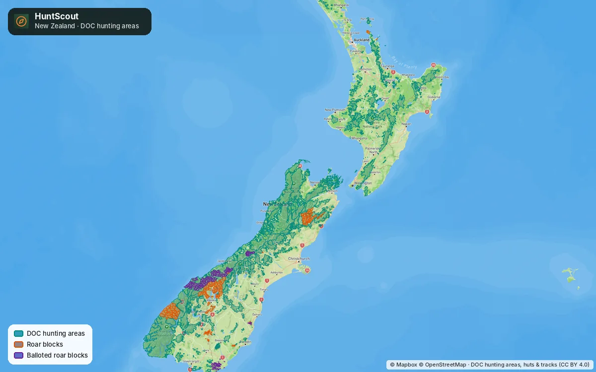 New Zealand in HuntScout: every DOC hunting area, with the Haast, Wānaka and Molesworth roar blocks picked out.
A short tour
New Zealand: DOC blocks, roar ballots and huts on one map
Tap any DOC hunting area and HuntScout shows its status, block type, permit area and DOC's date, access, dog and special conditions, with a link to that block's DOC page. Roar blocks and balloted roar blocks have their own colours, so you can see at a glance which country needs a ballot win in March and April. DOC huts, tracks and campsites are free for everyone, with no account needed.
A green polygon is not a permit. You still need a free DOC hunting permit, and our DOC hunting permit guide explains how to get one and how to read a block's conditions. For trip ideas by island and species, see where to hunt in New Zealand.
Victoria: what you can hunt on each parcel
Victoria is the closest thing in Australia to a North American hunt-unit map. Every public land parcel carries a code per species, so HuntScout can tell you that a block of State forest is open to sambar stalking but not hounds, or that a coastal reserve is duck-only. Read the Victoria hunting maps guide for how this compares with the government's free More to Explore app.
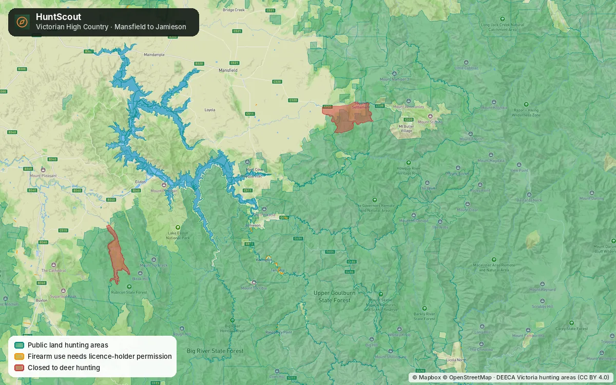 Victorian High Country: public land hunting areas, closed deer areas and firearm-permission land.
New South Wales: State forests at a glance
In NSW you hunt declared State forests with an R-Licence and a written permission for that forest. HuntScout shows every State forest, the forests not opened for hunting, and Forestry Corporation's exclusion layers, which makes it a quick way to shortlist forests before you book. The official Hunt NSW app is still the map you must carry under your permission conditions. Our NSW State forest hunting guide explains how the two fit together.
Tasmania: ballots, bookings and Permission to Shoot
Tasmania's public deer hunting runs on a ballot for the Zone 1 stag season and a booking system for everything else, across 19 public land hunting areas. HuntScout shows those areas, the deer management zones, Sustainable Timber Tasmania's public hunting areas and the Parks and Wildlife wallaby and duck areas, and tapping a deer area takes you to its booking page. See where to hunt in Tasmania.
Season dates you can trust (and check)
Every season row in HuntScout for Australia and New Zealand links to the agency page it was checked against and carries a "last verified" date. Examples you can browse on the web right now:
Where an agency hasn't published dates, we say "check" instead of guessing.
What HuntScout does not do here (yet)
We would rather you know this before you download:
- No private land boundaries or owner names in Australia or New Zealand. Our private parcel layer covers the US and Canada only.
- No Queensland, WA or ACT hunting layers, for the reason above.
- NZ game bird region boundaries are not drawn on the map yet. The dates by Fish & Game region are on the seasons screen and on the web.
- A polygon is never permission. It does not replace a DOC permit, a NSW written permission, a Tasmanian booking or a landholder's say-so.
- The NZ species layers are DOC distribution surveys from 2007 and 2014. Treat them as a rough guide to where animals were, not where they are this season.
Who it's for
- Kiwi hunters who want DOC blocks, huts, tracks and roar ballots on one offline map instead of three apps and a PDF.
- Victorian hunters who want to know what's allowed on a parcel before they drive there.
- Hunters in more than one state or both countries. One Australia & NZ plan covers every region above.
- Canadian and US HuntScout users heading south for a roar trip or a tahr hunt.
Pricing and download
HuntScout is free to download. The DOC huts, tracks and campsites and Tasmania's deer zones are free without an account, and closures and exclusions are free once you sign in. The hunting area layers are part of Australia & NZ Pro, which is A$39.99 a year or A$5.99 a month in Australia (NZ$39.99 / NZ$5.99 in New Zealand) on the web. App store prices are shown in your local currency before you pay.
The guides in this series
- DOC hunting permit and hunting areas map
- Where to hunt in New Zealand: a public land guide
- NSW State forest hunting map and R-Licence guide
- Victoria hunting maps: where you can hunt on public land
- Where to hunt in Tasmania
- Best hunting apps in Australia and New Zealand, compared
Last checked: 15 October 2026. Hunting rules, seasons and closures change often. Always confirm current regulations with the relevant agency (DOC, Fish & Game, GMA Victoria, NSW DPIRD, Forestry Corporation of NSW, NRE Tasmania) before you hunt.
Frequently asked questions
Does HuntScout work in Australia and New Zealand?
Yes. HuntScout maps public hunting land in Victoria, New South Wales, Tasmania, South Australia (game reserves) and the Northern Territory (hunting reserves), plus every DOC hunting area in New Zealand. It works on iPhone, Android and the web, and the maps can be downloaded for offline use.
Does HuntScout show private land in Australia or New Zealand?
No. Private land boundaries and owner details are only available in the US and Canada. In Australia and New Zealand HuntScout shows public land hunting areas and closures from government data.
How much does HuntScout cost in Australia and New Zealand?
The app is free to download, and DOC huts, tracks and campsites are free without an account. The hunting area layers need Australia & NZ Pro: A$39.99 a year or A$5.99 a month on the web, or NZ$39.99 / NZ$5.99 in New Zealand. App store prices are shown in local currency.
Is a hunting area on the HuntScout map the same as a permit?
No. The map shows official designations only. You still need the permit, permission, booking or ballot win the agency requires, such as a DOC hunting permit in New Zealand or a written permission for a NSW State forest.
Why are Queensland and Western Australia not covered?
Queensland, Western Australia and the ACT have essentially no public land recreational hunting scheme to map, so there are no hunting area layers for them.