About 88% of the more than 5.9 million white-tailed deer taken across the major deer-hunting states in 2021-22 came off private land, according to the National Deer Association's deer report. That figure reads like bad news to a hunter with no permission slips. It isn't. It tells you where the competition thins out, and it explains why the scruffy parcel two miles from your driveway deserves more scrutiny than the 400-acre block you found an hour away.
The direct answer to public land deer hunting near me is that "near me" is the wrong first filter. Legal access is. A parcel you can park at, walk into and legally shoot a deer on during your season beats a larger, closer block you can't enter without crossing posted ground.
Work it in this order. Identify the land category, map the parcel properly, confirm the rules that control you, score the candidates against each other, then plan the hours you'll spend on the ground.
Table of Contents
- Public Land Types That Allow Deer Hunting
- How to Map Public Deer Land Near You
- Confirm Access, Season and Vehicle Rules
- Choose and Score Candidate Parcels
- Plan Hunt Hours and Stay Safe
- Final Go or No-Go Check
Public Land Types That Allow Deer Hunting
Public deer hunting near you is never one thing. It's a stack of land categories, and each one answers to a different agency with a different rulebook. The Bureau of Land Management runs BLM parcels. The US Forest Service runs national forests. Your state wildlife agency runs wildlife management areas. A state forestry or state lands office runs state forests and state trust land. Counties and cities run parks, which frequently restrict hunting. Layered on top, a state walk-in program opens enrolled private ground to public hunters for set dates.
Sort the parcel you just found into one of those buckets before anything else. The bucket tells you which agency's rules govern you, and that agency is who you call when the map shading and the sign at the gate disagree.
| Land type | Usual manager | Deer hunting usually allowed | What to check first |
|---|---|---|---|
| BLM land | Bureau of Land Management | Usually yes, under state seasons | Closures, vehicle limits, private inholdings |
| National forest | US Forest Service | Usually yes, under state seasons | Forest closure orders, vehicle and camping rules |
| State wildlife management area | State wildlife agency | Usually yes, with area-specific rules | Season dates, parking, posted restrictions |
| State forest or state trust land | State forestry agency | Permitted only where the state has opened that parcel | Whether hunting is permitted on the parcel |
| County or city park | County or city government | Often restricted | Local ordinances and firearm rules |
| Private land in a walk-in program | State wildlife agency | Yes, for enrolled parcels | Enrollment dates and sign-in rules |
Why the acreage number misleads
Minnesota's deer permit area reports show the problem in miniature. One permit area lists 161 square miles of public hunting land, split into 67 square miles of state forest, 65 square miles of miscellaneous state land, 26 square miles of county land and just 3 square miles of wildlife management areas. Another area lists 76.5 square miles, and it's almost entirely wildlife management area acreage, per the Minnesota DNR deer permit area report.
The smaller number can be the better hunt. A compact wildlife management area with a parking pull-off on a county road beats a fragmented total where every good ridge sits behind a private inholding or inside a county park with an ordinance against firearms. Land category outranks acreage, and access outranks both.
Practical rule: when two parcels look identical on a satellite layer, the one whose managing agency actually permits deer hunting during your season wins.
How to Map Public Deer Land Near You
The mapping work happens at a kitchen table, not in a truck. Forty minutes of it on a laptop narrows a state's worth of ground to three parcels you can scout on foot, and it's the difference between a plan and a drive around.
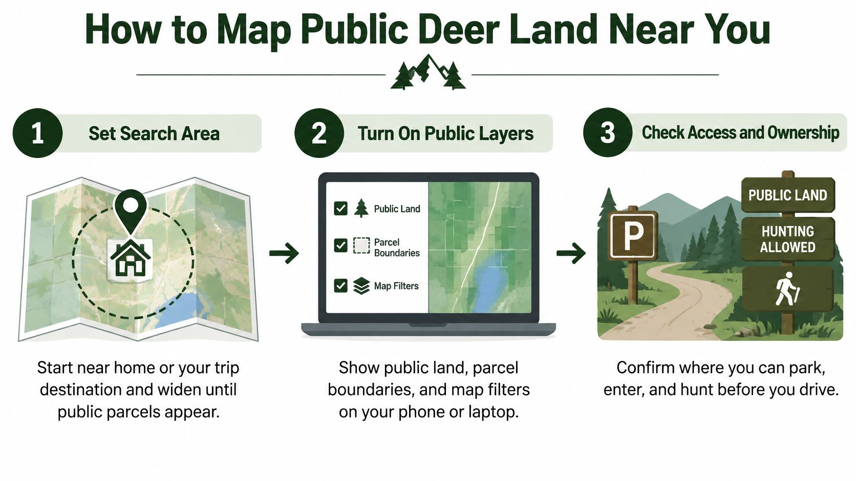
- Set the search area, then widen it. Start on a home pin or the town you're traveling to and push the boundary outward until public parcels surface. Ownership runs in blocks, so a tight frame often shows nothing but rented farmland while a wildlife area sits eight miles past the edge of your screen.
- Switch on every public land layer. BLM, US Forest Service, state wildlife areas and state forests each carry separate shading. Skip a layer and you'll conclude your county has no public ground when it has 4,000 acres of it.
- Tap each parcel and read the managing agency. A shaded block can turn out to be a county park, a state trust parcel leased to a grazing operation, or a private inholding sitting inside a forest boundary. The color isn't the answer. The parcel card is.
- Record the hunting unit or permit area. Units set seasons, weapon rules and bag limits, and a parcel straddling a unit line can put you in a different season by walking 200 yards. Confirm the line on the state agency's own unit map, not the app's.
- Mark two or three access points. A trailhead, a gate on a county road, a legal pullout. Then trace the full route from pavement to the tree you intend to sit in, and check it never crosses private ground or a gated easement.
- Save it all for offline use. Parcel, access points, and one backup area. Public ground sits where cell service doesn't, and a map that needs a signal is a map you don't have.
The scale you're working inside
In the West, the land base dwarfs anything east of the Mississippi. The Bureau of Land Management reports managing habitat for roughly 131 million acres of mule deer and 43 million acres of elk, most of it interlocked with private ground, state parcels, roads and easements.
That size changes the job. A US Fish and Wildlife Service analysis of deer hunting cited in the same BLM summary recorded 140,467 total hunting days, of which 32,673 were on public land, about 23%. Roughly one deer-hunting day in four happens on public dirt, and those days tend to run longer and further from a truck than private-land sits.
What the map proves, and what it doesn't
A public layer proves ownership. It doesn't prove open status, legal entry, or that your season is running on that parcel. Closures, temporary restrictions and unit lines don't live in the shading, and they change between seasons.
The layers you want are the ones that pair color with a unit boundary drawn over it: BLM, USFS, state parks and Wildlife Management Areas in the US, plus Canadian Crown land parcels marked general-use or restricted. HuntScout's US public land mapping tool stacks those layers with GMU boundaries on top, which is what turns a candidate parcel into a shortlist you can drive to.
Confirm Access, Season and Vehicle Rules
A mapped parcel is a candidate. These checks turn it into a legal hunt, and every one of them comes from an agency rather than an app.
Season dates differ by weapon. Archery, muzzleloader and general rifle seasons usually open on different dates, so confirm the window for the weapon you'll carry, not the first opening date on the calendar. Some units require a draw tag, and draw results, tag dates and leftover availability come from the state agency. Confirm the hunting unit or permit area as well, because the unit sets your bag limit and the season that applies to that specific ground.
The rule that catches out-of-state hunters
Vehicle rules are the easiest thing to miss, and New Mexico shows why. On most public lands in the state, hunters may not drive off existing roads and trails to hunt, including when retrieving a downed animal, as the BLM New Mexico hunting page states.
Read that twice before you plan a morning. Where you park stops being the end of a drive and becomes the start of a hike, and a mature buck killed a mile from the nearest legal road becomes a pack-out job you plan for in advance rather than improvise at last light.
| Rule | Where to confirm | Why it matters |
|---|---|---|
| Season dates for your weapon | State wildlife agency season page | Archery, muzzleloader and rifle seasons open on different dates |
| Draw or tag requirement | State draw results and license page | Some units require a draw tag before you can hunt |
| Hunting unit or permit area | Agency unit map | Boundaries set the season and bag limit that apply |
| Vehicle and trail limits | BLM or USFS office and site notices | Driving off roads and trails can be illegal, even on open land |
| Closures and restricted areas | Land manager notice | Closures can override what the map shows |
| Bag limit and check-in rules | State agency regulations summary | Harvest limits and reporting deadlines differ by unit |
HuntScout's US hunting regulations tool gives you a starting point for this pass, with verified opening and closing dates, weapon restrictions for archery, muzzleloader and general rifle, draw tag dates and bag limits, and a season tracker covering deer, elk, moose, waterfowl, turkey, bear and small game filtered by zone. Use it to build the checklist, then confirm the final answers with the issuing agency. HuntScout is informational on dates, bag limits and access rules, and the agency's word controls.
A boundary on a screen is never permission to shoot. On private ground, the landowner's permission still applies, and posted signs outrank every layer you downloaded.
Choose and Score Candidate Parcels
By now you should have two or three parcels that already cleared the legal gate: open to hunting, inside the right unit, in season for your dates. Everything after that is comparison, and comparison needs separate scores instead of one gut feeling about which spot "feels" better.
Start with the reality check. Public ground isn't where most deer hunters spend their time. Oklahoma's 2025 harvest survey reported that only 16% of hunting activity among active hunters happened on public land, per the Oklahoma Department of Wildlife Conservation harvest report. Limited acreage in some regions, drive distance, crowding, access friction and existing private-land permission all pull that share down. None of those reasons makes a public parcel worthless; they tell you what you're competing against.
The practical question is never which parcel is closest. It's which nearby tract justifies the scouting you're about to invest in it.
Three scores, kept separate
Habitat asks whether the ground can hold deer: food, water, bedding cover, and the edges where those meet. Pressure asks how many people the parcel absorbs, which you read at the trailhead lot, in fresh boot tracks, in how close the nearest town or campground sits. Access asks how far you walk from a legal road, how much elevation you gain, and whether the route crosses private ground or a gated easement.
Blend those into one number and you'll make bad calls. Keep them apart and the trade-offs show themselves. A parcel can post a strong habitat score and still fail outright if the only route in crosses posted ground, because legal reach is a pass-or-fail gate rather than a sliding score.
Why public-land averages don't transfer
In Pennsylvania's Sproul study area, the reported deer harvest rate was 5% on public land against 18% on private land, and the study tied harvest mortality and hunter distribution to road distance, slope, ownership and hunter density, according to the Pennsylvania Game Commission's deer study appendix.
Those are results from specific ground, not your odds on Saturday. State agencies also define success differently from one another, so a harvest figure from one state can't be lined up cleanly against another state's number. Read study results as confirmation that pressure and access shape outcomes, then score your own parcels on the ground you can walk.
| Score | What to look for | Red flag |
|---|---|---|
| Legal opportunity | Open status, correct unit, season overlaps your dates | Closed or outside your season |
| Habitat | Food, water, bedding cover and edges | Open ground with no cover |
| Pressure | Trailhead parking, fresh trails, nearby towns | Crowded parking at every access point |
| Access | Walk-in distance, legal road, easements | Only route crosses private ground |
A worked comparison
Say your closest parcel is ten minutes away with one gravel lot that holds four trucks. A second unit is 50 miles out with three separate access points and a season that overlaps your dates.
On paper the close one wins on fuel and sleep. On opening morning the four-truck lot fills before first light, every hunter funnels up the same trail, and the deer that were using the lower bench have shifted into cover nobody wants to drag from. The farther unit gets the nod because it intersects your calendar with less competition and more ways in. Habitat quality never entered the decision.
Score both parcels before you drive to either. If the near lot is already full at first light, that pressure red flag belongs in your table before it costs you a morning.
Working rule: every trip gets a backup parcel, and distance stays one factor among access, pressure and season rather than the deciding one.
Plan Hunt Hours and Stay Safe
Access gets you to the ground. Hours on the ground fill tags, and the gap between two hunters on the same parcel is usually measured in minutes of legal light rather than acres.
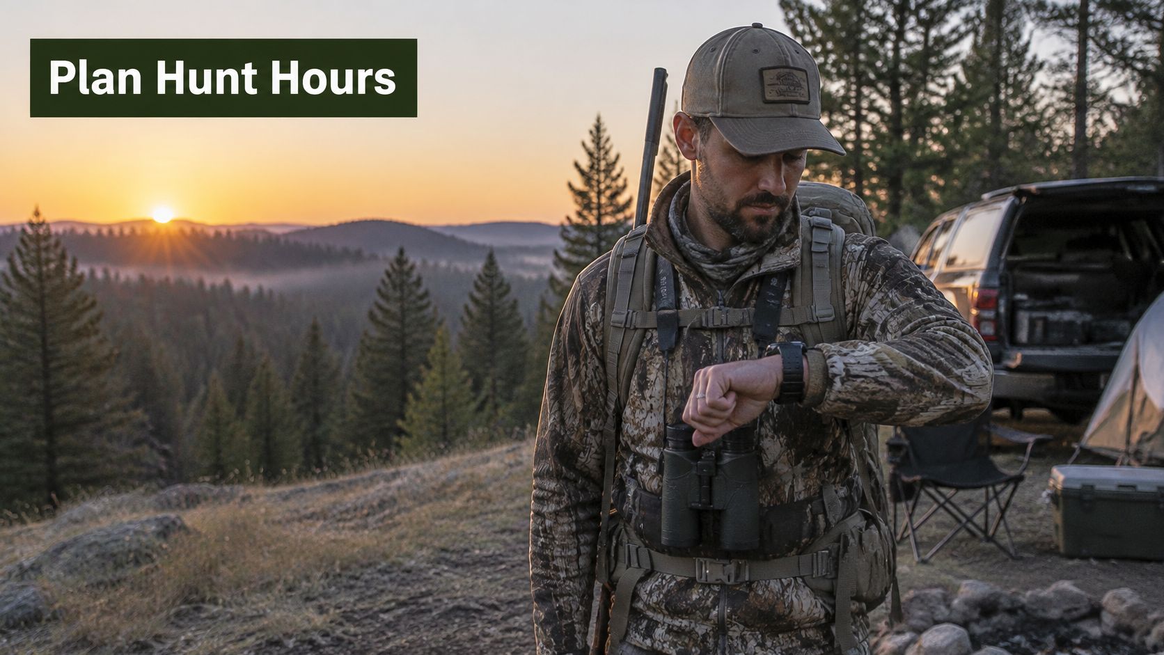
Hunter one parks 40 minutes before first light, walks in with a headlamp, and is sitting still while the timber is still dark. Hunter two pulls into the same lot at sunrise, walks the same trail, and settles in 20 minutes after legal light. Same parcel, same tag. Over a five-day trip, hunter two has surrendered most of the movement windows that matter, and the map never showed the difference.
The effort relationship is well documented. A six-year USDA Forest Service study of 416 hunters found that rifle-deer success was best predicted by hours spent outside camp during legal hunting hours, with each additional hour increasing the odds of success by 26%. Read that as an odds increase. It lets you compare effort plans against each other, and it says nothing about the probability of your own Saturday.
A hunt-day schedule that holds up
- Scout access points before opening day. Drive the roads, find the legal pullouts, and mark the ones that put you closest to cover without crossing a fence line.
- Walk in before first legal light. Give yourself enough time that you're stationary and quiet when the timber starts to move.
- Hunt the first and last legal light periods. Those two windows carry most of the daylight movement, and they're the ones hunters give up first.
- Bank time to reach overlooked cover. A thicker pocket 20 minutes further in is worth more than a convenient edge everyone walks past.
- Set a turnaround time before you walk in. The last half hour of light goes fast on unfamiliar ground, and I count the walk out as part of the hunt's time budget.
Two pitfalls and the safety list
The first pitfall is a long walk-in that eats the best hour of the morning. The second is leaving the stand at midday because nothing moved at ten, when pressure from other hunters often pushes deer into a quiet window after lunch.
- Check your state's blaze orange rule before you pack. Requirements vary by season and by whether you're on public or private ground.
- Carry a headlamp for the walk out, plus a spare battery. Most lost-hunter stories start at last light.
- Leave your route and expected return time with someone at home, including the parcel name and the lot you parked in.
- Confirm boundaries in the field. A fence, a posted sign or a survey marker outranks your download. No map grants permission, and crossing onto private ground without the landowner's okay can end a season.
- Plan for insects. Carry a repellent registered with the EPA or your national health authority, and check for ticks after each outing. A moisturiser that deters ticks and mosquitoes is a light backup for the truck on early-season scouting trips when the spray can is empty.
- Know how your maps behave without a signal. This guide to using offline maps for hunting covers saving parcels and routes before you lose service.
Final Go or No-Go Check
Everything above collapses into one pass you run the night before you drive. It takes ten minutes, and it's the step that stops a two-hour trip built on last season's rules.
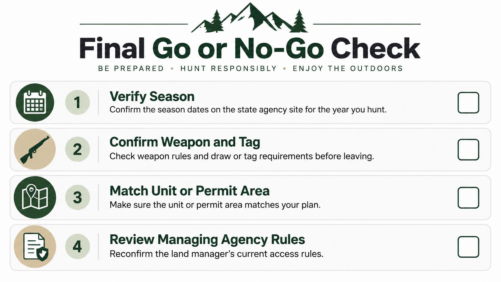
- Verify the season on the state agency site for the year you're hunting, for your weapon, and check that the unit is open on those dates.
- Confirm weapon and tag requirements, including whether the unit needs a draw tag you don't hold.
- Match the unit or permit area to the exact parcel you plan to hunt, not just the county it sits in.
- Review the managing agency's current rules by calling the district office or reading the site notice for closures, fire restrictions and road gates.
- Confirm the parcel and one backup are saved offline with your access points pinned, so the plan survives a dead battery on the truck charger.
HuntScout fits at the front of that list rather than the end. The free tier covers public land maps, season dates, GMU and WMU zone lookups, web tools and basic waypoints, and maps saved to your device keep parcel lines and hunting zones visible with airplane mode on while the phone's GPS chip holds your position. The state agency stays the authority on dates, bag limits and access, and HuntScout stays informational.
The decision rule is short. Go when the parcel clears the legal check and its access and pressure scores are acceptable. If any one of those fails, shift to the backup, rerun the same checks, and don't talk yourself into a parcel that only looks good because it's close.
HuntScout keeps the whole sequence in one place: color-coded BLM, USFS, state and WMA layers with GMU boundaries over the top, season dates that link out to the issuing wildlife agency, and offline maps that keep working past the last bar of service. Download it free and map your first three candidate parcels tonight, before the season crowds the good ground. Start at HuntScout and turn this week's scouting into a parcel list you can hunt.