When two apps draw the same fence line an inch apart, which one is right? Neither, necessarily. The familiar HuntStand vs onX argument treats boundary accuracy as the whole test, and that framing buries the question that keeps hunters out of trouble: which app tells you when ownership, physical access and legal permission have stopped agreeing with each other?
onX Hunt carries the strongest documented case for US private-land data and offline downloads of the apps examined here. HuntScout puts the US, Canada and Australia in one tool on iPhone, Android and the web. HuntStand built its following on mobile map sharing, and its current pricing, coverage and offline behaviour aren't verified in this review, so it gets judged only on what the record supports.
The stakes show up in the national numbers. A U.S. Fish and Wildlife Service analysis of the 2006 national survey found that 12.5 million hunters used public land, private land, or both, and more than 80% of them hunted on private land. Private ground is where nearly every permission question lives, and where a wrong line costs the most.
Table of Contents
- HuntStand vs onX Hunt at a Glance
- What Each Plan Costs and What It Covers
- Private Land Data and Boundary Accuracy Compared
- Offline Maps and Field Reliability Before You Go
- Coverage Across the US, Canada and Australia
- Where iHunter, BaseMap, HuntWise and GoHunt Fit
- Which App Fits Your Hunt and How to Decide
HuntStand vs onX Hunt at a Glance
The useful comparison starts with scale, because scale is the easiest onX claim to audit. Outdoor Life's profile of onX described the company in 2024 as having millions of users and approximately 400 employees, while reporting that onX did not disclose an exact user count. That reach supports the private-land and offline case onX is known for. It still leaves the harder test untouched: whether the line on the screen matches ownership, whether the ground can legally be reached, and whether the season rule fits that exact place.
| App | Starting point | Coverage signal | Private-land line | Offline confidence |
|---|---|---|---|---|
| onX Hunt | $34.99 per year for one state; Elite expands to all 50 states plus Canada | State-by-state buying makes the real price equal the states needed for the trip | US parcel and landowner layers; county source and update date decide confidence | Downloads sit inside paid plans |
| HuntStand | No single public entry price is directly comparable | North America is the clearest footprint; depth outside that core needs proof for the exact hunt area | Parcel tools exist, but county update cadence is the detail that matters | Field accounts put it behind onX when service disappears |
| HuntScout | Free tier; Pro carries a 7-day free trial | US, Canada and Australia in one tool | Over 100 million private parcels across the US and Canada | Unlimited downloads on Pro |
iHunter, BaseMap, HuntWise and GoHunt answer narrower questions, so their rows sit with the specialist-app comparison rather than in this headline table.
Read the table by trip, not by brand. Count the states or provinces, name the country, then decide whether the hunt needs owner names and parcel IDs or only public land and season dates. Draw one fence you already know and separate three answers: who owns it, how it can be reached legally, and which agency rule applies there. If those three disagree, the app earns its keep only by making the disagreement obvious. A boundary on any screen never grants permission; the landowner still does.
What Each Plan Costs and What It Covers
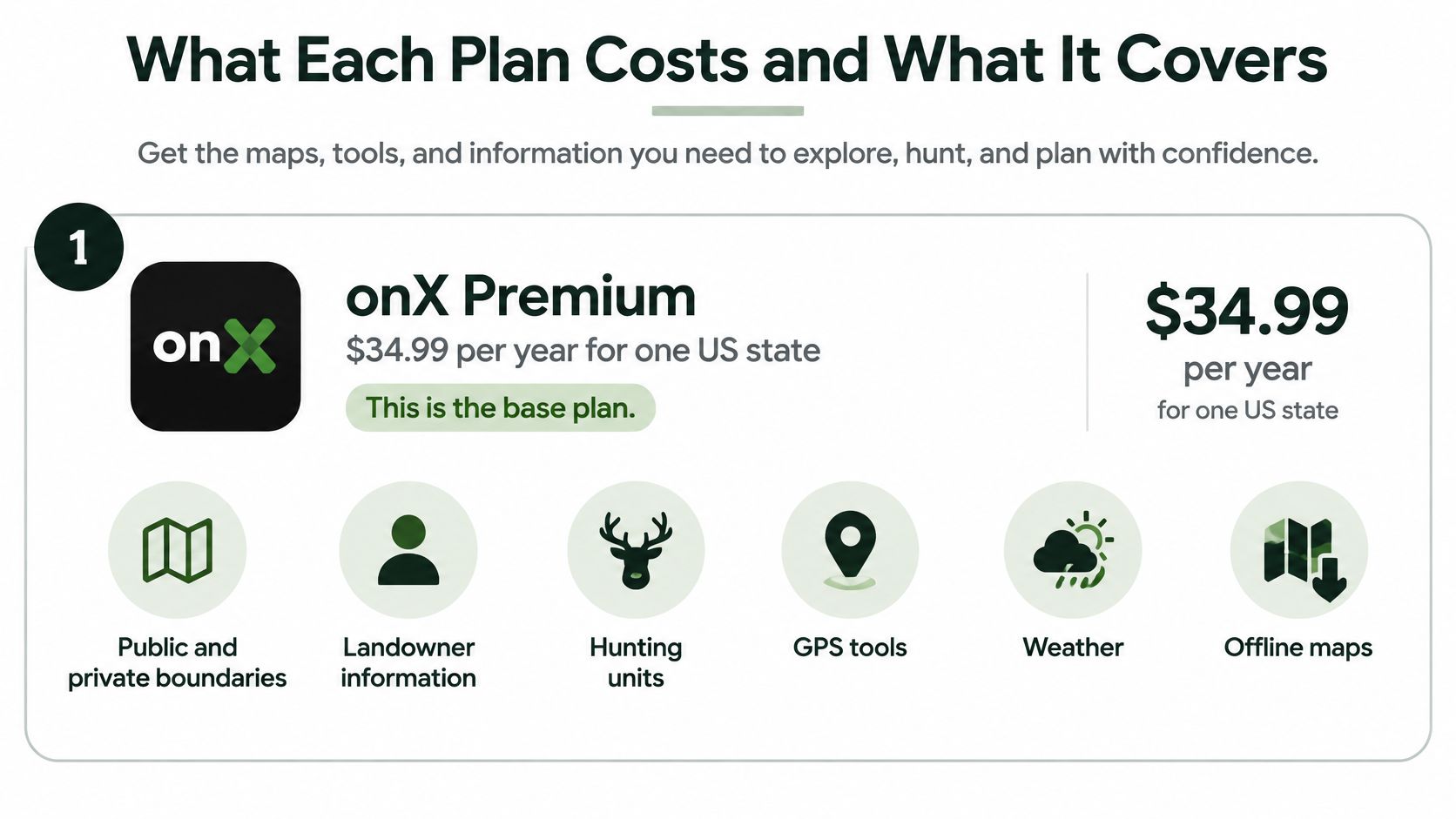
onX sells coverage by state rather than by feature, and that single design decision drives everything else about its price. According to onX's published pricing page, the lineup works like this:
- onX Premium, $34.99 per year for one US state, including public and private boundaries, landowner information, hunting units, GPS tools, weather and offline maps.
- onX Premium Two-State, $49.99 per year for two selected states.
- onX Elite, $99.99 per year, which expands coverage to all 50 US states plus Canada.
The state trap is simple arithmetic. A hunter who needs three states can't buy one plan, so the comparison isn't $34.99 against a competitor's headline price, it's whatever plan covers the trip. Cost per state falls as coverage grows, and Elite only looks expensive until you price three single-state subscriptions against it.
HuntScout prices the other way round. The free tier includes public land maps, season dates, GMU and WMU zone lookups, web tools and basic waypoints. Pro adds private parcel boundaries, unlimited offline map downloads and advanced layers. Upgrades are available at any time, and there's a 7-day free trial to test whether the parcels you need are there.
HuntStand, iHunter, BaseMap, HuntWise and GoHunt aren't priced here because no verified figure was available for this review. Check each provider's current page before buying.
Three hunters make the ladder concrete. The single-state deer hunter with a lease and one out-of-state trip a year needs one state, so Premium covers the season without paying for ground they'll never see. The two-state elk hunter who adds a neighbouring state is the exact case Premium Two-State was built for, and buying Elite is a waste unless Canada enters the plan. The US-plus-Canada hunter chasing a moose or bear tag north of the border needs Elite, because that's the only onX tier where Canada appears at all. Prices change, so confirm on each provider's own page on the day you buy, and pick the cheapest plan that includes the states, provinces and offline needs of the trip.
Private Land Data and Boundary Accuracy Compared
Vendors publish different things about their own accuracy, and the difference tells you how much they're willing to be checked. onX's Premium membership page advertises private landowner information for approximately 161 million US properties and states that property boundaries are generally accurate to within 5 to 10 feet depending on the county, with ownership data updated every one to two years depending on county and source recency.
That's a published tolerance and a published refresh window.
HuntScout cites over 100 million private parcels across the US and Canada, with landowner names and tax parcel IDs. HuntStand publishes no comparable tolerance on its public pages, so the first question for its support team is a simple one: what's your stated accuracy, and when was this county last updated?
| Source | Stated scale or accuracy | Verify before you hunt |
|---|---|---|
| onX Hunt | About 161 million US properties; boundaries generally within 5 to 10 feet depending on county | Check the edge against the county GIS or assessor record |
| Parcel data in general | Discrepancies of roughly 5 to 50 feet depending on county data quality | Treat close edges as private until confirmed |
| HuntScout | Over 100 million private parcels across the US and Canada, with landowner names and tax parcel IDs | Match the tax parcel ID to the county record |
| HuntStand | No published accuracy tolerance on its public pages | Request its stated accuracy and county update dates |
Why a crisp line is not a boundary
Neither product generates ownership data. Both generally depend on county assessor, USDA and USFS records, and quality varies by jurisdiction, as hunters comparing notes on boundary accuracy in practice point out. Displayed parcel lines can sit several yards off, and ownership records can lag a sale. onX's own app FAQ puts parcel discrepancies at roughly 5 to 50 feet depending on county data quality, and states plainly that mapping apps are not legal surveys. A screen that renders a line to the pixel can still be wrong by a truck length.
Cartographic accuracy versus legal access
The distinction that matters on opening morning is between seeing land and reaching it. Public ground on a screen doesn't prove that the adjoining road is open, that the access easement exists, or that the parcel can be reached without crossing private property. Checkerboard country in the West, narrow corridors and water boundaries turn that gap into a trespass charge.
The test for any close edge: pull the county GIS or assessor record, match the tax parcel ID, and treat every uncertain edge as private until someone verifies it. A boundary line is never permission.
onX's head start explains part of the dataset maturity. TechCrunch's 2018 funding report traces the company to 2009, when founder Eric Siegfried built software to pair hunting maps with a Garmin GPS device on $27,000 of personal funds. Years of county-by-county data collection show up in the update cadence and the depth of ownership records, not in the screenshots. Where a vendor doesn't publish when its parcel layer began or how often each county refreshes, the comparison answers itself: the app that states a tolerance can be held to it.
HuntScout's position here is narrow: a boundary on its map is never permission to shoot, and the landowner's permission is still required. The useful differentiator isn't the presence of parcel lines, it's whether the app shows you where the data came from and when it changed. HuntScout's guide to hunting apps for private land maps covers how to run that check against the county record.
Offline Maps and Field Reliability Before You Go
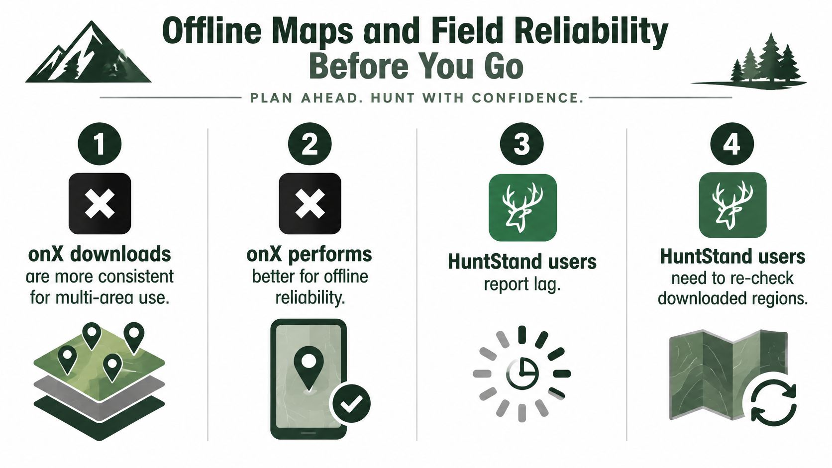
Field reports favour onX on downloads, and they're consistent about it. An independent comparison from World Deer describes onX downloads as more consistent for multi-area use and offline performance, while HuntStand users report occasional lag, the need to re-check downloaded regions and trouble starting a download without a cellular connection. Another discussion characterizes HuntStand offline maps as weaker while noting stable GPS behaviour in some conditions.
Treat those as field reports, not benchmarks. Nobody has published controlled latency, battery or fix-accuracy data for either app, and the difference between a download that works and one that needs restarting is often the phone and the region size, not the software.
The pre-season offline test
Run this on your own ground before the season, not at the trailhead.
- Download the whole hunt area, including approach roads, access corridors, backup units and likely exit routes. Most offline failures happen on the walk in, not at the glassing point.
- Switch the phone to airplane mode. This is the only honest simulation of a dead zone.
- Pan, zoom and check parcel lines and GPS position. A map that stutters while panning is a map that will freeze when you're navigating in the dark.
- Confirm every layer you need is cached. Some layers vanish offline, and the one that disappears is usually the unit boundary.
- Re-check the downloaded regions a day before you leave. Regions can need refreshing, and a trip planned three weeks out is three weeks of app updates.
- Confirm season dates and rules with the official agency. An offline layer can be older than the rule that changed in July.
Power belongs in this test too. A phone that dies at 4pm ends the experiment early, and LuminAID's guide to off-grid phone chargers covers solar options that keep a GPS running through a multi-day backcountry trip.
For HuntScout, the app runs on iOS and Android and works offline in zero cell service areas, and Pro adds unlimited offline downloads, so check how many regions your plan lets you save before you commit a week to one. HuntScout's breakdown of offline hunting maps walks through what caching covers.
The app that passes this test on your ground is the one to trust. The app with the most layers is the one that can fail most quietly.
Coverage Across the US, Canada and Australia
Coverage claims need jurisdiction names attached, or they mean nothing. onX's Elite coverage page identifies the 50 US states and Canada, and advertises more than 1.8 billion acres of public land across the US and Canada, 15,880 hunting units, 421 map overlays and more than 400,000 miles of trails. Australia isn't identified as part of Elite coverage in those materials, so it shouldn't be assumed until an official product source says otherwise.
HuntScout covers all 50 US states and all 10 Canadian provinces in one tool, with Crown land and WMU or WMZ boundaries on the Canadian side, and it also covers Australia, New Zealand, the UK, Germany and Austria, with state forests, DOC hunting blocks, Flurstücke, protected sites and season dates. HuntStand is described as covering North America and other regions, which is a phrase broad enough that anyone hunting outside the US should check the actual layers before paying.
Match the jurisdiction, not the marketing
Three hunters illustrate how differently coverage requirements land. The Western US big-game hunter needs BLM, National Forest and state land plus unit boundaries for draws, and the agency to confirm with is the state wildlife agency that issues the tag. The Canadian hunter needs WMU or WMZ boundaries and provincial season dates, sourced from the province rather than from a US app's international expansion. The Australian hunter needs state forest areas where hunting is allowed and the rules of the relevant state body, such as NSW DPI hunting in New South Wales or the Game Management Authority Victoria. Each of those is a different dataset with a different custodian, and no app's coverage badge substitutes for the agency page.
Coverage is a claim until you've opened the layer for your own unit. Open it before you buy, not after.
For Canadian hunters comparing what each tool renders north of the border, HuntScout's guide to the best hunting apps for Canada sorts the provincial layers from the marketing. Whatever app you carry, confirm the region's rules with the issuing agency before the trip.
Where iHunter, BaseMap, HuntWise and GoHunt Fit
Four apps sit outside the HuntStand and onX matchup, and each one has to earn its place on your phone the same way the front-runners do. The questions are the same; only the answers on each vendor's site will differ:
- What does the paid tier cost for the exact states or provinces you hunt?
- Does it cover Canada or Australia down to the specific layer you need, rather than as a region named in marketing?
- Where do the parcel boundaries come from, and how often are they updated for your county?
- Can you download every required layer and use it with no signal?
A fifth question separates a useful map from a safe assumption: does the app flag the difference between owning land and being allowed to hunt it? A boundary line shows where a parcel ends. It cannot show permission, a lease or a closed season, so check whether the app warns you when ownership, access and legal certainty diverge, or draws lines and leaves the rest to you.
iHunter deserves a look from anyone hunting several provinces, so check whether its pricing and provincial coverage fit your trip and whether downloads hold across more than one region. BaseMap should be judged on its private land source and update dates against the county record. HuntWise combines mapping with forecasts, so compare its unit boundaries and season information for your hunt with the official agency before trusting either. GoHunt's strength is unit and draw research, which means checking what map layers come with it and whether its offline maps keep waypoints.
Keep a short record of each answer with the vendor page you checked and the date, so the four apps can be compared on the same terms.
Which App Fits Your Hunt and How to Decide
Start from the hunt, not the app. This table skips the feature counts and matches situations to a starting point.
| Hunt situation | Start with | Why it fits | Check first |
|---|---|---|---|
| Western big game across three or more US states | onX Elite | Covers all 50 states plus Canada with public land and hunting-unit layers | Confirm the units you hunt are covered |
| Two-state US hunt | onX Premium Two-State | Two selected states, one tier above the single-state plan | Pick the two states before you buy |
| Single-state US private-land hunt | onX Premium or HuntScout Pro | Private parcel boundaries and landowner information | Compare the edges with county GIS |
| Canadian Crown land and WMU hunt | HuntScout | Covers all 10 provinces with Crown land and WMU or WMZ boundaries | Confirm season dates with the provincial agency |
| Australian state forest hunt | HuntScout | Covers state forests and public hunting areas; onX materials don't name Australia | Check rules with the state body |
| Multi-day trip with no cell service | onX Premium or Elite | Field reports favour onX for offline downloads | Run the offline test before departure |
| Lowest-cost start for public land and season dates | HuntScout free tier | Public land maps, season dates and GMU or WMU lookups at no cost | Upgrade to Pro when you need private parcels |
Two purchase mistakes account for most of the regret. The first is buying the broadest plan when you hunt one state, which is Elite money for a Premium trip. The second is leaning on a free tier when the hunt depends on parcel boundaries and a downloaded map, which is exactly the ground where a missing layer turns into a permission problem.
The verdict by situation
onX Hunt wins where the requirement is documented private-land depth and offline reliability across several US states, and its published accuracy window makes it the easier product to audit. HuntScout wins on cost and on the two countries onX's materials don't fully cover, Canada and Australia, in a single app. HuntStand earns a place only after someone confirms its current coverage, pricing and offline behaviour directly, because a reputation built on mobile map sharing isn't the same as a verified parcel dataset.
No app replaces the regulation or the landowner. The best you can buy is the one that tells you when it's guessing.
Three steps before you pay
- List every state, province or country on your plan for the next twelve months, not just the opener.
- Start the free trial on your top choice and confirm it covers those units, then run the airplane-mode test on one real hunt area.
- Confirm season dates, weapon rules and access with the official agency, and carry a paper or second-device map as backup.
HuntScout treats its output as informational, and the dates, bag limits and access rules should always be confirmed with the issuing wildlife agency before you hunt. Corrections and questions go to help@huntscout.app.
HuntScout shows private parcel lines with landowner names and tax parcel IDs, public and Crown land, GMU and WMU boundaries, season dates linked to the issuing agency, and offline maps for ground with no signal, across the US, Canada and Australia. Start on the free tier to check the units you hunt, then take Pro on a 7-day free trial when you need parcels and unlimited downloads. Visit HuntScout and put the boundary question to your own ground before opening day.